Recta del Tin-Tin Road, Argentina
Reinhard Prinzmeier
Reinhard Prinzmeier www.herumkommer.de/uns…
licensable
This photo is copyrighted by the author.
Thank you for respecting the rights and efforts of our photographers. Please contact the author for further information.

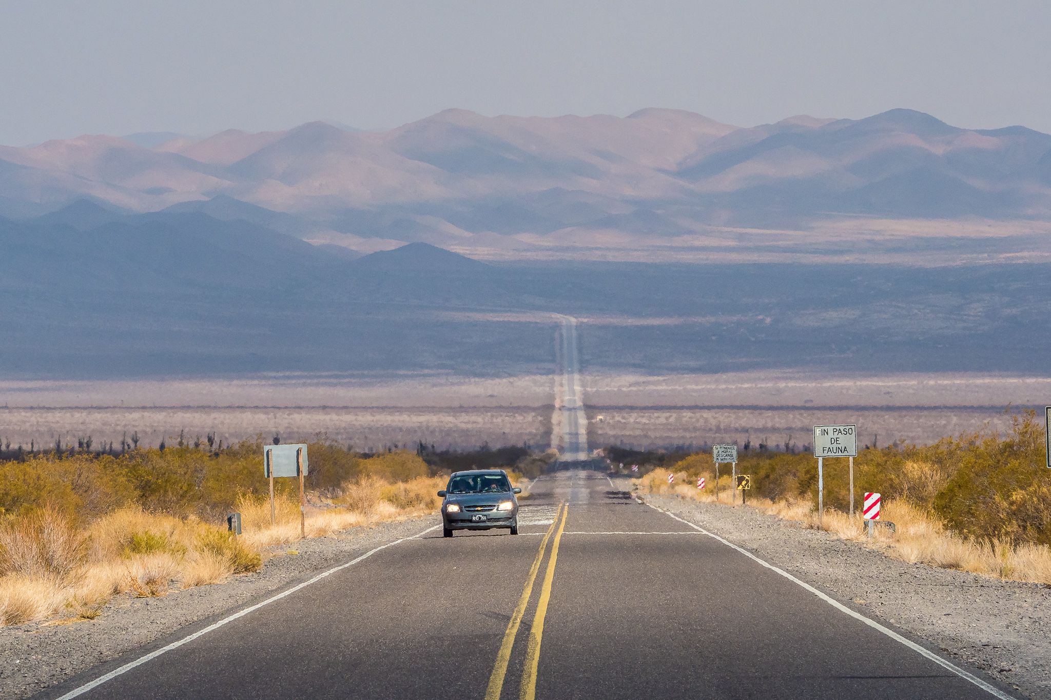
Argentina Recta del Tin-Tin Road

  • Please log in or sign up for free to see the GPS coordinates & weather for this photo spot
The dead-straight, 18 km long "Recta del Tin-Tin", an old Inca trail, now runs through the depression of the Parque Nacional Los Cardones as an asphalt road.
Spot Type Outdoor
Crowd Factor Nearly no other people
Best Timing Daytime
Sunrise & Sunset 07:51 - 18:49 | current local time: 23:13
Photo Themes National Park Nationalpark road

Get the exact geo-position for this spot

Log in to see the GPS coordinates, sun directions, and the map for this photo spot. Or simply bookmark it along with other spots to plan your next trip.

Spot Comments (0)

Please log in or sign up for free to leave a comment or ask a question.

Ratings (1) starstarstarstarstar

starstarstarstarstar
0
starstarstarstarstar
0
starstarstarstarstar
1
starstarstarstarstar
0
starstarstarstarstar
0

Popular photo spots in this region

Thank you Reinhard Prinzmeier for creating this photo spot in Argentina.
Imprint & Contact © Locationscout 2024 Privacy / Terms