
One of the essential elements in landscape photography is fog because it gives a magic mood to every landscape and it is also a good cover-up for man-made structures in a landscape, such as streets and small villages in a valley. For most of you, fog is an absolute upgrade to your landscape pictures. With modern Meteorology, it is possible to forecast fog for two to three days in the future, which means, that you can easily see if a chosen location will be covered in fog or not.
For me, I only go on location when I can expect fog or another weather phenomenon such as a red sky, clear visible milky-way, and so on. With your smartphone in your pocket, it is possible to get weather data via the internet 24/7. However, there is much knowledge needed for a correct interpretation of weather forecast models. One of the weather forecast models, which is just perfect for central Europe, is the WRF 4km model you can find on modellzentrale.de (German) or wunderground.com especially for the USA. When you click on this model, you will see a list of different weather parameters, which a forecasted 72h into the future in steps by 3h.
The 3 parameters for fog forecasting
On every parameter map, you can find an initial date and a validation date. The initial date is just the date when the maps were calculated by the supercomputer by a weather service, the validation date shows you the date when the map is valid. The time is measured in UTC, which means that every timestamp is calculated by the time zone of Great Britain and you have to calculate your local time. For example, you have to add +2h to the UTC time to get the central European summer time. Most of those parameters are completely uninteresting for you as a photographer and for forecasting fog, we just need three parameters:
2 m relative humidity
The relative humidity shows the percental humidity of the air. This means, that when the map shows zero, there is no dissolved water in a layer of air 2 m high over the ground. When it shows 50%, the air has reached half of its capacity for dissolved water and when it reaches 100%, the air is full. This means, that no more gasiform water can be dissolved in the air, and therefore fog will occur.

Map for the 2 m relative humidity parameter, shown for Germany. The brighter the areas are, the higher the relative humidity with up to 100% for white areas.
10 m wind
This map shows the direction and the speed of the wind within a layer 10 m above the surface, which also respects mountains and valleys. When the wind is strong, obviously no fog can occur. You should make sure that the wind speed doesn’t exceed 20 km/h when the 2 m relative humidity shows 100% because that's when your chances for fog are pretty high.

This map shows the strength of the wind within a layer of 10 m above the surface.
Low clouds
When there is really dense fog, the weather model will forecast the fog as low clouds. So when there is a 2 m relative humidity forecasted of 100% for a location, you can take a look at this map if it shows low clouds at the same place. The special thing with this map is, that you can see mountain peaks rising through the fog when they are taller than the upper boundary. In this example, you can see the fog marked by dotted lines. I've also marked the Taunus Mountains, Rhön Mountains and the Swabian Alb. You can see the contours of those mountains and by that, you can easily know how high the forecasted fog will be.

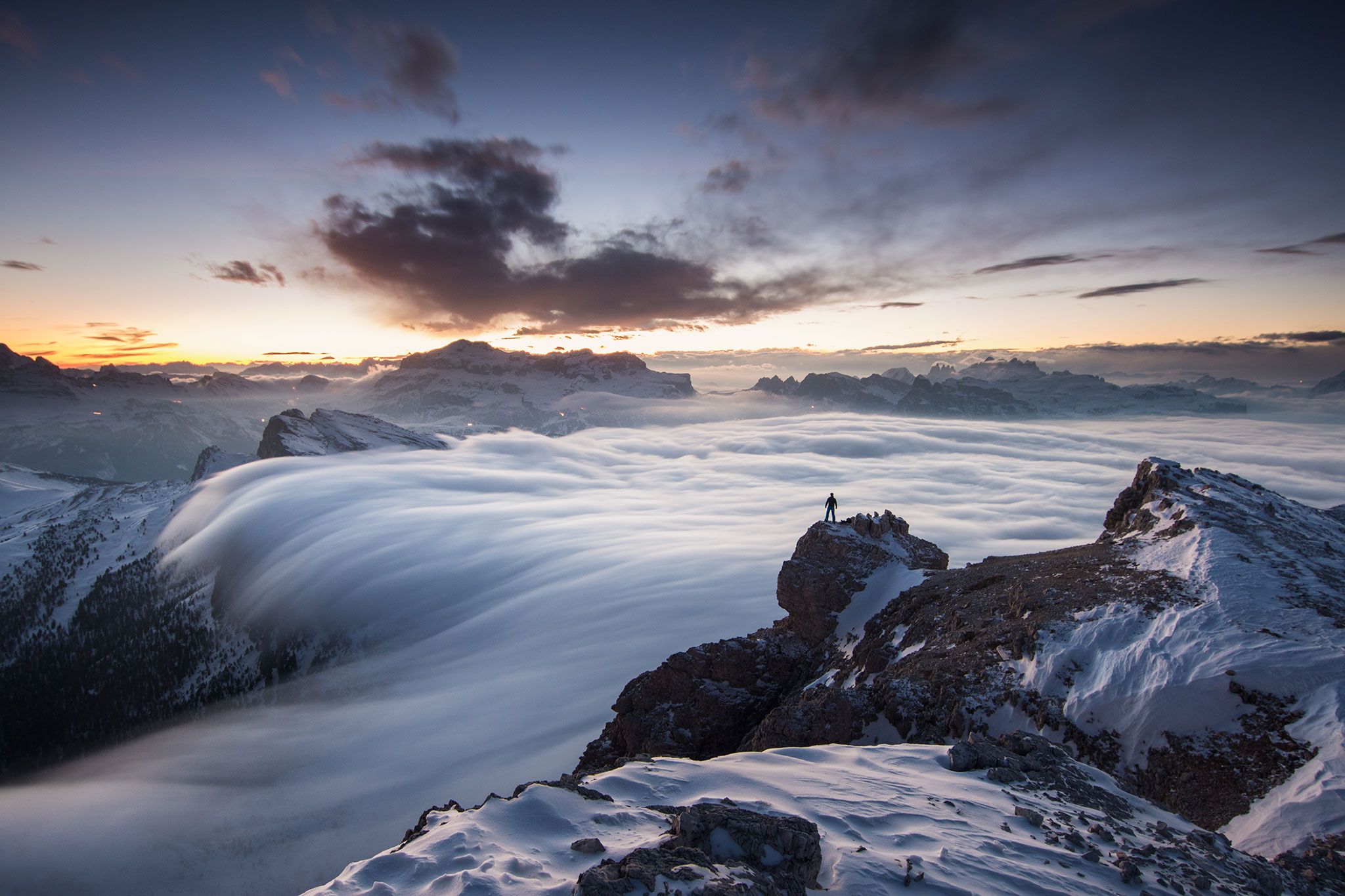
This map shows the low clouds for Germany. Blue areas right inside the white cloud areas usually show the peaks of mountains, rising through the fog. Situations like this offer a great chance to photograph a valley full of clouds from above, as I did in the next image.

Using knowledge about the weather and in this case, the fog forecast successfully helped me to get a photo like this one.
Final words
Most of the time, fog will occur in mostly wind- and cloudless nights in valleys. The time to shoot is the time by sunrise because after the sun has risen, the fog will dissolve again while the air is getting hot. For that reason, you have to check the weather maps from modellzentrale.de at the time by sunrise for the three parameters. But don't forget to calculate what your local time is in UTC time!
Sadly, I can only show you a really small part of the weather forecasts which are possible in landscape and outdoor photography in general. You can buy my book at Rheinwerk Verlag.

Bastian's book about weather forecasting (currently only available in German), published by the Rheinwerk Verlag.


Comments (11)