Le Rocher du Bieley, Belgium
Wallophoto
Wallophoto www.wallophoto.com
licensable
Le Rocher du Bieley, Belgium
Michael Gemine
Michael Gemine www.gemine.be
This photo is copyrighted by the author.
Thank you for respecting the rights and efforts of our photographers. Please contact the author for further information.

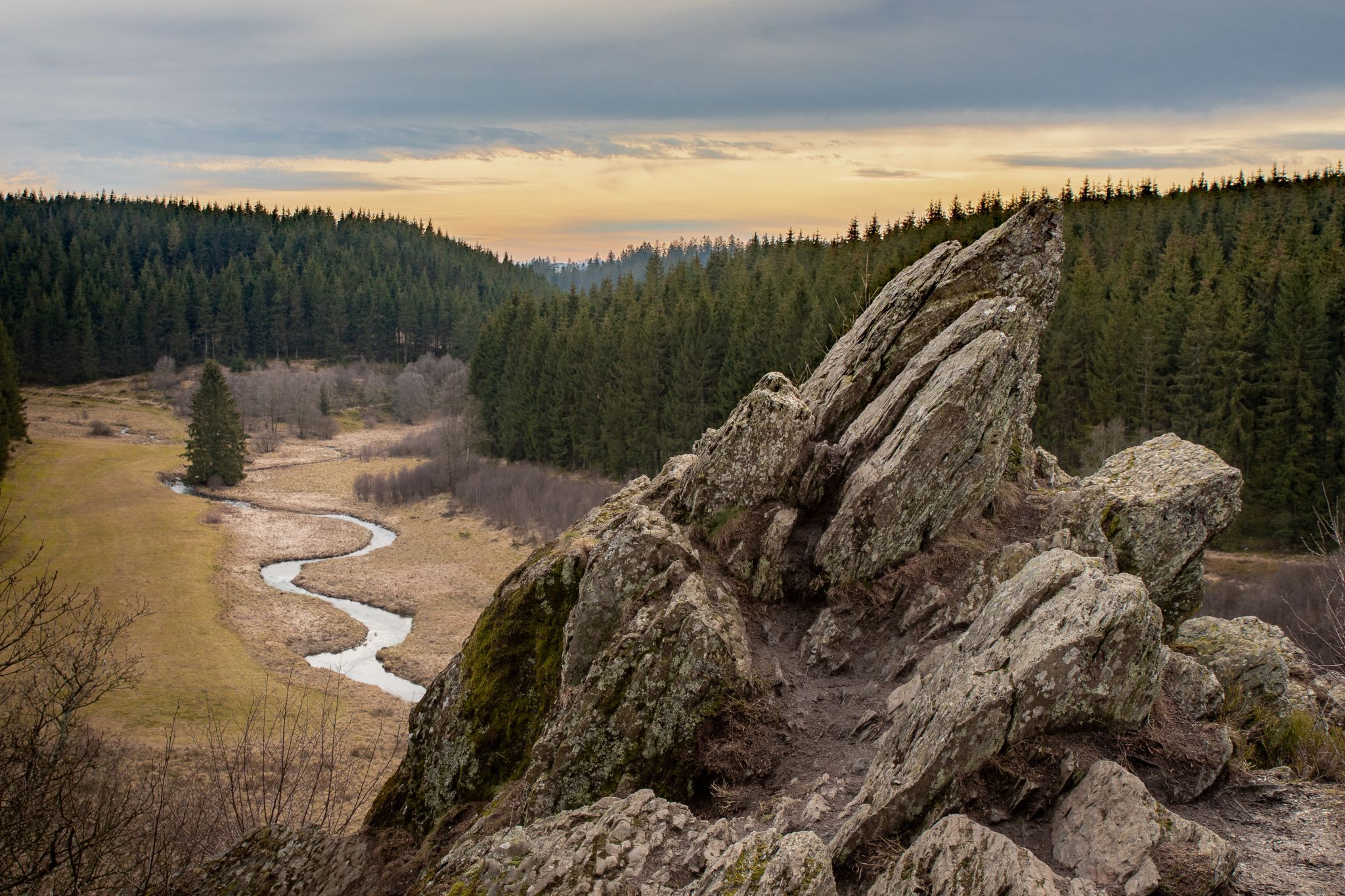
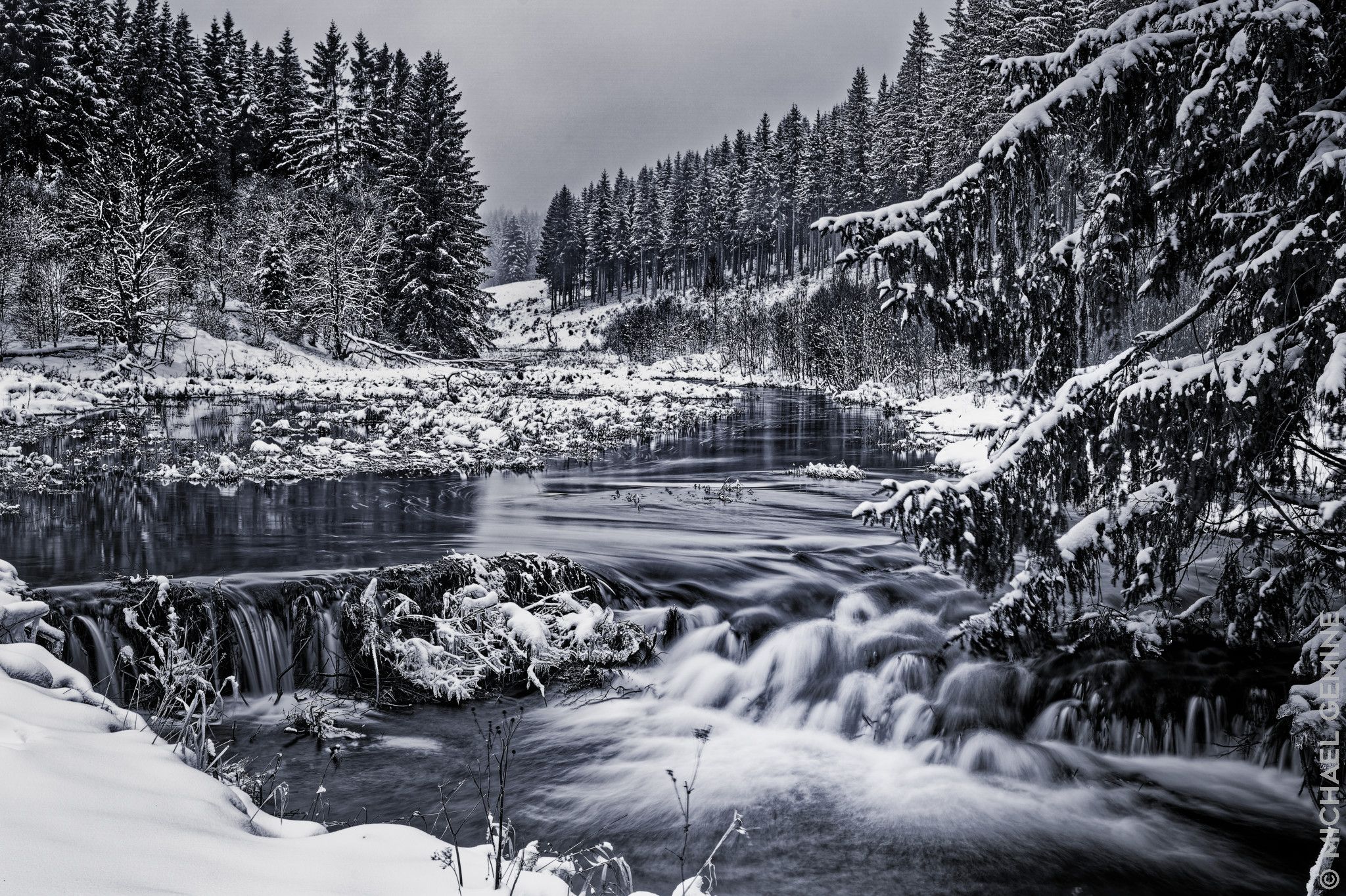
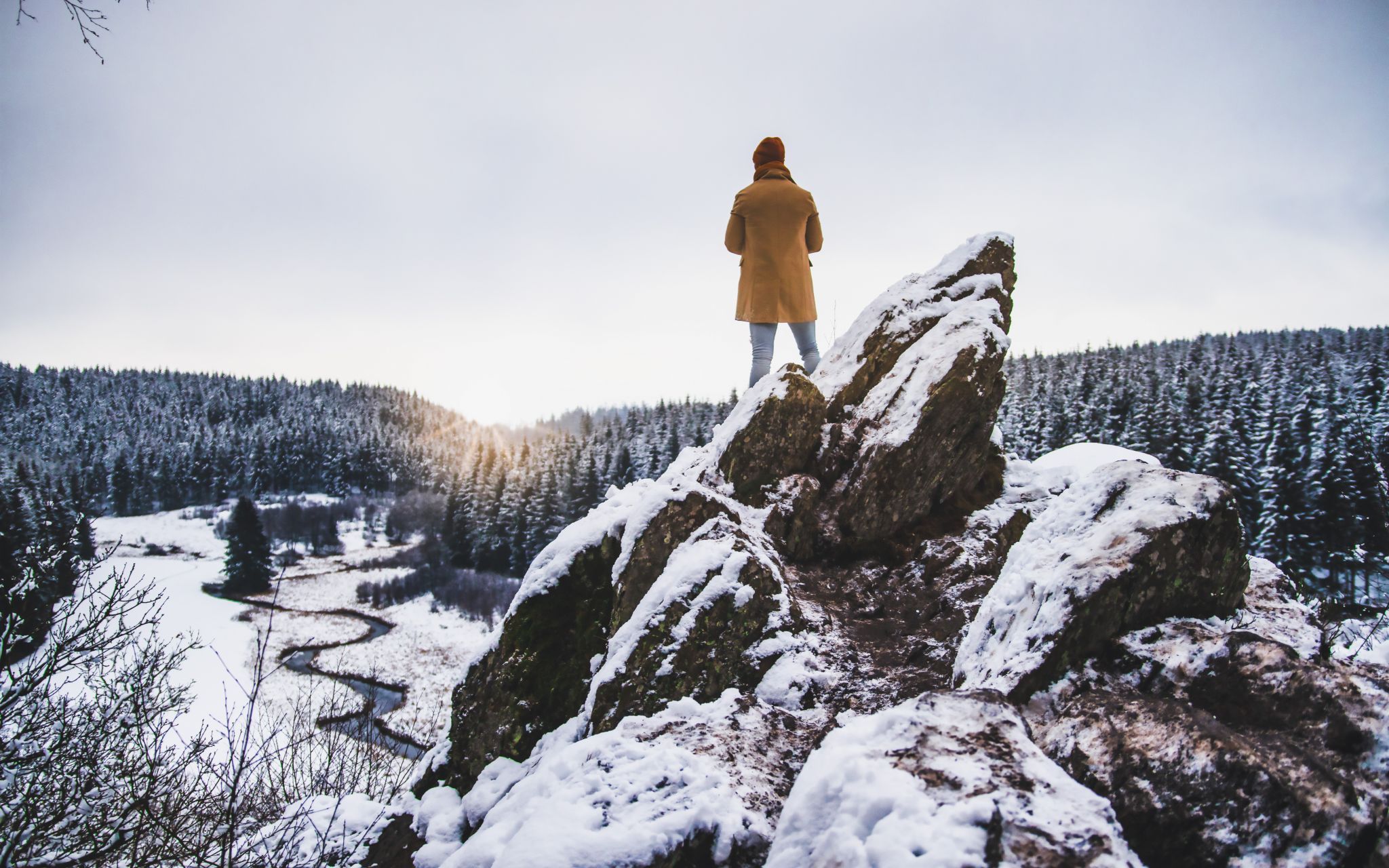
Belgium Le Rocher du Bieley

  • Please log in or sign up for free to see the GPS coordinates & weather for this photo spot

Travel Information

This location is near a Military Domain, not easy to get to, which is divided in 3 zones. During military exercises (with life ammo!) some areas could be closed for the public. The red zone is the closest to the forbidden zone, and on the Butgenbach website you can find if it's allowed to enter. A hike of 5km is needed. You can find a roundtrip hike here:

https://nl.wikiloc.com/routes-wandelen/rocher-de-bieley-66224043
Spot Type Outdoor
Crowd Factor Just a few people
Best Timing All timings are equally good
Sunrise & Sunset 06:16 - 19:02 | current local time: 10:34
Photo Themes Mountains Rock snow
Locations Ardennes

Get the exact geo-position for this spot

Log in to see the GPS coordinates, sun directions, and the map for this photo spot. Or simply bookmark it along with other spots to plan your next trip.

Spot Comments (5)

Please log in or sign up for free to leave a comment or ask a question.
Peter Luxem
Peter Luxem 28.10.2021 , edited
You also have to check this website before going: http://www.buellingen.be/index.php?id=bekanntmachugen or through the website of the gemeinde Butgenbach: http://www.butgenbach.be/ I found it rather quickly --- BE SAFE! --- The area is located in the red zone
Peter Luxem
Peter Luxem 28.10.2021
I've added travel information which should have been there in the first place :( Still looking for an quicker access to this location for a sunset/sunrise shoot
Manuel Becker Team
Manuel Becker 02.11.2021
I just accepted your change, thank you very much Peter for adding it. 5km is definitely a challenge for a night walk... What does "area is located in the red zone" mean? Because of wildlife?
Peter Luxem
Peter Luxem 02.11.2021
In essence it is military territory, which is divided in 3 zones. During military exercises (with life ammo!) some areas could be closed for the public, the red zone is the closest to the forbidden zone, and on the Butgenbach website you could find if it's allowed to enter.
Manuel Becker Team
Manuel Becker 02.11.2021
Oh, that's quite an important info I would say! Thank you very much, I will add that as well to make sure that everybody takes care of that.

Ratings (2) starstarstarstarstar

starstarstarstarstar
2
starstarstarstarstar
0
starstarstarstarstar
0
starstarstarstarstar
0
starstarstarstarstar
0

Popular photo spots in this region

Thank you Robert Urban for creating this photo spot in Belgium and Wallophoto, Michael Gemine, Peter Luxem, Manuel Becker for improving it with additional photos or content.
Imprint & Contact © Locationscout 2024 Privacy / Terms