Lençóis Maranhenses National Park, Brazil
Reiner Boehme
Reiner Boehme www.reinerboehme.de
This photo is copyrighted by the author.
Thank you for respecting the rights and efforts of our photographers. Please contact the author for further information.

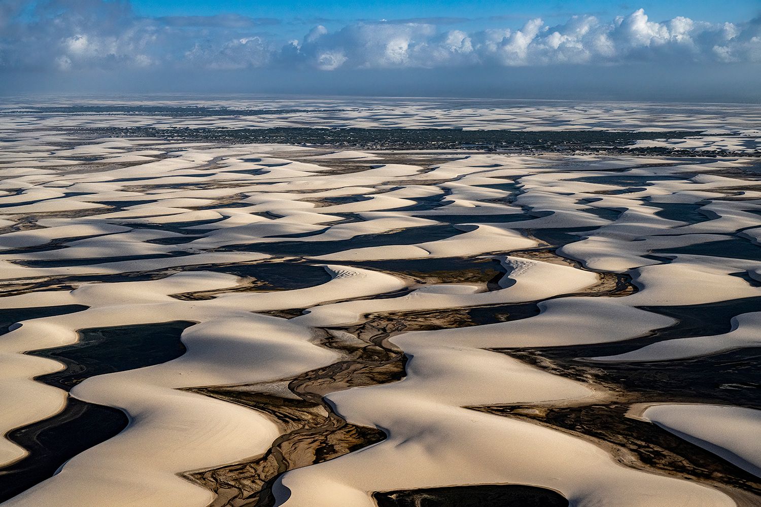
Brazil Lençóis Maranhenses National Park

  • Please log in or sign up for free to see the GPS coordinates & weather for this photo spot
Unique water-filled desert.

Photography Tips

To capture this image, you need a drone or a low-flying scenic flight over Lençóis Maranhenses National Park.

Travel Information

To fly to Lençóis Maranhenses, book a flight to São Luís (SLZ), the nearest major airport. From there, you can arrange a scenic flight with local tour operators in Barreirinhas. To reach Barreirinhas, take a 4–5 hour drive by bus or van from São Luís. Scenic flights usually depart from a small local airstrip in Barreirinhas.
Spot Type Outdoor
Crowd Factor Nearly no other people
Best Timing Summer
Sunrise & Sunset 05:55 - 17:56 | current local time: 13:19
Photo Themes Aerial view

Get the exact geo-position for this spot

Log in to see the GPS coordinates, sun directions, and the map for this photo spot. Or simply bookmark it along with other spots to plan your next trip.

Spot Comments (0)

Please log in or sign up for free to leave a comment or ask a question.

Ratings (1) starstarstarstarstar

starstarstarstarstar
1
starstarstarstarstar
0
starstarstarstarstar
0
starstarstarstarstar
0
starstarstarstarstar
0

Popular photo spots in this region

Thank you Reiner Boehme for creating this photo spot in Brazil and Mia Pflieger for improving it with additional photos or content.
Imprint & Contact © Locationscout 2025 Privacy / Terms