

Canada Churchill River
On the 520 km stretch of the Trans Labrador Highway between Happy Valley-Goose Bay and Wabush / Labrador City, there is only one town: Churchill Falls is about half way. Here the Churchill River in 32 km drops by more than 300 m. The energy of this water is converted into electricity in one of the largest underground hydroelectric power plants in the world.
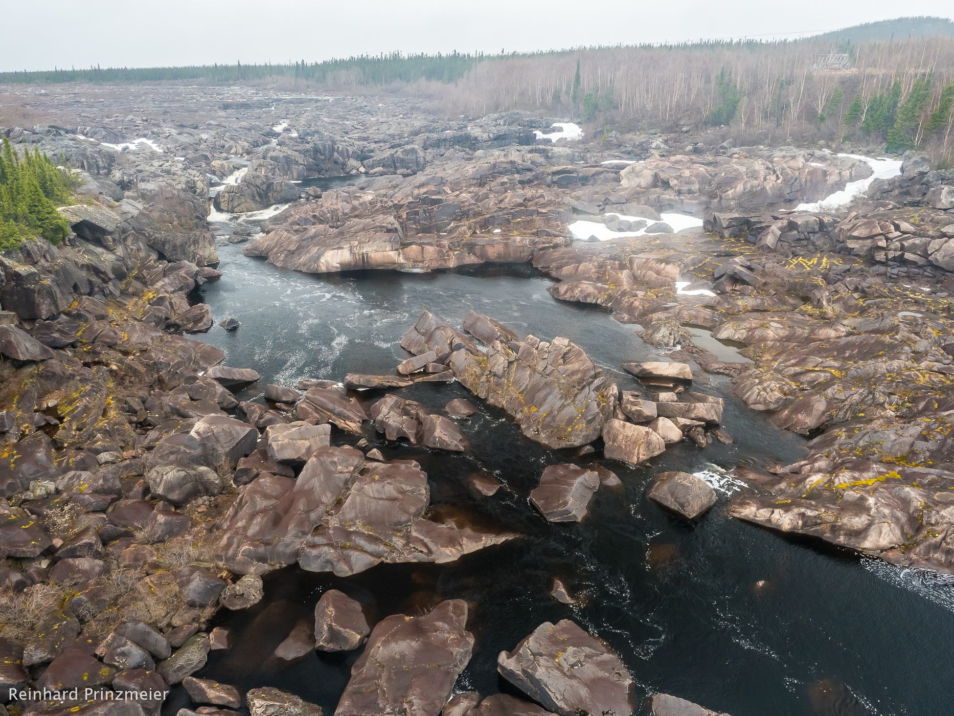
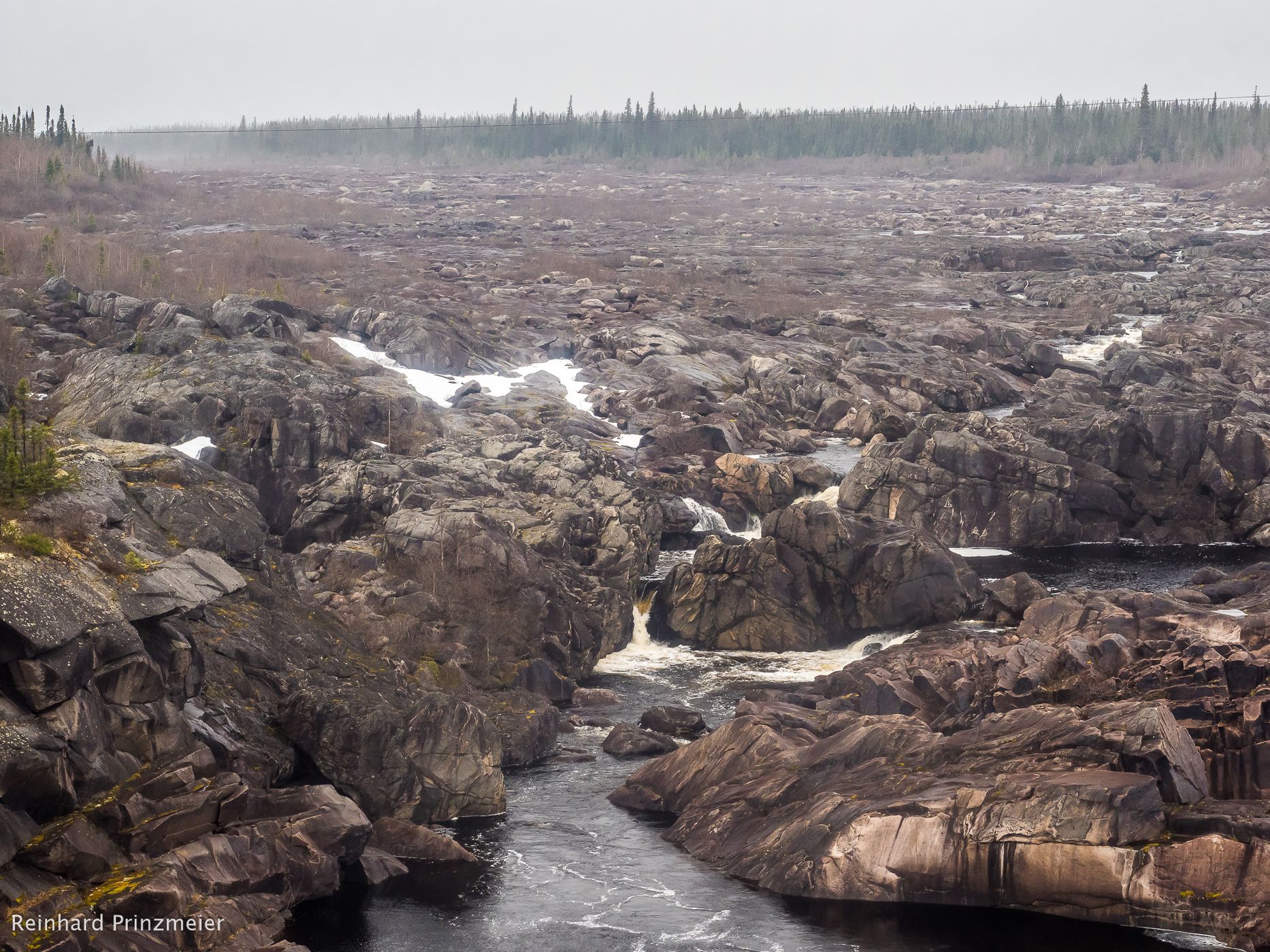
About an hour's drive west from Churchill Falls an unusual bridge whose lane is a steel grate, crosses the Churchill River. A trickle flows in a much too big rocky riverbed. But it can be seen that the riverbed is at times well filled – if the power plant wants it.
About an hour's drive west from Churchill Falls an unusual bridge whose lane is a steel grate, crosses the Churchill River. A trickle flows in a much too big rocky riverbed. But it can be seen that the riverbed is at times well filled – if the power plant wants it.
Spot Type
Outdoor
Crowd Factor
Nearly no other people
Best Timing
Daytime
Sunrise & Sunset
05:14 - 21:33
| current local time: 21:45
Photo Themes
Riverbed
Rocks
Locations
Labrador
Churchill Falls
Newfoundland and Labrador
Spot comments (0)