

Canada Tent Ridge
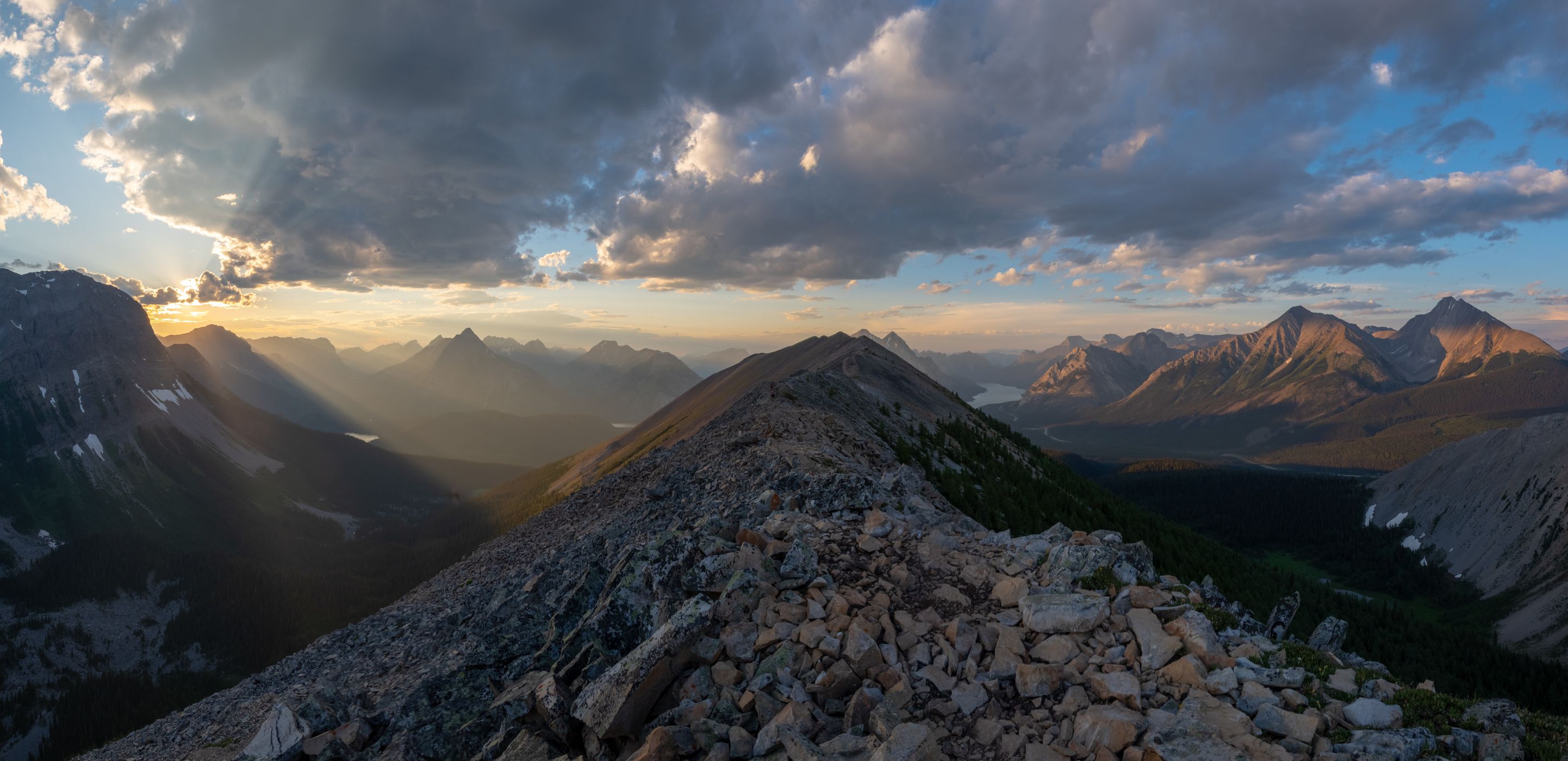
The Tent Ridge Horseshoe hike is a challenging but rewarding loop trail located in Spray Lakes Provincial Park, Alberta. It offers stunning panoramic views of the Spray Valley, Kananaskis area, and southeastern Banff National Park from an elevation of approximately 8,000 feet. The hike covers a distance of 7.2 miles with an elevation gain of 2153 feet, taking about 5 hours to complete in summer and fall.
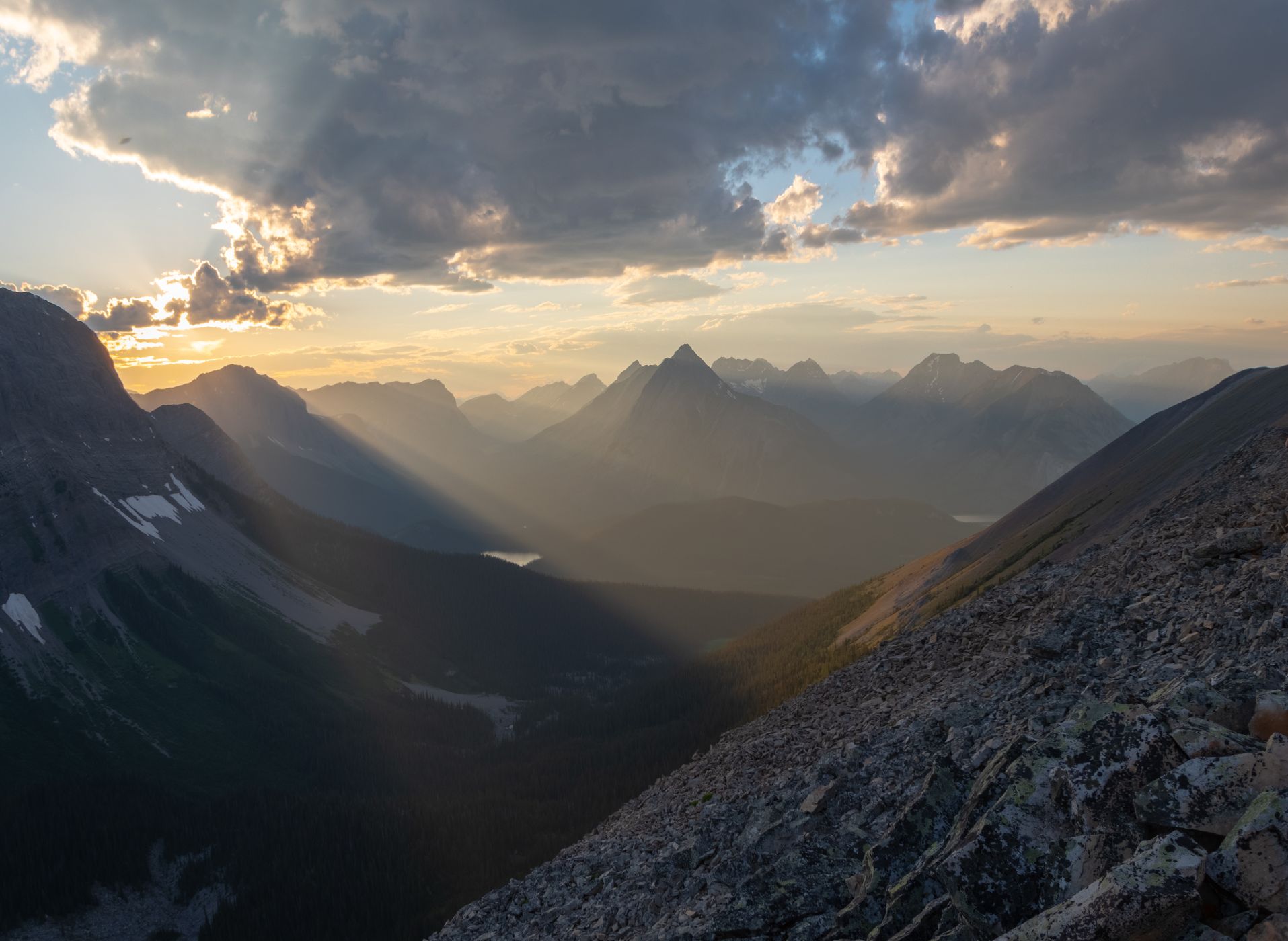
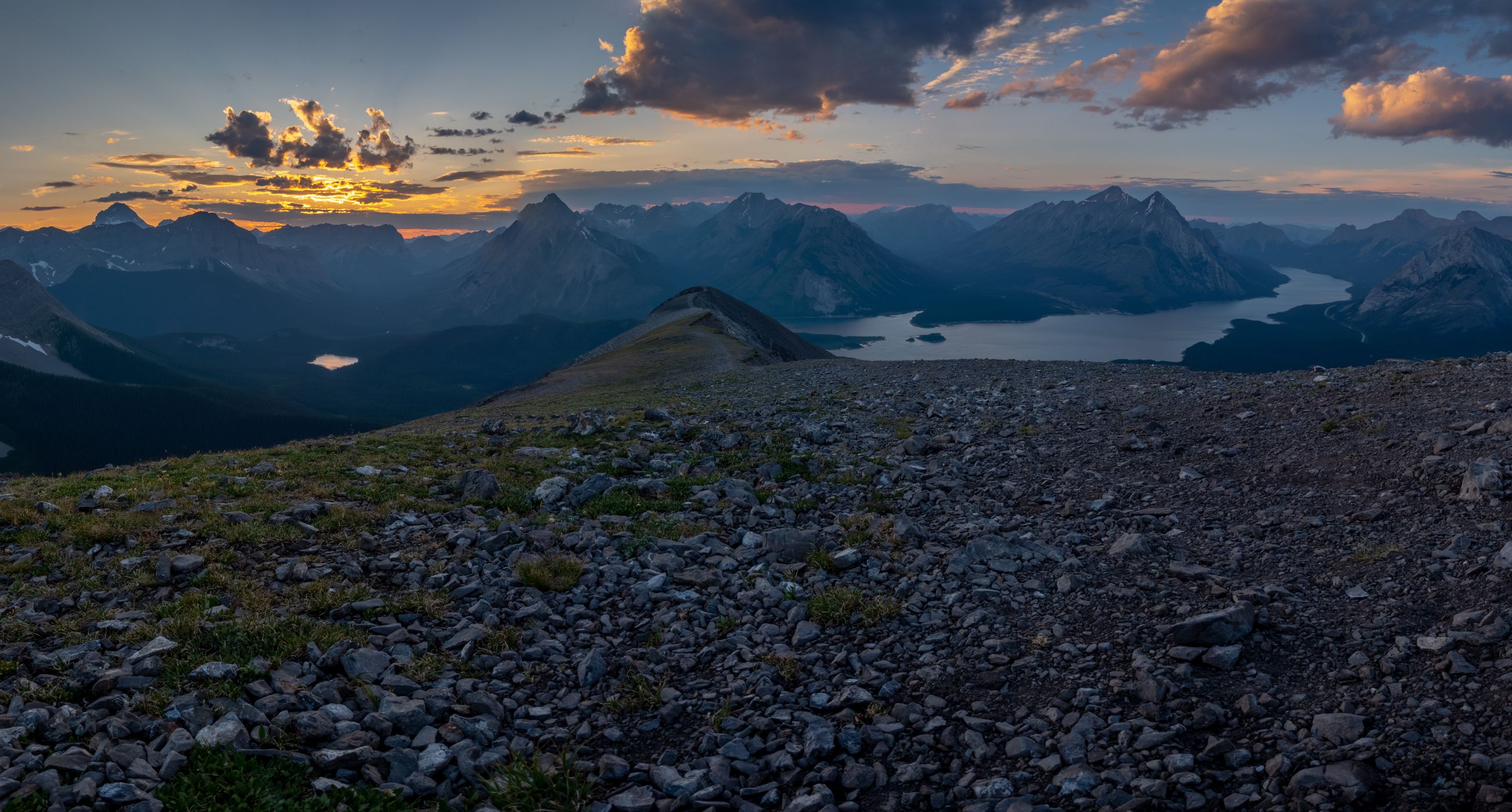
The trail begins along Mount Shark Road and ascends through alpine meadows, larch forests, loose scree slopes, and narrow ridge walks. Hikers should expect some light technical sections, steep exposures, and short Class 3 scrambling sections, especially on the ridges. The route passes a weather station outpost overlooking Tryst Lake and offers opportunities for stunning photography.
While rated as a moderate hike by many, the high elevation and exposed slopes can be strenuous for some hikers. Trekking poles are recommended for stability, especially during descents. The trail ends back at Mount Shark Road, providing a full loop experience.
The location of the hike in Spray Lakes Provincial Park offers a wilderness setting away from more crowded areas like Johnston Canyon and Downtown Banff, making it a popular choice for those seeking a challenging yet scenic hike in the Canadian Rockies. Nearby amenities include the Mount Engadine Lodge, known for its Afternoon Tea and three-course dinner menu, offering a satisfying post-hike meal option.
Photography Tips
A tripod is recommended for sunrise/sunset conditions, however it is not necessary.
Travel Information
To reach the Tent Ridge Horseshoe hike, you will need to travel to Spray Lakes Provincial Park in Alberta, Canada. Here are the general directions to get there:
Starting Point: Canmore, Alberta
Travel Route: Drive along the Smith-Dorrien/Spray Trail (Highway 742) from Canmore.
Trailhead Location: Look for the unmarked but popular trailhead along Mount Shark Road. The trailhead is located along the gravel road, and you may need to backtrack about 0.1 mile from where you park your car.
Trailhead Coordinates: GPS coordinates for the trailhead can help with navigation. You can find these coordinates online or use a GPS device or smartphone app to locate the trailhead precisely.
Parking: Park your vehicle at the Tent Ridge Horseshoe Trail Head along Mount Shark Road.
While driving to the trailhead, it's essential to follow any specific directions or maps provided by local authorities or hiking guides. Road conditions and access points may vary, especially in mountainous regions like Kananaskis Country. Additionally, consider factors such as weather conditions and seasonal closures, as they can affect accessibility to the trailhead and safety during your hike.
Spot Type
Outdoor
Crowd Factor
Nearly no other people
Best Timing
Sunset in summer
Sunrise & Sunset
05:57 - 21:38
| current local time: 15:49
Photo Themes
Canadian Rockies
Lakes
Landscape
Mountains
Nature
Rocky Mountains
Sunset


Spot comments (0)