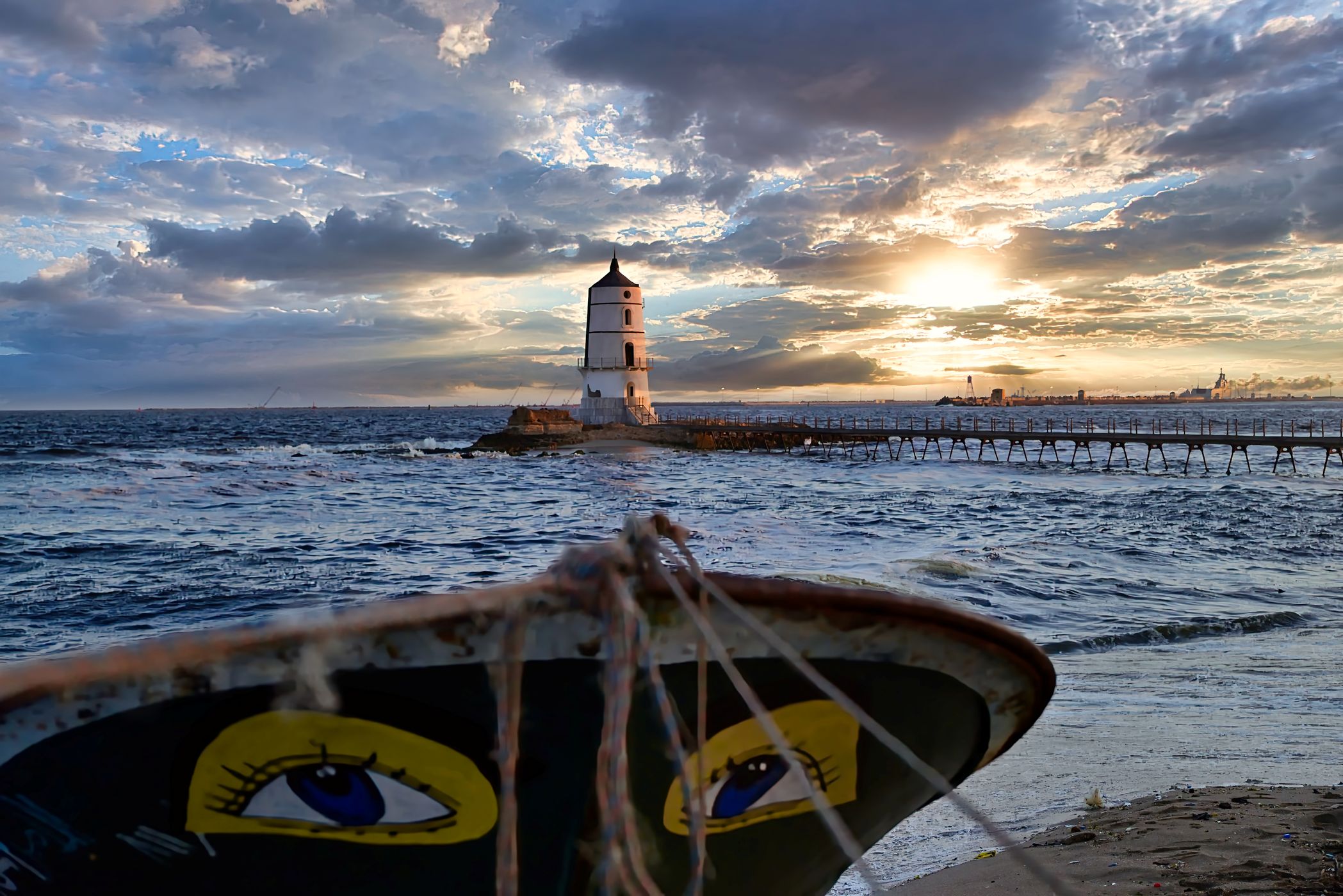

Egypt Al Fanar Al Meks Dekhela, Alexandria Governorate, Egypt
- Al Fanar Lighthouse (فنار المكس القديم)
Historically, this lighthouse was a guiding beacon for ships entering Alexandria’s western port. While the old lighthouse is no longer active, it remains a symbolic landmark of the area’s maritime past
Historically, this lighthouse was a guiding beacon for ships entering Alexandria’s western port. While the old lighthouse is no longer active, it remains a symbolic landmark of the area’s maritime past
Photography Tips
Camera + tripod
Travel Information
By Car / Taxi
- From central Alexandria (Corniche, Raml Station, or downtown) → head west along the Corniche road toward Dekhela.
- Continue past Qabbary and Agami until you reach Al Meks.
- The drive usually takes 20–30 minutes depending on traffic.
- Taxis and ride-hailing apps (like Uber or Careem) are the most convenient option if you’re not familiar with the area.
:bus: By Public Transport
- Local microbuses run along the Corniche and connect central Alexandria with Dekhela and Al Meks.
- Ask for a ride toward Al Meks (المكس) or Dekhela (الدخيلة).
- From the drop-off point, you may need a short walk or tuk-tuk ride to reach Max Al Shalehat directly.
:walking: Nearby Landmarks
- Al Fanar Lighthouse (فنار المكس القديم) — though no longer active, it’s a key reference point.
- Sea Gull Restaurant and Al-Lol Fish Restaurant are well-known markers right at Max Al Shalehat.
:memo: Travel Tips
- The area is more local and rustic compared to Alexandria’s city center, so expect narrow streets and fishing boats along the shore.
- Best time to visit is afternoon to sunset, when seafood restaurants are lively and the Mediterranean view is at its best.
Would you like me to also map out a step-by-step route from Cairo to Max Al Shalehat, since you’re based in Cairo? That way you’ll know how to get there for a day trip.
Spot Type
Outdoor
Crowd Factor
No info yet
Best Timing
All timings are equally good
Sunrise & Sunset
06:09 - 20:04
| current local time: 22:45
Photo Themes
Landscape
Mediterranean Sea
Panoramic View
Seascape
Seaside
Locations
Alexandria Governorate
Al Meks
Dekhela


Spot comments (0)