Kalsoy Island by drone, Faroe Islands
carlo alberto conti
carlo alberto conti www.carloalbertoconti.it
licensable
This photo is copyrighted by the author.
Thank you for respecting the rights and efforts of our photographers. Please contact the author for further information.

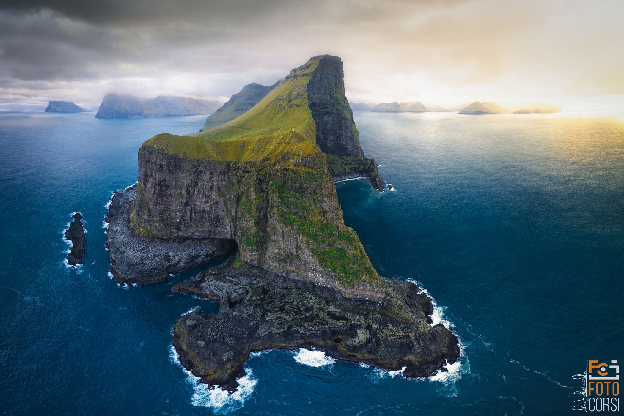
Faroe Islands Kalsoy Island by drone

  • Please log in or sign up for free to see the GPS coordinates & weather for this photo spot
Aerial drone view of Kalsoy Island and Kallur lighthouse

Photography Tips

you need to move the drone away from the island at least 7-800 meters, be careful of the strong wind that is characteristic of this island. Also be careful of Fulmars that are very present on the site.

Travel Information

spot reachable on foot after about 45 minutes of walking along the island of Kalsoy. The first part of the path is uphill, but it is very simple. Approaching the coast instead, you need to be very careful of the wind and the cliffs on the sea present.
Spot Type Outdoor
Crowd Factor Just a few people
Best Timing Sunset in summer
Sunrise & Sunset 03:26 - 23:29 | current local time: 22:53
Photo Themes Aerial Photography Aerial view Sea Cliff Seascape
Locations Kalsoy

Get the exact geo-position for this spot

Log in to see the GPS coordinates, sun directions, and the map for this photo spot. Or simply bookmark it along with other spots to plan your next trip.

Spot Comments (0)

Please log in or sign up for free to leave a comment or ask a question.

Ratings (1) starstarstarstarstar

starstarstarstarstar
1
starstarstarstarstar
0
starstarstarstarstar
0
starstarstarstarstar
0
starstarstarstarstar
0

Popular photo spots in this region

Thank you carlo alberto conti for creating this photo spot in Faroe Islands.
Imprint & Contact © Locationscout 2025 Privacy / Terms