Mosel Bend Bremm, Germany
Dirk Wiemer
Dirk Wiemer dirkwiemer.de
Mosel Bend Bremm, Germany
Torsten
Torsten www.torstenrichertz.com
1
Mosel Bend Bremm, Germany
Daniel Schmitz
Daniel Schmitz www.schmitzpics.com
licensable
Mosel Bend Bremm, Germany
Daniel Schmitz
Daniel Schmitz www.schmitzpics.com
licensable
This photo is copyrighted by the author.
Thank you for respecting the rights and efforts of our photographers. Please contact the author for further information.

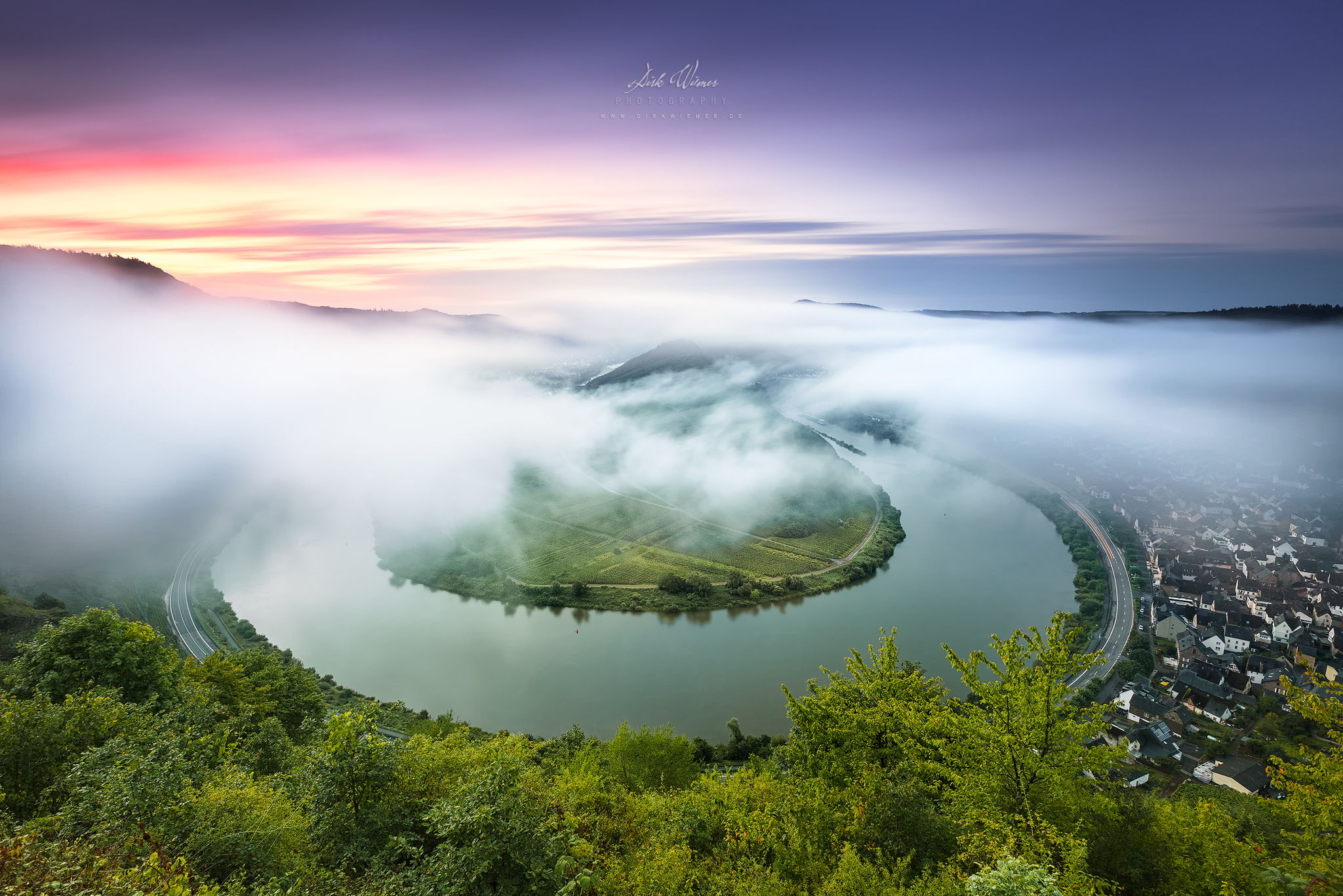
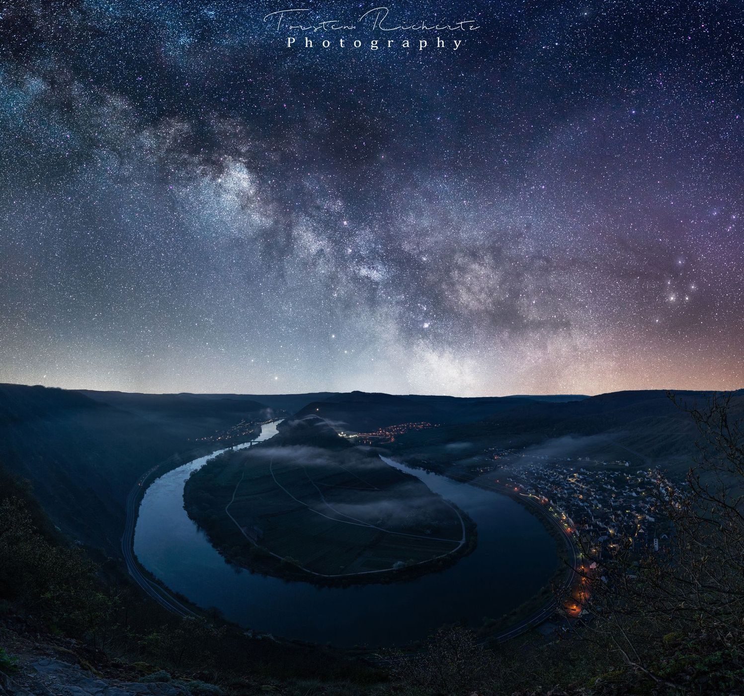
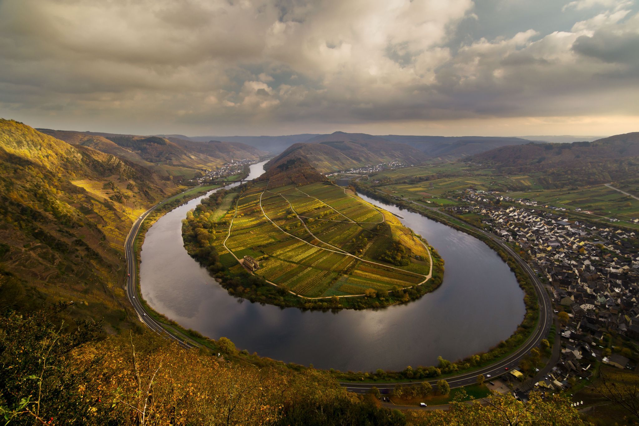
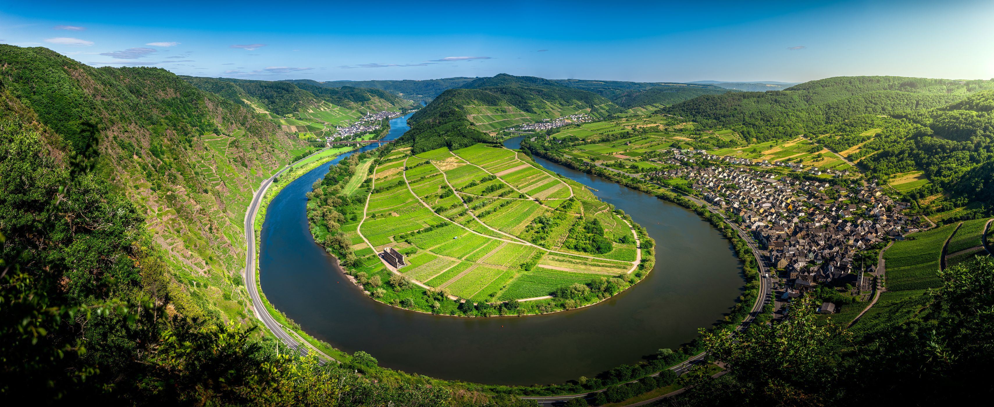
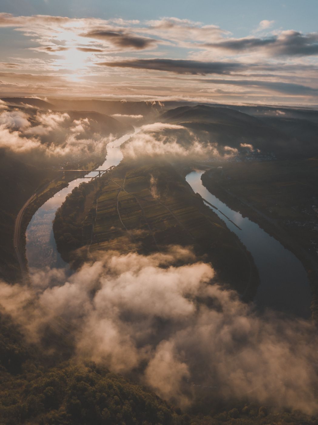
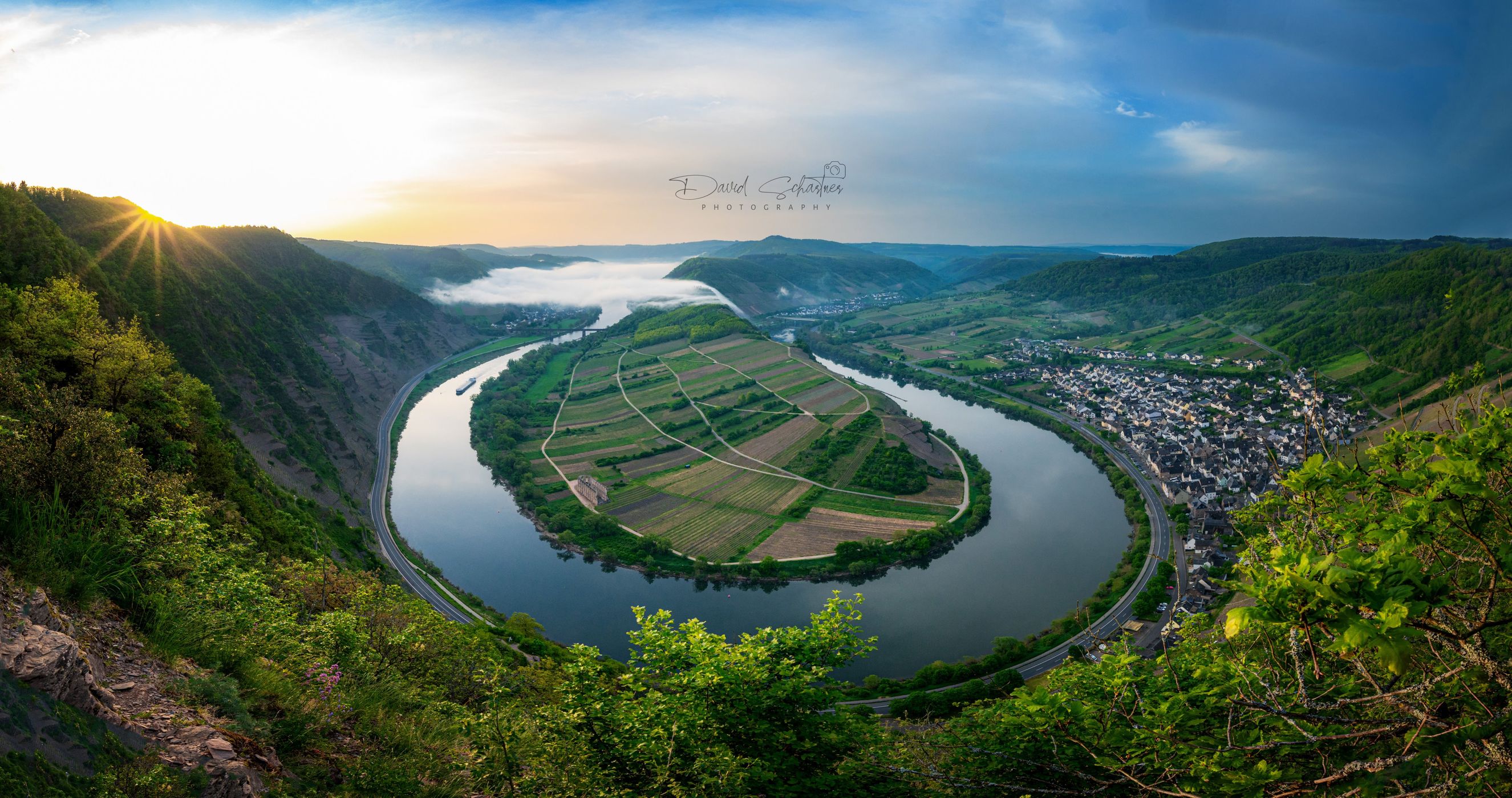
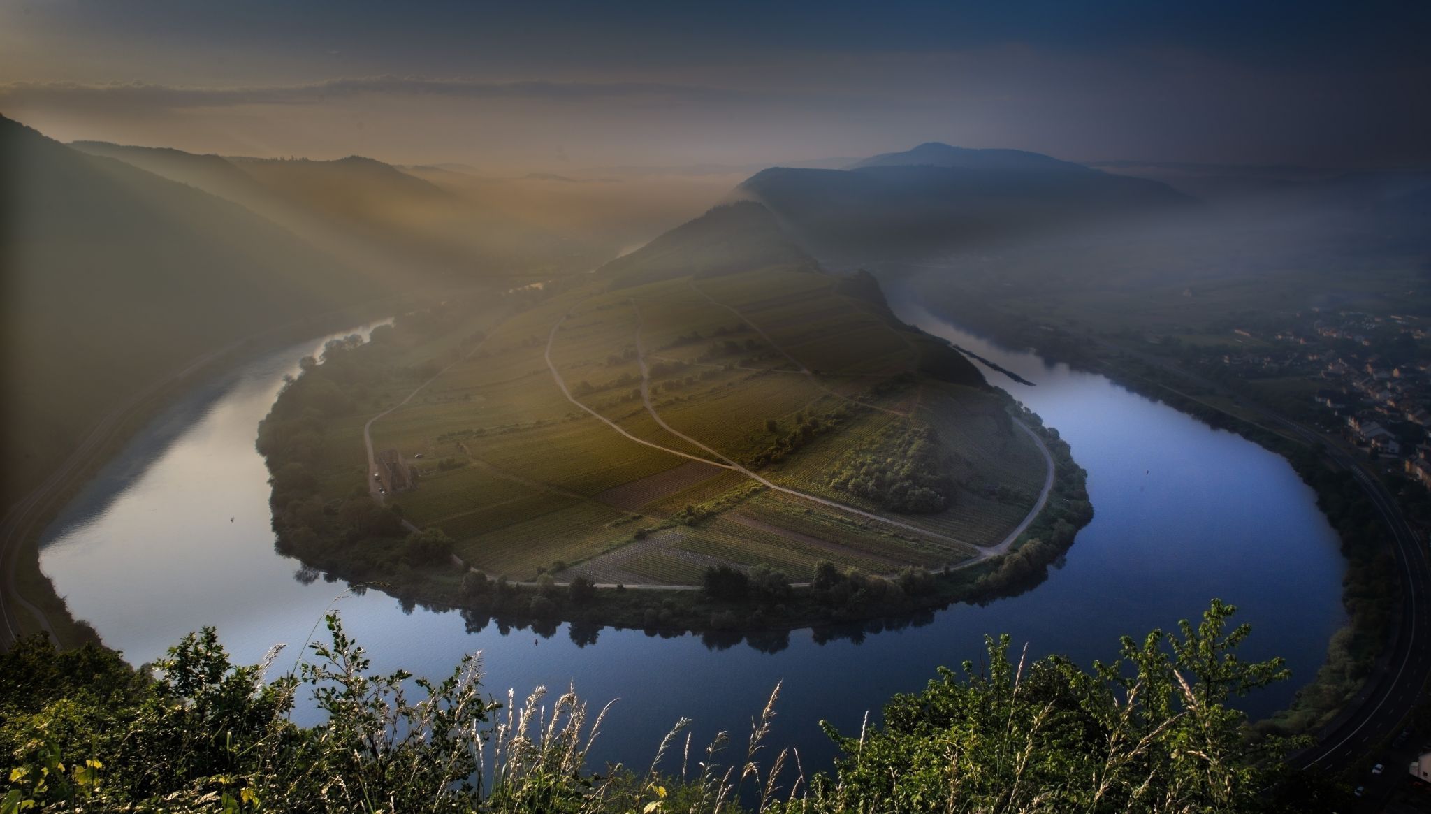
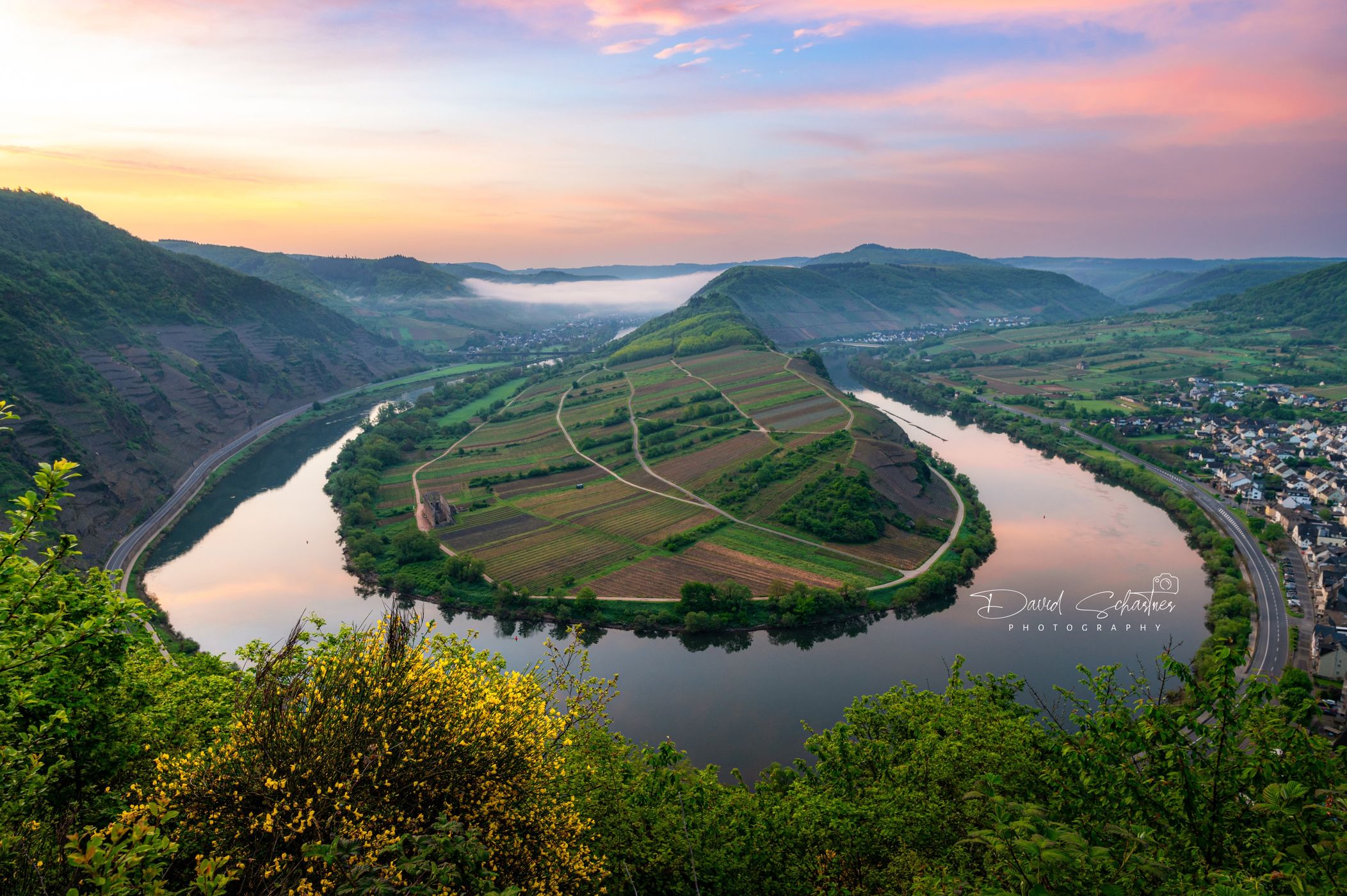
Germany Mosel Bend Bremm

  • Please log in or sign up for free to see the GPS coordinates & weather for this photo spot
The municipality lies at a bow in the river Moselle between Trier and Koblenz, among the sloped vineyards of the Calmont, which with an elevation of 380 m above sea level and a slope of roughly 65° is Europe’s steepest vineyard location. This stretches along the Moselle from Ediger-Eller to Bremm and is part of the Mosel wine region.

Photography Tips

Try shooting at sunrise in autumn. Also, try shooting the milky way in spring/early summer.

Travel Information

I avoided the steep climb and parked on the road, even if I had to pass by a longer walk.
Spot Type Outdoor
Crowd Factor Just a few people
Best Timing Sunrise during fall
Sunrise & Sunset 06:13 - 18:59 | current local time: 13:35
Photo Themes River viewpoint Vineyard

Get the exact geo-position for this spot

Log in to see the GPS coordinates, sun directions, and the map for this photo spot. Or simply bookmark it along with other spots to plan your next trip.

Spot Comments (10)

Please log in or sign up for free to leave a comment or ask a question.
Prathibha Harihara Subramanian
Prathibha Harihara Subramanian 10.08.2022
Hello Dirk, Can you let us know how to reach the view point.
Giuseppe Bevilacqua
Giuseppe Bevilacqua 19.07.2016
Great Picture. I Like the colors in the sky! Very Nice Spot!
Dirk Wiemer
Dirk Wiemer 19.07.2016
Thank you Giuseppe! Yes, this bend is really worth a visit. ;)
Florian Schwenk
Florian Schwenk 02.10.2015
Really great photo! I want to go there for sunrise too. How long did you walk?
Manuel Becker Team
Manuel Becker 02.10.2015
Good, you already found this spot. Dirk already gave me a good explanation on how to get down there. I would probably use this spot because it's easier and faster to get a little bit more down instead of up.
Dirk Wiemer
Dirk Wiemer 02.10.2015
Thanks a lot Florian! Google Maps means 26 minutes by foot for the walk I'll send you via your facebook account.
Manuel Becker Team
Manuel Becker 02.10.2015
I will add that as a feature idea so that the path also can be added on the map... Would make sense, wouldn't it? ;)
Dirk Wiemer
Dirk Wiemer 03.10.2015
That sounds pretty damn good Manuel! :) Really a great idea. I hope the feature as a unique point will be used properly.
Andreas Brett
Andreas Brett 09.08.2015
Dirk, your photographs are so gorgeous and inspiring! Awesome stuff!!
Dirk Wiemer
Dirk Wiemer 09.08.2015
Thanks so much Andreas! I really do appreciate such kind words.

Ratings (8) starstarstarstarstar

starstarstarstarstar
5
starstarstarstarstar
3
starstarstarstarstar
0
starstarstarstarstar
0
starstarstarstarstar
0

Popular photo spots in this region

Thank you Dirk Wiemer for creating this photo spot in Germany and Torsten, Rene Schlinkmann, Daniel Schmitz, Kristiina Aksberg, Mia Pflieger, Yvonne Becker for improving it with additional photos or content.
Imprint & Contact © Locationscout 2024 Privacy / Terms