



Germany Edmund Probst Haus, Nebelhorn, Oberstdorf
The Edmund Probst Haus at Höfatsblick directly beneeth the Nebelhorn summit is not only good for taking a rest. On clear days you can also enjoy the panorama of the Alps.
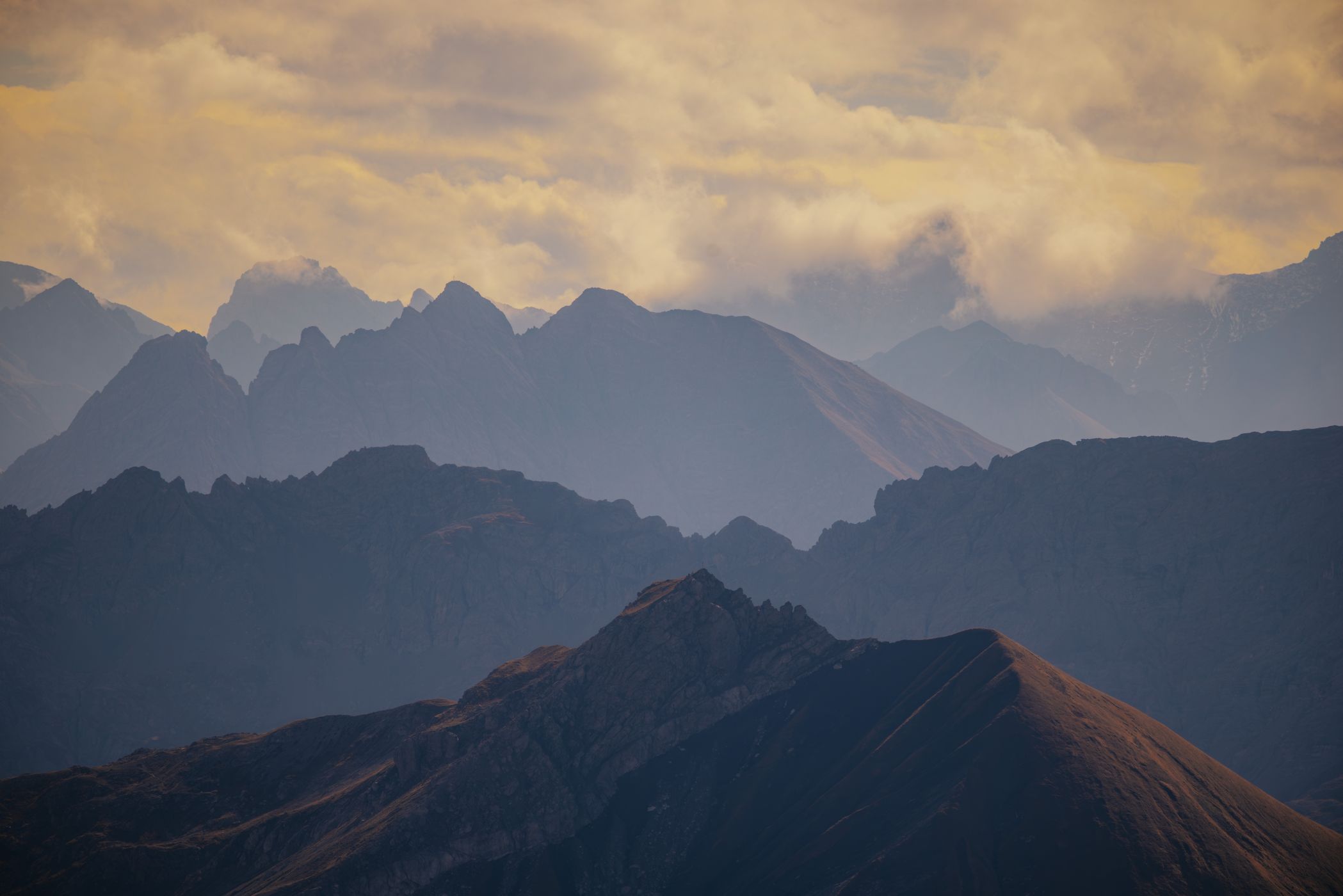
The Edmund-Probst-Haus sits at 1,932 metres above sea level on the Nebelhorn in the Allgäu Alps, surrounded by dramatic mountain peaks and expansive views across the Alpine landscape. On clear days, the combination of rugged ridgelines, deep valleys and distant mountain ranges makes this a fantastic location for landscape photography, especially when atmospheric conditions create distinct layers of mountains fading into the distance.
The Edmund-Probst-Haus sits at 1,932 metres above sea level on the Nebelhorn in the Allgäu Alps, surrounded by dramatic mountain peaks and expansive views across the Alpine landscape. On clear days, the combination of rugged ridgelines, deep valleys and distant mountain ranges makes this a fantastic location for landscape photography, especially when atmospheric conditions create distinct layers of mountains fading into the distance.
Photography Tips
Use a telephoto lens: Try 100–500mm or longer to compress overlapping mountain ridges and emphasise the layers.
Look for contrast: Dark foreground ridges against brighter, distant mountains create a strong sense of depth.
Keep the composition simple: Use repeating ridgelines, alternating light an shadow, and a clean horizon to guide the viewer's eye.
Check visibility and wind: Clear air is ideal for crisp distant peaks, while a little haze can create more atmospheric layers. A stable tripod can help in low light, but it isn't essential in good conditions.
Look for contrast: Dark foreground ridges against brighter, distant mountains create a strong sense of depth.
Keep the composition simple: Use repeating ridgelines, alternating light an shadow, and a clean horizon to guide the viewer's eye.
Check visibility and wind: Clear air is ideal for crisp distant peaks, while a little haze can create more atmospheric layers. A stable tripod can help in low light, but it isn't essential in good conditions.
Travel Information
The Edmund-Probst-Haus can be reached easily by taking the Nebelhornbahn cable car from Oberstdorf to the Höfatsblick mountain station, followed by a short walk to the hut. For a more adventurous experience, hike from Oberstdorf via Faltenbachtobel and Seealpe, a challenging ascent of around 1,100 metres in elevation that takes approximately 3–3.5 hours. Alternatively, a scenic but more demanding route leads from Reichenbach past the Gaisalp lakes and up to the hut. Always check trail conditions and cable car operating times before setting off, especially in autumn and winter.
Spot Type
Outdoor
Crowd Factor
Lots of people
Best Timing
Daytime in winter
Sunrise & Sunset
07:03 - 17:00
| current local time: 13:01
Photo Themes
House
Mountains
ski
winter
Locations
Höfatsblick
Alps
Nebelhorn
Oberallgäu
Allgäu
Bavaria


Spot comments (0)