
Germany Bacher Lay
Bacher Lay
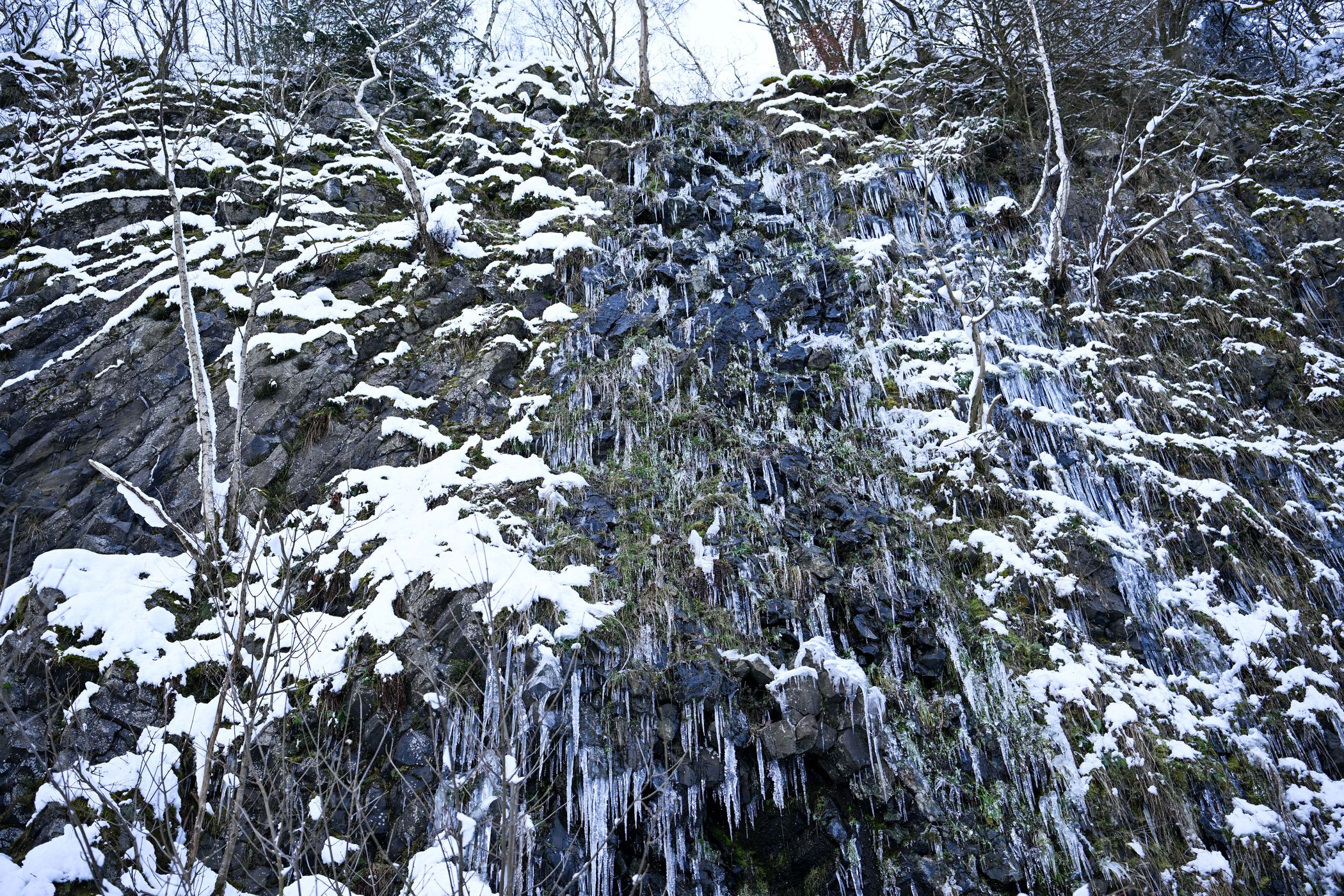
Es handelt sich um einen stillgelegten Basaltsteinbruch, der zwischen Bad Marienberg und Nisterau direkt an der Schwarzen Nister, einem Zulauf der großen Nister, gelegen ist. Der Name leitet sich von dem früher eigenständigen Ort Bach, der heute ein Ortsteil der Gemeinde Nisterau ist, ab; Lay bedeutet in diesem Fall Steinbruch. Das Gebiet erstreckt sich in Teilen über die Gemarkungen Bad Marienberg, Bach, Eichenstruth und Stockhausen-Illfurth.[1]
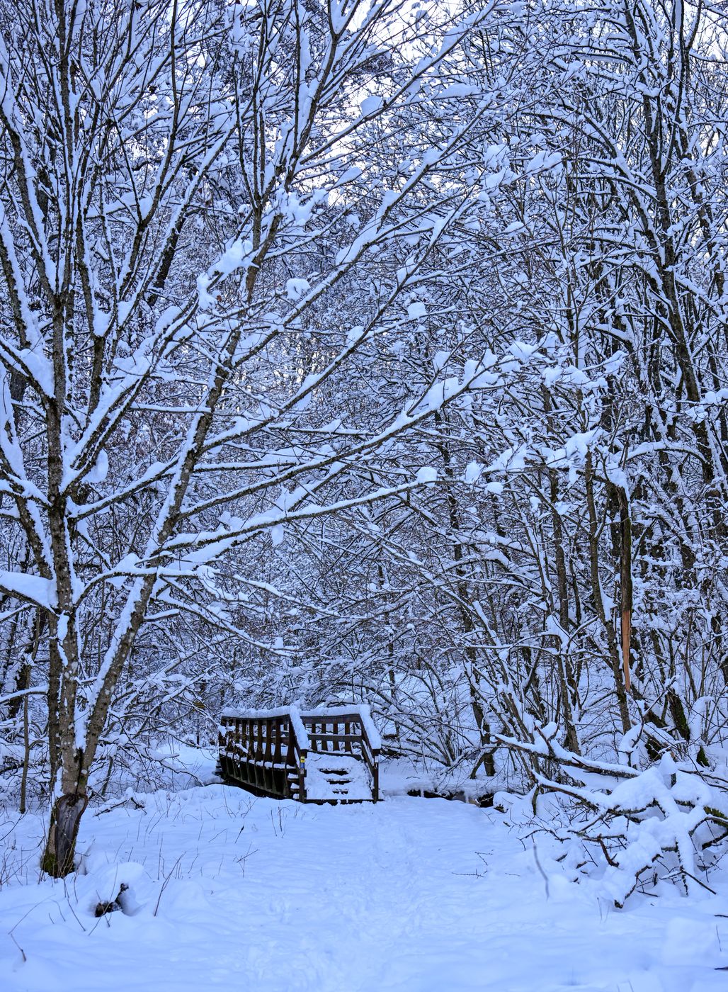
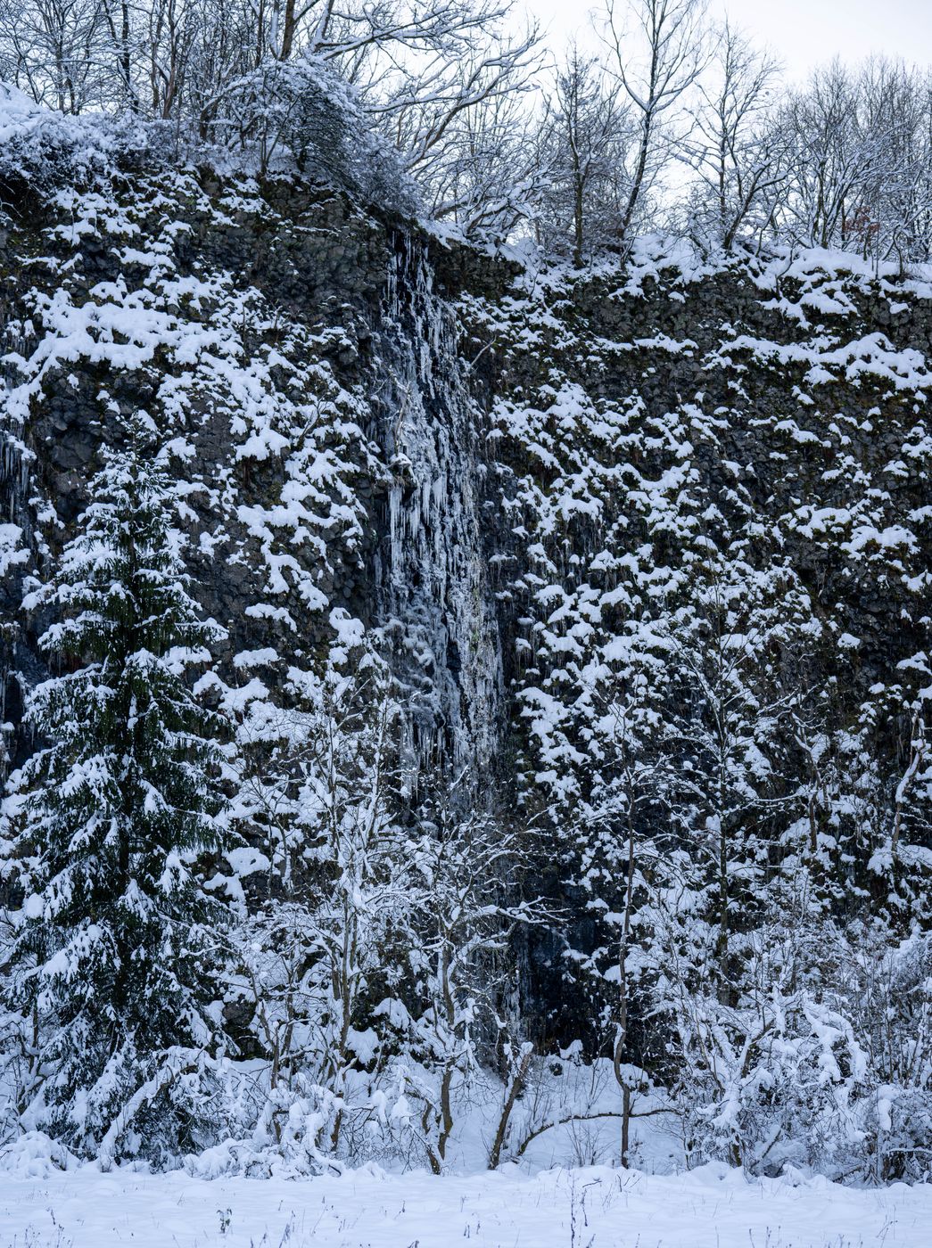
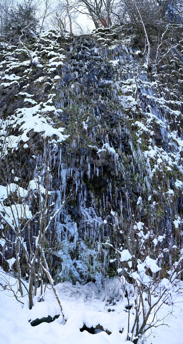
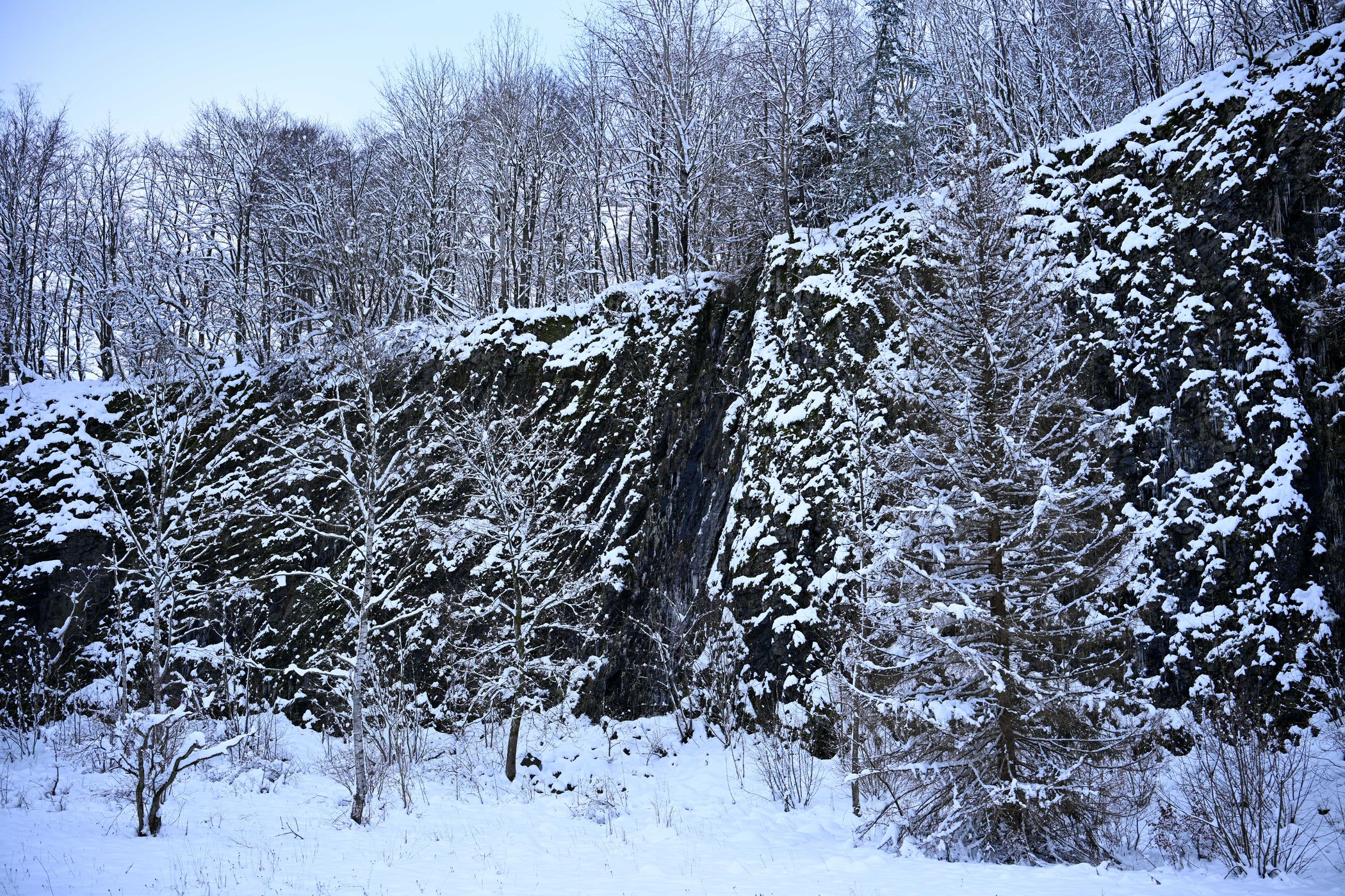
Die Bacher Lay ist gekennzeichnet durch eine mächtige, fast senkrechte Basaltsteinwand, die durch den früheren Basaltabbau entstanden ist. Das nahegelegene "Pfaffenmal", ein 18 Meter hoher Säulenbasaltkegel in Meilerstellung, ist auch sehenswert.
Bis zur Bacher Lay sind es von der Stadtmitte Bad Marienberg zu Fuß ca. 4 Kilometer.
Es handelt sich um einen stillgelegten Basaltsteinbruch, der zwischen Bad Marienberg und Nisterau direkt an der Schwarzen Nister, einem Zulauf der großen Nister, gelegen ist. Der Name leitet sich von dem früher eigenständigen Ort Bach, der heute ein Ortsteil der Gemeinde Nisterau ist, ab; Lay bedeutet in diesem Fall Steinbruch. Das Gebiet erstreckt sich in Teilen über die Gemarkungen Bad Marienberg, Bach, Eichenstruth und Stockhausen-Illfurth.[1]
Die Bacher Lay ist gekennzeichnet durch eine mächtige, fast senkrechte Basaltsteinwand, die durch den früheren Basaltabbau entstanden ist. Das nahegelegene "Pfaffenmal", ein 18 Meter hoher Säulenbasaltkegel in Meilerstellung, ist auch sehenswert.
Bis zur Bacher Lay sind es von der Stadtmitte Bad Marienberg zu Fuß ca. 4 Kilometer.
Spot Type
Outdoor
Crowd Factor
A decent amount of people
Best Timing
Blue hour/at night in winter
Sunrise & Sunset
05:37 - 21:31
| current local time: 10:24
Photo Themes
Wasserfall
Locations
Bad Mareinebrg


Spot comments (0)