
Iceland Goðafoss
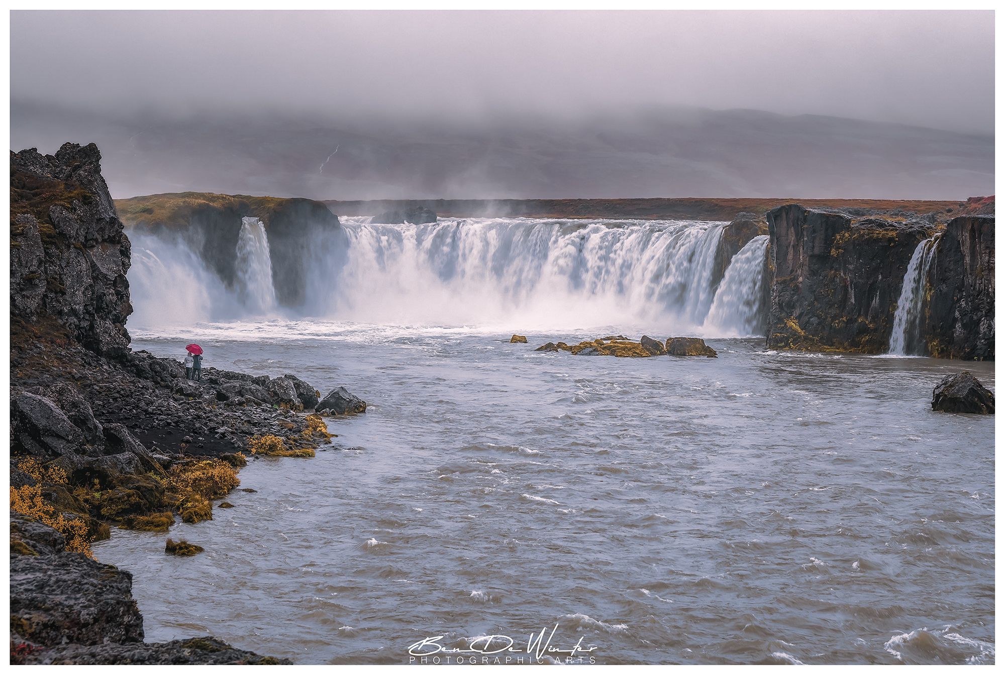
Goðafoss, meaning "Waterfall of the Gods", is one of Iceland’s most iconic and historically significant waterfalls. Located in the northeastern region of the country along the Skjálfandafljót River, it stands about 12 meters high and 30 meters wide, with a semi-horseshoe shape that makes it visually striking.
The waterfall can appear crystal clear in autumn and murky with glacial runoff in spring.
The surrounding cliffs and rock formations divide the waterfall into smaller cascades, enhancing its beauty and appeal for photographers.
The waterfall can appear crystal clear in autumn and murky with glacial runoff in spring.
The surrounding cliffs and rock formations divide the waterfall into smaller cascades, enhancing its beauty and appeal for photographers.
Photography Tips
The east bank offers a panoramic view of the entire waterfall. The west bank gets you closer to the cascades and mist. Aerial shots reveal the horseshoe shape beautifully.
Include foreground elements like rocks or moss for depth. Use leading lines from the river or cliffs.
Try vertical shots to emphasize the height and power of the falls.
Camera Settings:
Long Exposure: use ND filters and a tripod to smooth the water (e.g., 1–5 seconds).
Fast Shutter: to freeze water motion and capture detail (e.g., 1/500s).
Wide Angle Lens: to capture the full breadth of the falls.
Travel Information
From Akureyri:
Distance: ~35 km
Drive Time: ~30–40 minutes
Route: Take Route 1 (Ring Road) east toward Mývatn. Goðafoss is clearly signposted and has parking on both sides of the river.
From Reykjavík:
Distance: ~422 km
Drive Time: ~5.5 hours
Route: Follow Route 1 north through Borgarnes, Blönduós, and Varmahlíð, then east toward Akureyri and onward to Goðafoss.
Free parking on both sides of the river.
Walking paths and viewpoints are easily accessible.
Spot Type
Outdoor
Crowd Factor
Lots of people
Best Timing
Sunset in fall
Sunrise & Sunset
03:11 - 23:22
| current local time: 07:48
Photo Themes
Landscape
Natural Landscape
north iceland
River
Waterfall
Locations
Þingeyjarsveit
Northern Iceland


Spot comments (0)