
Iceland F210 Maelifell
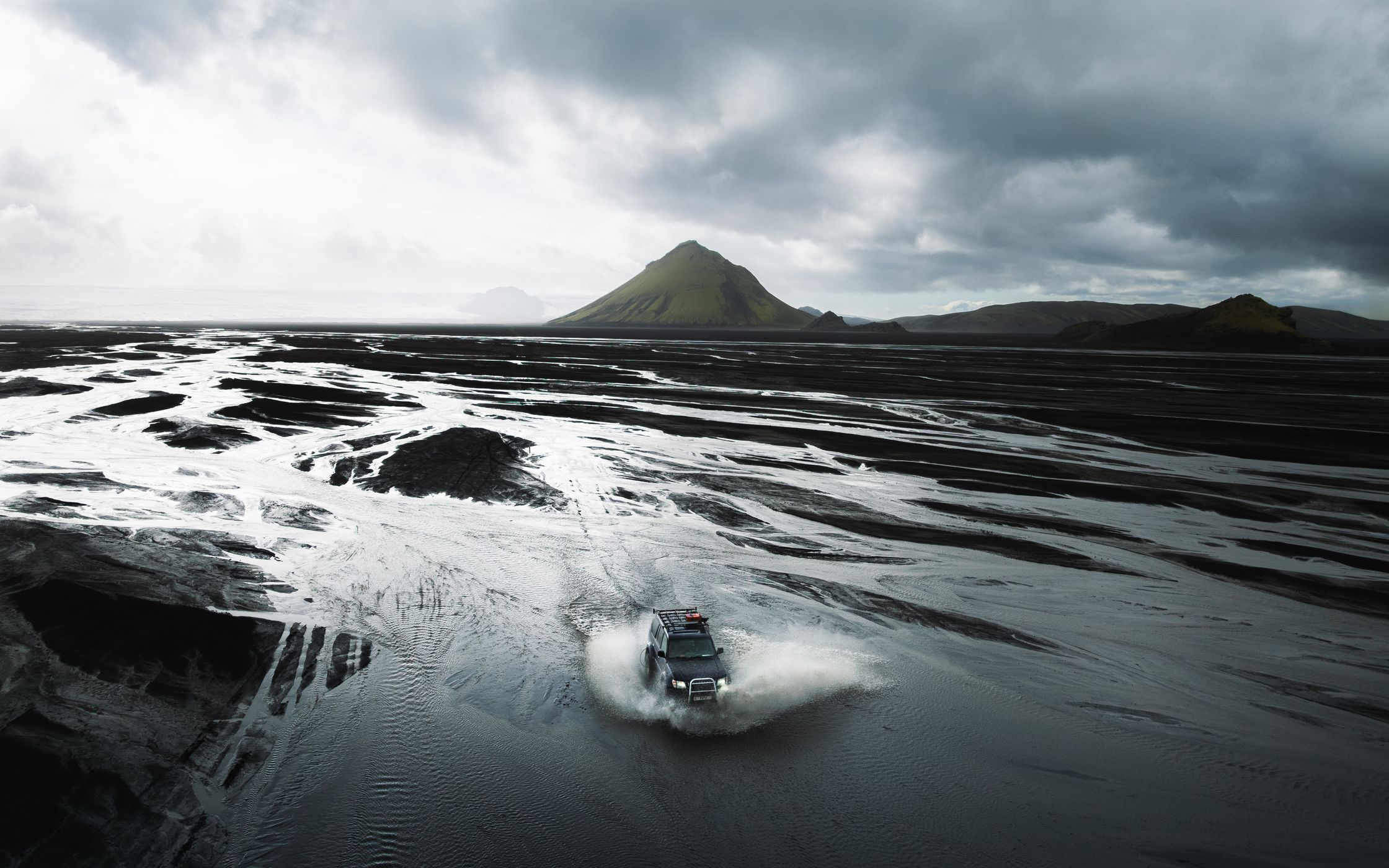
Maelifell is a 791m tall green volcano in the middle of the vast black volcano desert of Icelands highlands. There are many angles around from which to shoot this marvelous mountain. It often has glacial outflows in different strength around.
Photography Tips
Flying a drone from a moving platform is not the easiest. Check out Locationsocuts new guide for doing that in a more safe way.
Keep a fast shutter with multiple shots (burst mode) to get the most out of your photos.
Keep a fast shutter with multiple shots (burst mode) to get the most out of your photos.
Travel Information
To reach Maelifell, you need to take the F210. Please be extremely careful since this road is one of the toughest F-Roads and only for people who know how to cross rivers and have a bigger 4x4 truck. The roads here can be pretty flooded when the glacial outflows being strong! Be careful when driving.
Check www.safetravel.is for safety and travel information.
Check www.safetravel.is for safety and travel information.
Spot Type
Drone
Crowd Factor
Nearly no other people
Best Timing
Summer
Sunrise & Sunset
03:46 - 22:57
| current local time: 21:22
Photo Themes
drone shot
Highland
overlanding
river crossings
volcanic landscapes
Volcano
Locations
Icelandic Highlands
F210
Maelifell
Skaftarhreppur


Spot comments (0)