
Ireland Doonagore Castle, Ireland
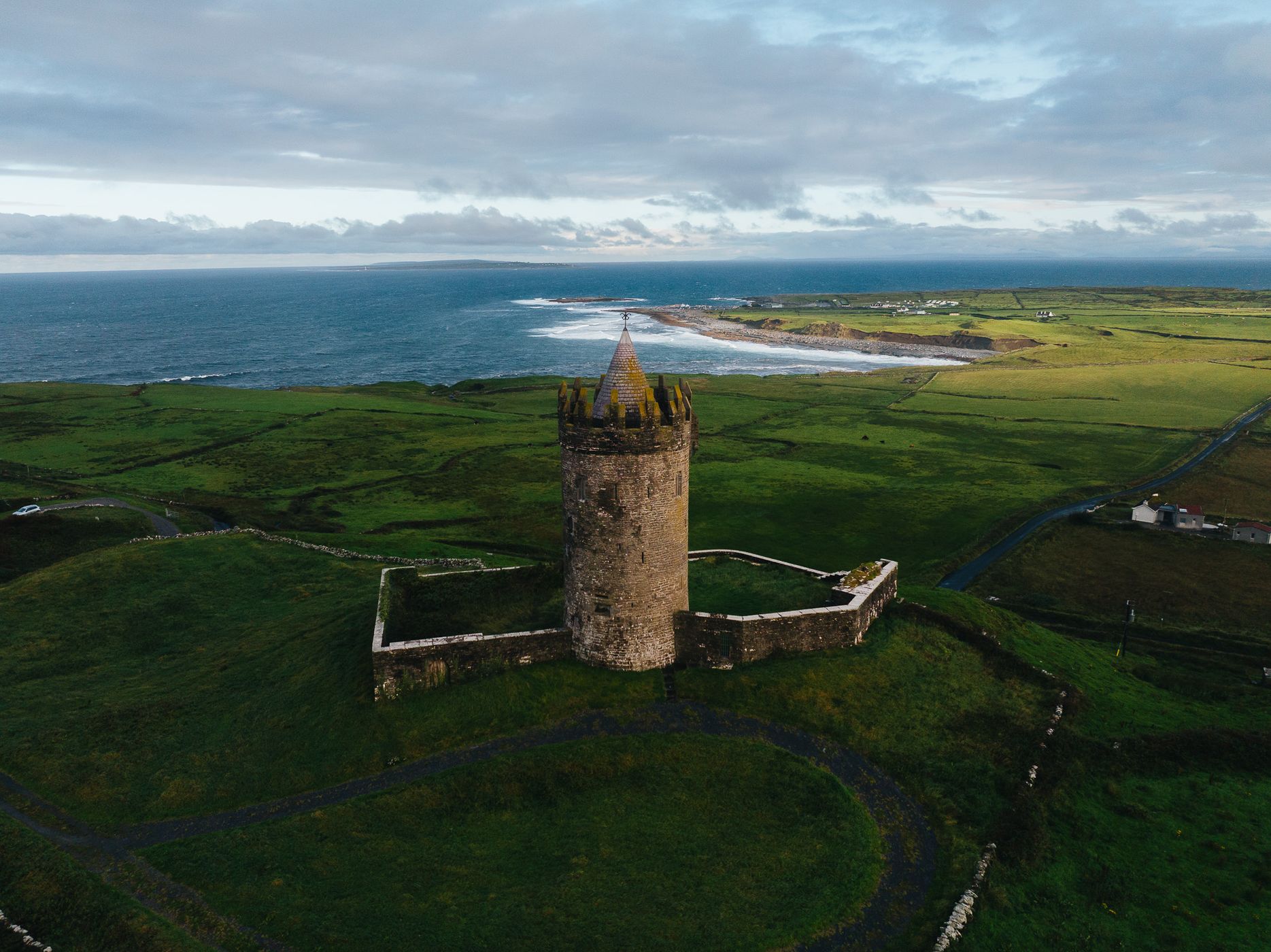
Perched above the Atlantic near Doolin, Doonagore Castle (Dún na Gabhair – “Fort of the Goats”) is one of the Wild Atlantic Way’s most iconic landmarks. This 16th-century round tower house, with its conical roof and fortified courtyard, overlooks the ocean and the Aran Islands in the distance. From above, the castle’s setting becomes even more striking — a solitary tower surrounded by emerald fields and the rugged Clare coastline. It’s one of those rare locations that captures the timeless charm of Ireland’s west coast in a single frame.
Photography Tips
A drone offers the best way to capture the geometry and isolation of the castle within its landscape. Aim for early morning or late afternoon light to bring out texture in the stone walls and rolling fields. From above, the circular pathway and the curve of the coast create beautiful leading lines guiding the viewer’s eye toward the horizon. Keep the horizon low to emphasize the vastness of the Atlantic, or center it to balance land and sea. Wind conditions here can be intense, so fly cautiously and stay well within visual line of sight.
Travel Information
Doonagore Castle lies just south of Doolin village in County Clare, along the Wild Atlantic Way. While the castle itself is privately owned and not open to visitors, it’s easily admired from the roadside or nearby pull-offs. Parking is limited but available at small lay-bys along the road. Be respectful of private property and fly your drone responsibly, maintaining distance from livestock and nearby homes. This location pairs perfectly with nearby Fisher Street, the Cliffs of Moher, and the Doolin Waterfall viewpoint for a complete photography circuit.
Spot Type
Drone
Crowd Factor
Nearly no other people
Best Timing
Sunrise
Sunrise & Sunset
05:41 - 21:46
| current local time: 11:04
Photo Themes
Castle
Hillside
Ocean
oceanview
Sunrise
Locations
County Clare
Doolin
Doonagore


Spot comments (0)