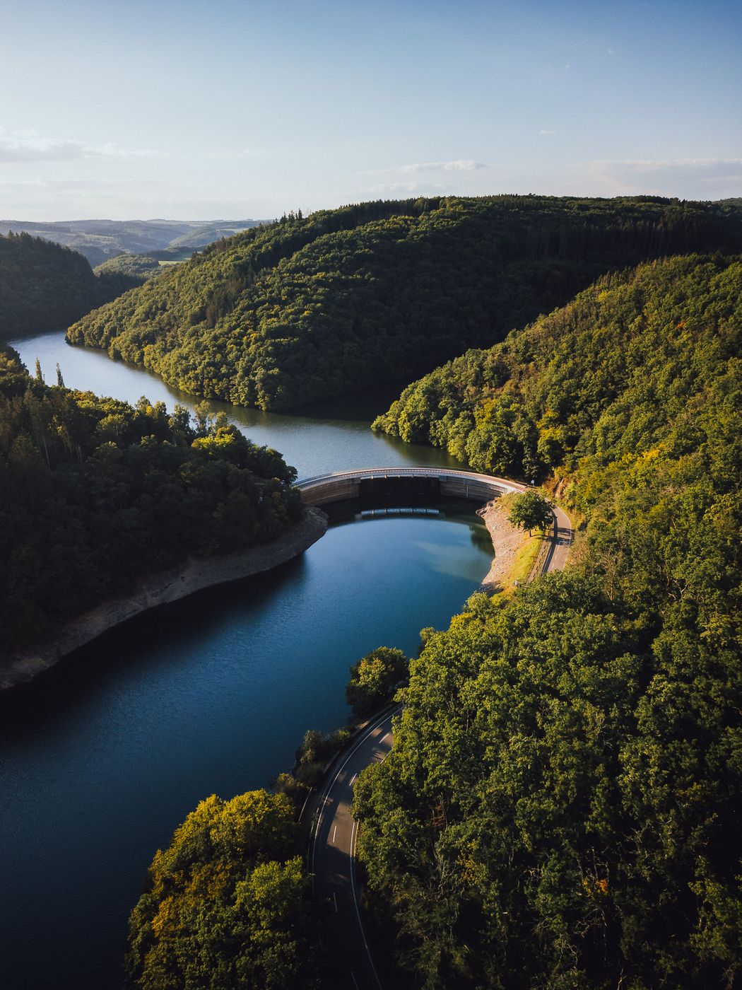

Luxembourg River Dam at Béiwenerbaach, Luxembourg
This striking aerial shot captures the Béiwenerbaach Dam nestled within the lush green hills of northern Luxembourg, near Esch-sur-Sûre. The winding river and curving road create a visually dynamic composition, with the Béiwenerbaach stream flowing gracefully into the Upper Sûre Reservoir. The golden evening light enhances the rich textures of the forest canopy and the deep blue tones of the water, giving the scene a calm yet powerful atmosphere. This location is a hidden gem in the Éislek region — a perfect blend of engineering and natural beauty.
Photography Tips
A drone offers the best perspective to showcase the symmetry of the dam and winding river, especially from a high angle that captures both the curves of the road and the layers of forested hills. The golden hour provides the most flattering light, highlighting depth and texture while avoiding harsh midday shadows. Use manual exposure or bracketed shots to preserve detail in both the dark forest and reflective water. A polarizing filter can help reduce glare on the water and deepen the greens of the landscape. Plan your flight path ahead, as the valley’s depth may affect signal strength.
Travel Information
The Béiwenerbaach Dam is part of the Upper Sûre Nature Park, located near Esch-sur-Sûre and Bourscheid in northern Luxembourg. It’s accessible by road, with several pull-off points offering scenic views over the reservoir. The area is ideal for a day trip combining drone photography, hiking, and scenic drives through the winding mountain roads of Éislek. While drone flying is allowed in most rural regions, always respect local regulations and maintain a safe distance from power lines and water management infrastructure.
Spot Type
Outdoor
Crowd Factor
Nearly no other people
Best Timing
Sunset
Sunrise & Sunset
05:58 - 21:27
| current local time: 10:36
Photo Themes
Dam
Forest
River
Locations
Lac de la Haute-Sûre
Goesdorf
Buderscheid


Spot comments (0)