This photo is copyrighted by the author.
Thank you for respecting the rights and efforts of our photographers. Please contact the author for further information.

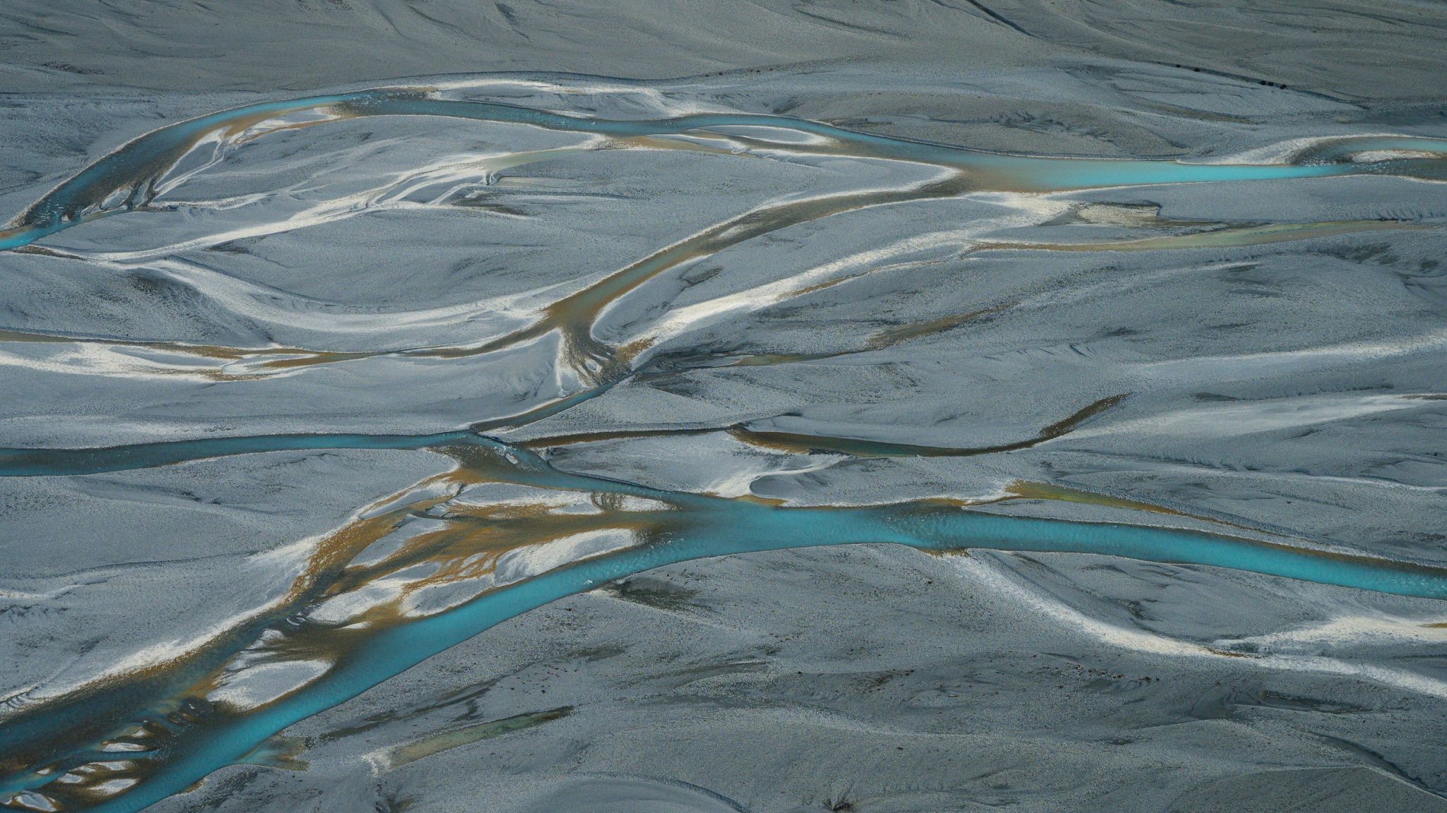
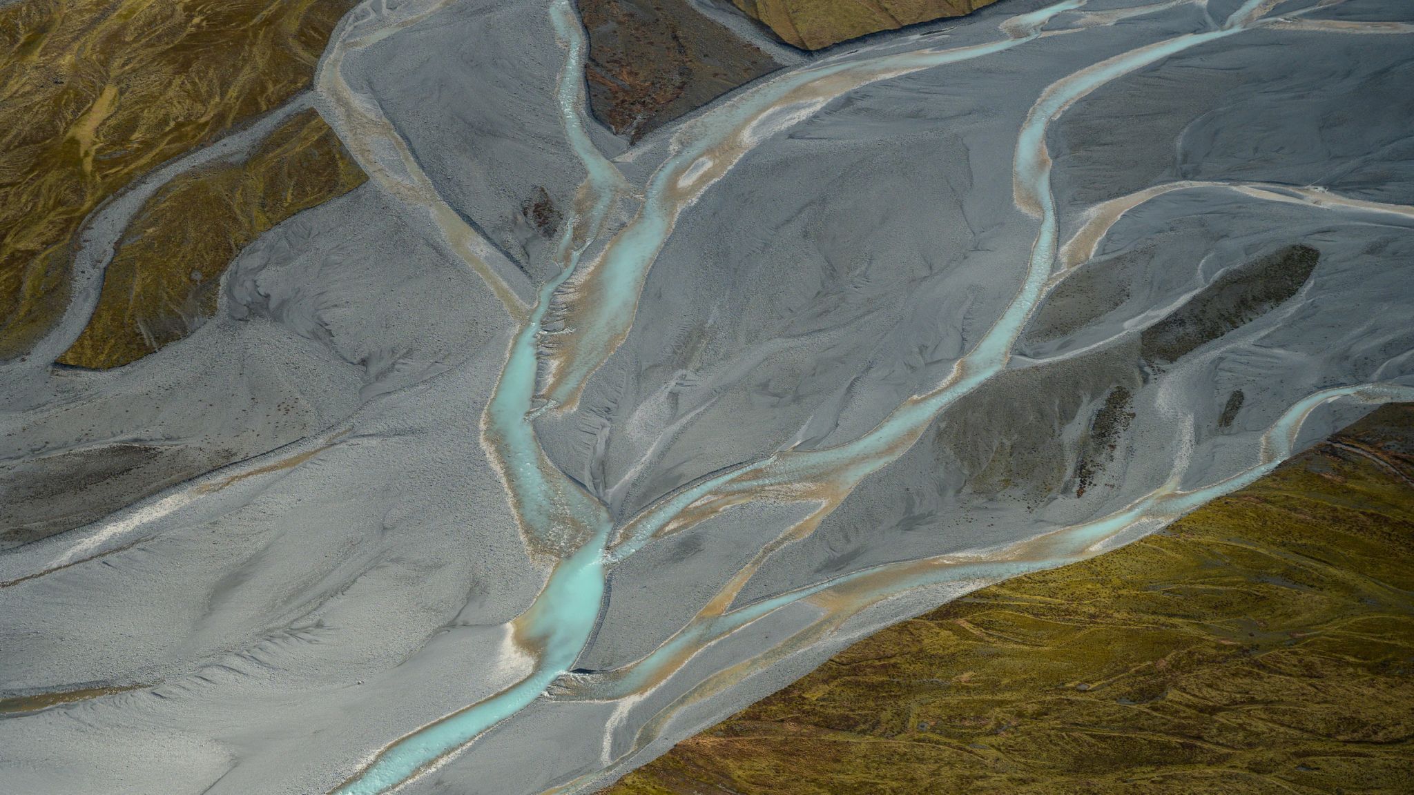
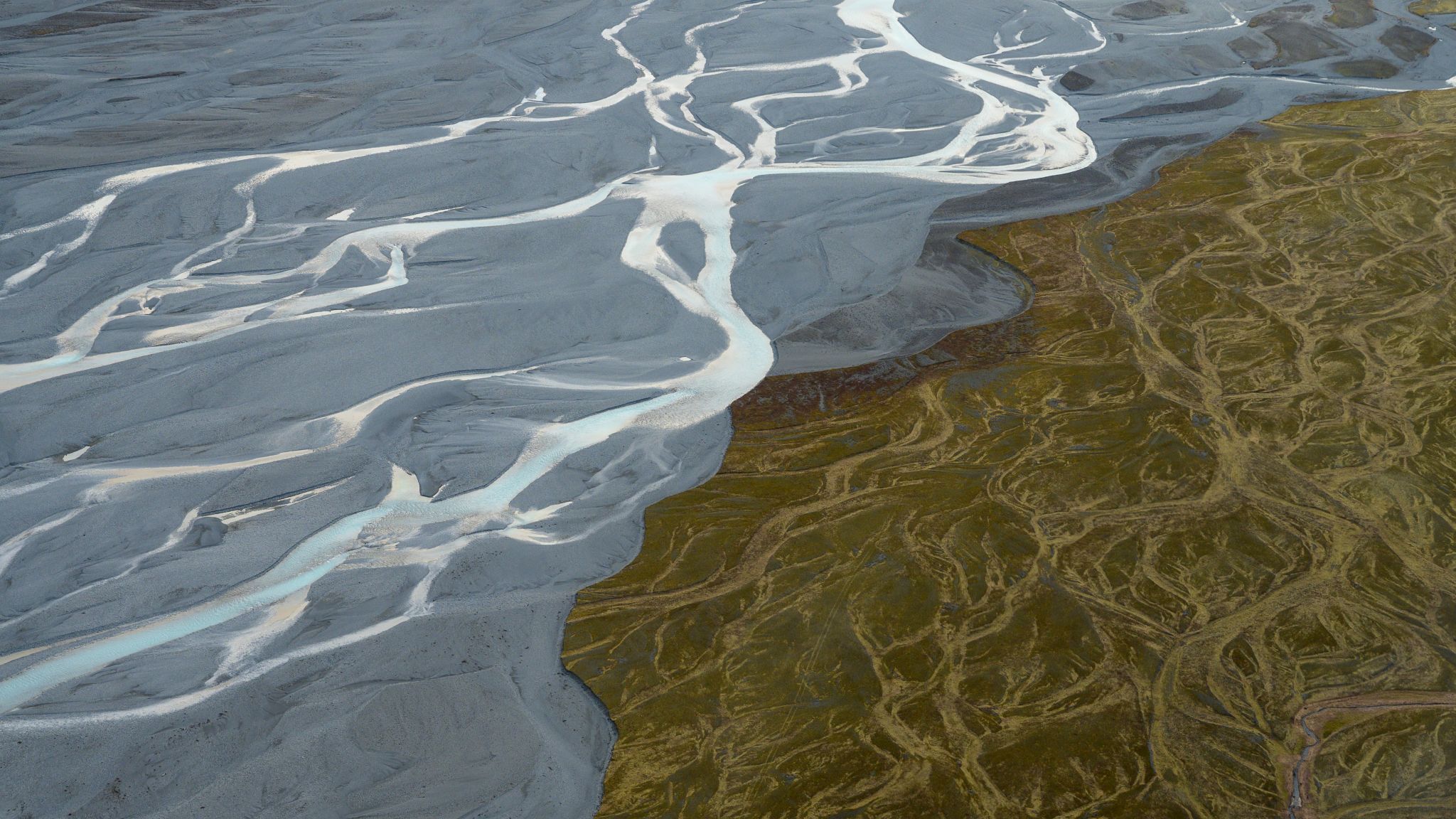
New Zealand Tasman River from the Air

  • Please log in or sign up for free to see the GPS coordinates & weather for this photo spot
The Tasman river feeds into Lake Pukaki. The braided river bed is an interesting landscape from the air.

Photography Tips

There is a strict no drone policy in National Parks so a Helicopter flight is the best option.

Travel Information

Do the 30 or 40 minute flights with the Helicopter Line out of Glentanner. They are about 10 minutes out of Mt Cook Village. https://www.helicopter.co.nz/
Spot Type Outdoor
Crowd Factor Just a few people
Best Timing Sunset
Sunrise & Sunset 07:51 - 19:36 | current local time: 07:15
Photo Themes Riverbed

Get the exact geo-position for this spot

Log in to see the GPS coordinates, sun directions, and the map for this photo spot. Or simply bookmark it along with other spots to plan your next trip.

Spot Comments (0)

Please log in or sign up for free to leave a comment or ask a question.

Ratings (1) starstarstarstarstar

starstarstarstarstar
0
starstarstarstarstar
1
starstarstarstarstar
0
starstarstarstarstar
0
starstarstarstarstar
0

Popular photo spots in this region

Thank you Graeme Partridge for creating this photo spot in New Zealand.
Imprint & Contact © Locationscout 2024 Privacy / Terms