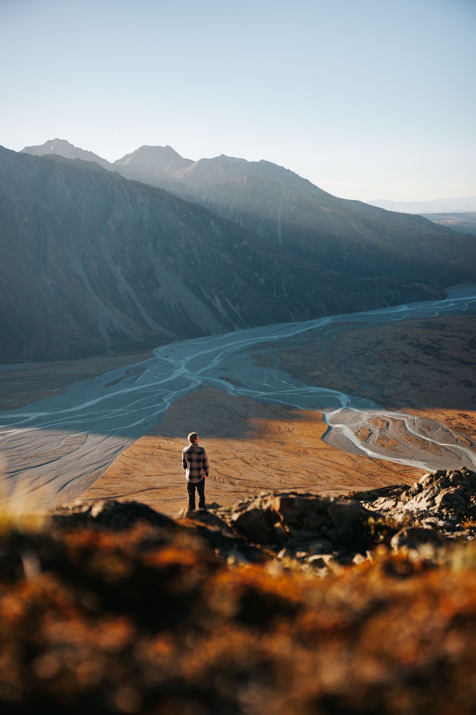

New Zealand Valley view below Mount Wakefield
The way to Mount Wakefield offers stunning views to both sites of the valley: Mueller Lake and Tasman Glacier. Up to the viewpoint is a steep way, but super worth it. Once you are up and out of the bush line you can enjoy several beautiful views into the valleys.
Photography Tips
Place a person for scale. Use the out coming river veins from the glacier lake as a leading line in between the person. Play with the light and shadows.
Travel Information
Park directly behind the bridge at the left handed street. There are few spaces left.
This track is not longer a DOC one due to landslides. From the marked spot you will find the way up the bush line around 100 meters further down the street. The hike is challenging and steep. The distance one way is around 2.2 kilometer with 650 meters of elevation.
This track is not longer a DOC one due to landslides. From the marked spot you will find the way up the bush line around 100 meters further down the street. The hike is challenging and steep. The distance one way is around 2.2 kilometer with 650 meters of elevation.
Spot Type
Outdoor
Crowd Factor
Nearly no other people
Best Timing
Sunrise in summer
Sunrise & Sunset
08:06 - 17:25
| current local time: 17:08
Photo Themes
Mountain Lake
Mountain Panorama
Mountain Peaks
Mountain Range
Mountain River
Mountain Valley
Mountain View
Mountains
Mountainscape
River veins


Spot comments (0)