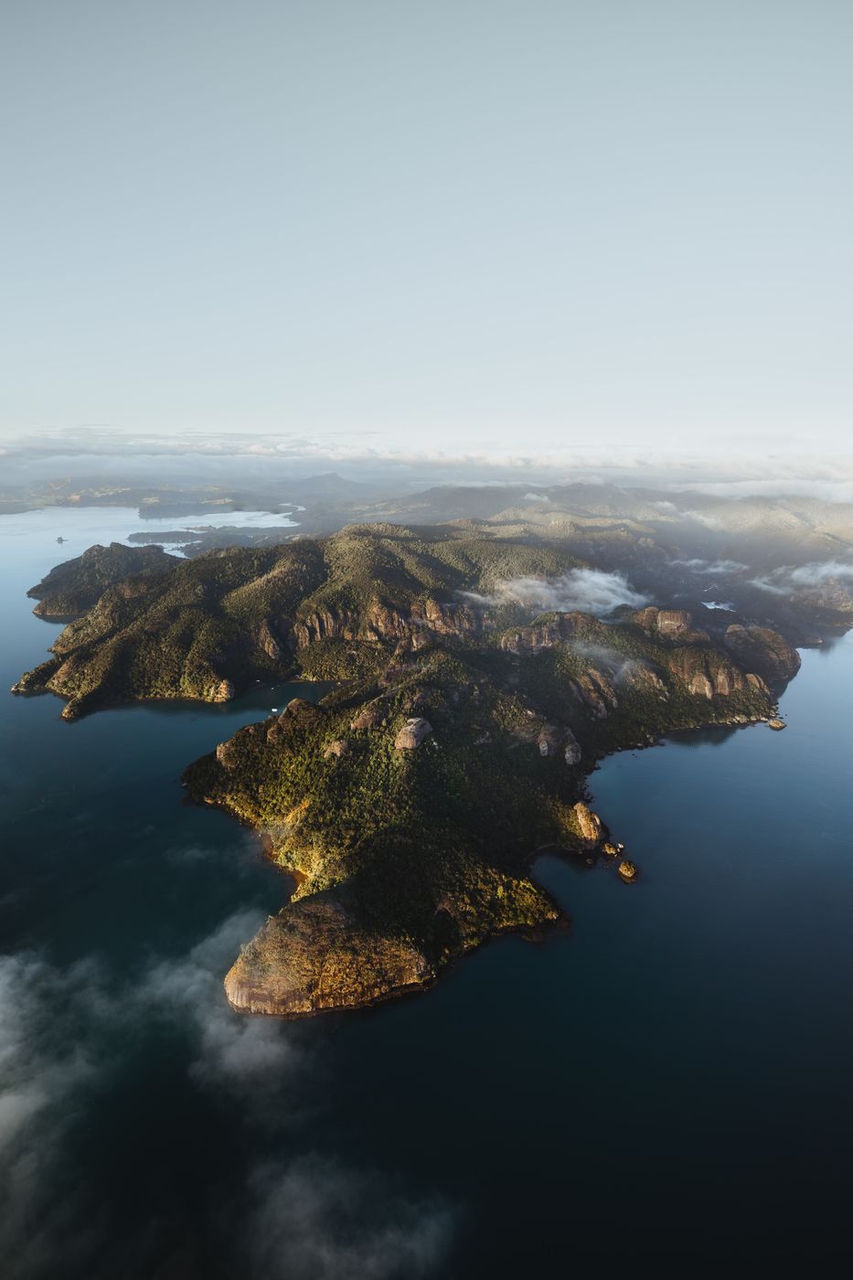

New Zealand Pekapeka Bay and Waihi Bay, Totara North
The coastline in between Pekapeka Bay and Waihi Bay offers great views to the curvy indentations of rocky green cliffs. The step formed coastline is a quiet, idyllic place.
Photography Tips
Use your drone at the open space on top of the rock and see what the landscape offers you from the air. The best option is a panorama.
Have a valid flight license with you and check the wind conditions before you start your flight.
Have a valid flight license with you and check the wind conditions before you start your flight.
Travel Information
Hike to Duke´s Nose and fly your drone from the top. This 10,3 km out-and-back trail with around 528 meter of elevation is a moderate hike and requires a normal level of fitness. Just at the end of the trail is a climbing section with some ladders. If it was rainy the days before the river stream crossing after half of the way can be a bit tricky. So take care on slippery sections.
Spot Type
Drone
Crowd Factor
Just a few people
Best Timing
Sunrise in summer
Sunrise & Sunset
07:27 - 17:35
| current local time: 17:29
Photo Themes
Blue Ocean
Cliff
Cliff Coast
cliffs
Coast
Coastal
Coastal Scenery
Coastal View
Coastline
Ocean
Ocean Cliff
Ocean Cliff
Ocean Coastline
Ocean Pool
Ocean View
oceanscape
oceanview
Rocky Coast
Rugged Coastline
steep coast


Spot comments (0)