
Spain Pico La Sagra
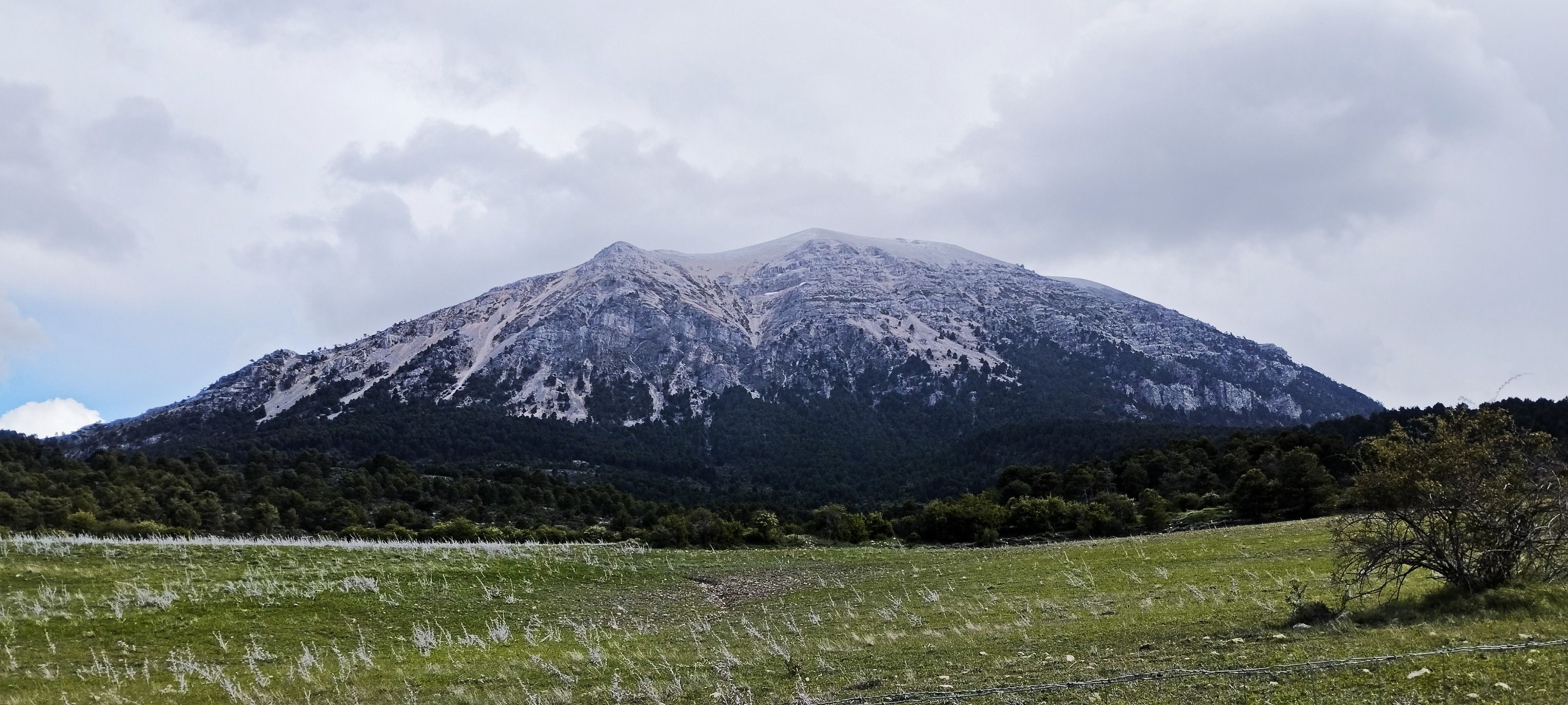
La Sagra (2383 m) es la montaña más alta de los Sistemas Prebéticos y del Altiplano Granadino. Este pico aislado, en forma de barco invertido, está ubicado entre Huéscar y Puebla de Don Fadrique en la provincia de Granada (Andalucía, España), cerca de los límites con Murcia y Jaén
Es el segundo islote montañoso más alto de Andalucía tras Sierra Nevada y alberga los árboles gigantes (secuoyas) más altos de Europa en su ladera norte
Es el segundo islote montañoso más alto de Andalucía tras Sierra Nevada y alberga los árboles gigantes (secuoyas) más altos de Europa en su ladera norte
Photography Tips
Hacer la ruta hasta la cima y disfrutar.
Travel Information
Facil de llegar por carreteras de montaña.
Spot Type
Outdoor
Crowd Factor
Just a few people
Best Timing
Sunrise in spring
Sunrise & Sunset
08:24 - 19:25
| current local time: 06:38
Photo Themes
Granada
montain view
Montana
Naturaleza
Locations
Andalucia
España
Andalusia
Pico de La Sagra





Spot comments (0)