
Spain Erosion Cartography
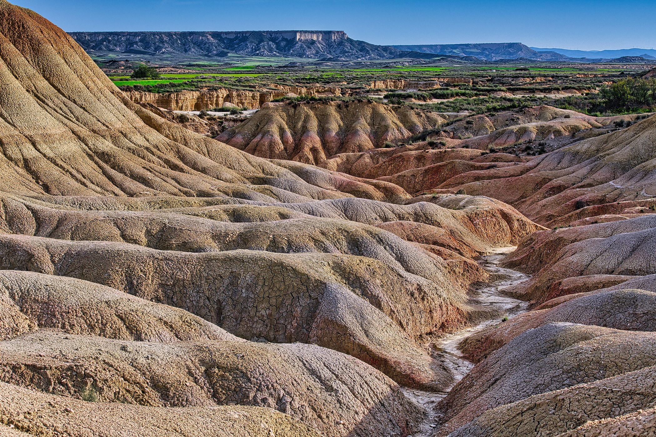
The Bardenas Reales are located in the south-eastern sector of Navarre, in northern Spain, within a transitional zone between the Ebro Valley and the pre-Pyrenean ranges. This semi-arid territory extends over approximately 42,000 hectares and is recognised as a UNESCO Biosphere Reserve. Its landscape results from the interaction between extreme climatic conditions and a geological base highly susceptible to erosion, forming a terrain that reads as a continuous inscription of geological time. The visible morphology reveals undulating reliefs, ravines, and fragmented surfaces shaped by prolonged erosion acting on clays, gypsum, and sandstones. Sparse vegetation and irregular rainfall intensify these processes, while ochre and grey tones shift with light. During our stay, the landscape resisted full apprehension, suggesting the need to return.
Photography Tips
Nikon D850, 70-200/2.8 • Iso 250 • 70mm • f/10 • 1/320sec
Photograph during early morning or late afternoon to emphasise the relief through long shadows and enhanced texture. A medium telephoto focal length helps compress the undulating terrain and reveal the repetitive patterns created by erosion. Use an aperture around f/8–f/11 to maintain detail across the scene while preserving maximum sharpness. After rainfall, subtle colour variations in the clay and sandstone become more pronounced.
Photograph during early morning or late afternoon to emphasise the relief through long shadows and enhanced texture. A medium telephoto focal length helps compress the undulating terrain and reveal the repetitive patterns created by erosion. Use an aperture around f/8–f/11 to maintain detail across the scene while preserving maximum sharpness. After rainfall, subtle colour variations in the clay and sandstone become more pronounced.
Travel Information
Approximate coordinates identified by the photographer:
The coordinates provided refer to the photographed location, but may not correspond exactly to the point from which the image was taken.
The photograph was taken in the Bardenas Reales Natural Park, Navarra, northern Spain. The area is accessible by a network of unpaved but generally well-maintained tracks suitable for standard vehicles in dry conditions. Several designated parking areas are available near the main viewpoints and hiking routes. Visitors should carry water, particularly during summer, as temperatures can exceed 35°C and shade is virtually absent. Sunrise and sunset offer the most favourable light and the lowest visitor numbers. Access regulations may vary depending on weather conditions and conservation requirements, so it is advisable to check local information before travelling.
Spot Type
Outdoor
Crowd Factor
A decent amount of people
Best Timing
All timings are equally good
Sunrise & Sunset
06:31 - 21:46
| current local time: 22:10
Photo Themes
Desert Landscape
erosion
Landscape
texture
Locations
bardenas reales
navarre
Northern Spain
Navarra


Spot comments (0)