Lands End (Drone), United Kingdom
Sebastian Grafe
Sebastian Grafe sebastian-grafe.de
licensable
Lands End (Drone), United Kingdom
Sebastian Grafe
Sebastian Grafe sebastian-grafe.de
licensable
Lands End (Drone), United Kingdom
Sebastian Grafe
Sebastian Grafe sebastian-grafe.de
licensable
This photo is copyrighted by the author.
Thank you for respecting the rights and efforts of our photographers. Please contact the author for further information.

United Kingdom Lands End (Drone)

  • Please log in or sign up for free to see the GPS coordinates & weather for this photo spot
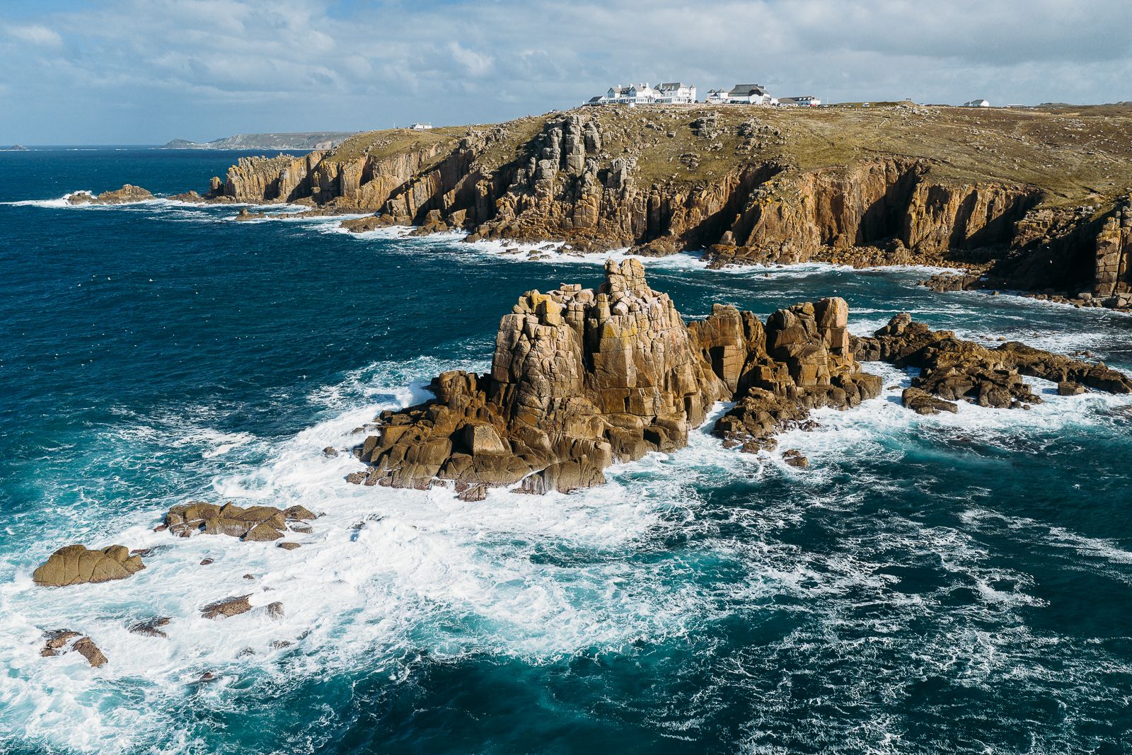
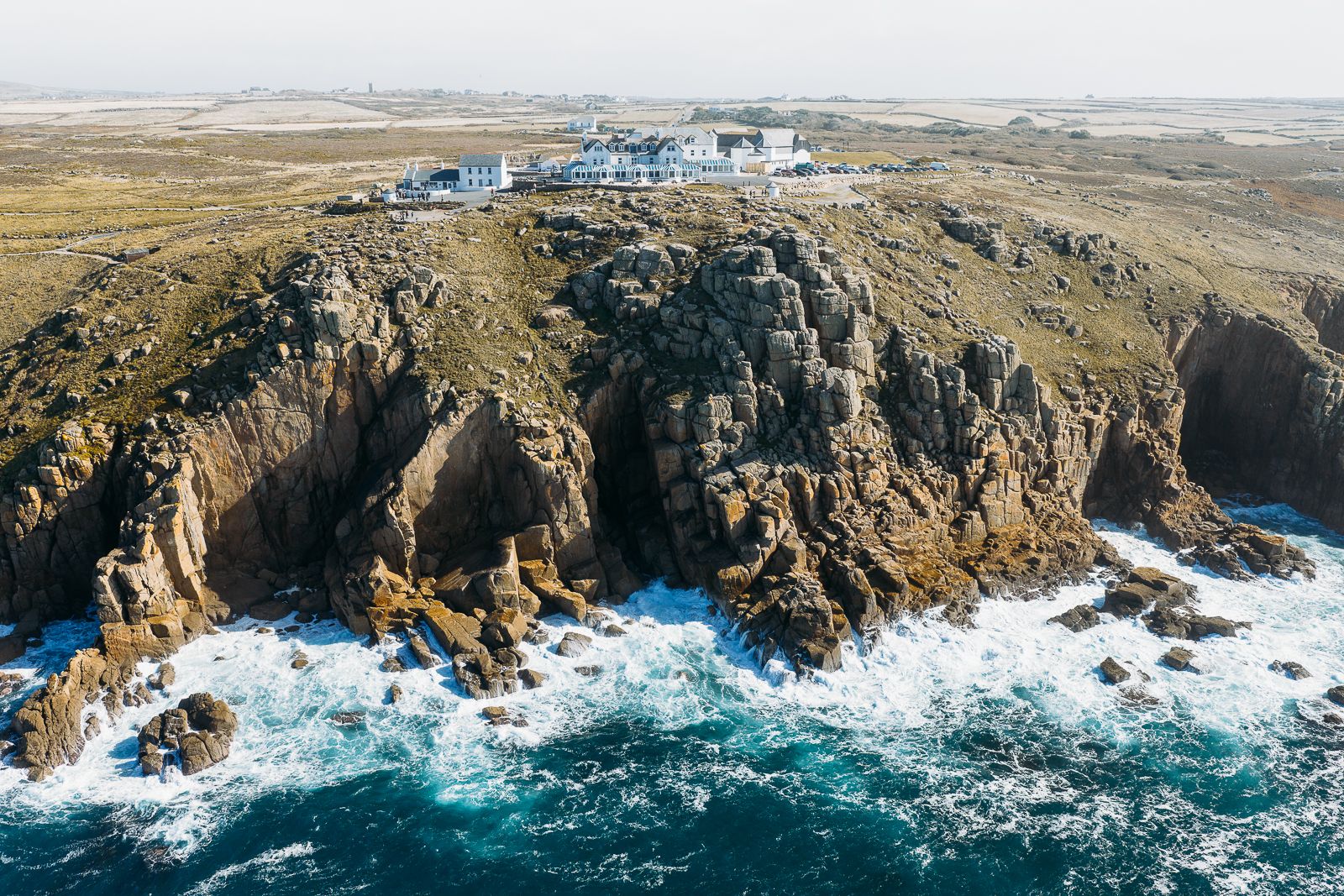
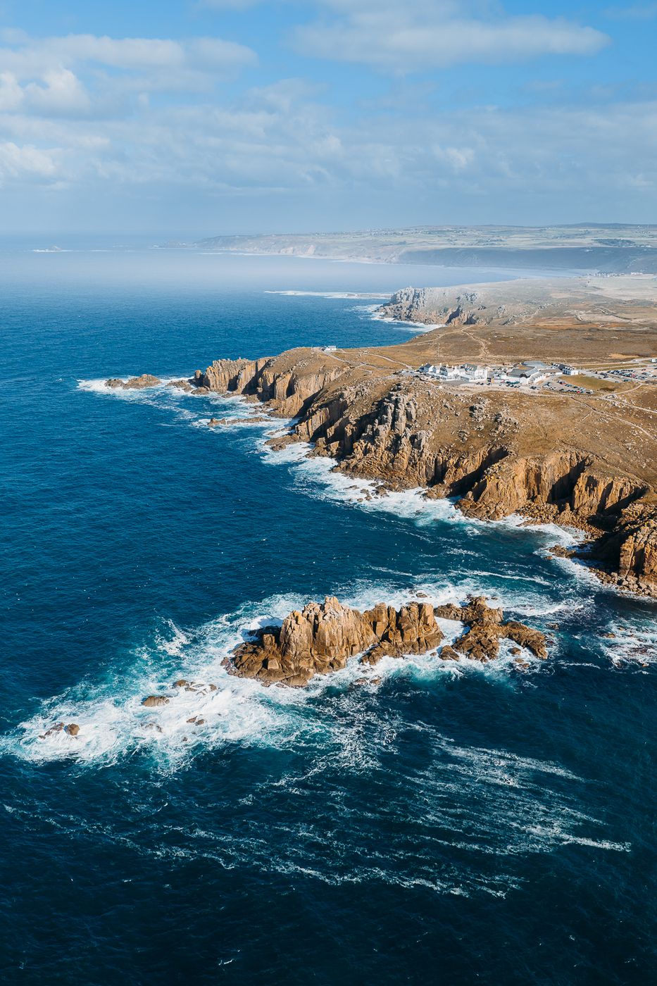
Land's End (Cornish: Penn an Wlas [KK], Pen an Wlas [UCR]), located in the parish of Sennen near Penzance, Cornwall, is a village and the headland of the same name. The tip of the headland is the westernmost point of England on the main island of Great Britain.

Photography Tips

Check local drone regulations first. Watch for high winds and make shure your drone can handle them.

Travel Information

Park at the Lands End Parking lot. Unfortunately you have to buy a full day pass.
Spot Type Drone
Crowd Factor Just a few people
Best Timing Daytime
Sunrise & Sunset 05:16 - 21:26 | current local time: 03:23
Photo Themes Cape Cliff Drone Ocean Wave
Locations Cornwall Penzance

Get the exact geo-position for this spot

Log in to see the GPS coordinates, sun directions, and the map for this photo spot. Or simply bookmark it along with other spots to plan your next trip.

Spot comments (0)

Please log in or sign up for free to leave a comment or ask a question.

Ratings (1) star star star star star

star star star star star
0
star star star star star
1
star star star star star
0
star star star star star
0
star star star star star
0

Popular photo spots in this region

Thank you Sebastian Grafe for creating this photo spot in United Kingdom.
Imprint & Contact © Locationscout 2026 Privacy / Terms