Chain of Rocks Bridge, USA
Michael Matney
Michael Matney www.mikematney.com
Chain of Rocks Bridge, USA
Michael Matney
Michael Matney www.mikematney.com
Chain of Rocks Bridge, USA
Michael Matney
Michael Matney www.mikematney.com
Chain of Rocks Bridge, USA
Michael Matney
Michael Matney www.mikematney.com
Chain of Rocks Bridge, USA
Michael Matney
Michael Matney www.mikematney.com
Chain of Rocks Bridge, USA
Michael Matney
Michael Matney www.mikematney.com
Chain of Rocks Bridge, USA
Michael Matney
Michael Matney www.mikematney.com
Chain of Rocks Bridge, USA
Michael Matney
Michael Matney www.mikematney.com
This photo is copyrighted by the author.
Thank you for respecting the rights and efforts of our photographers. Please contact the author for further information.

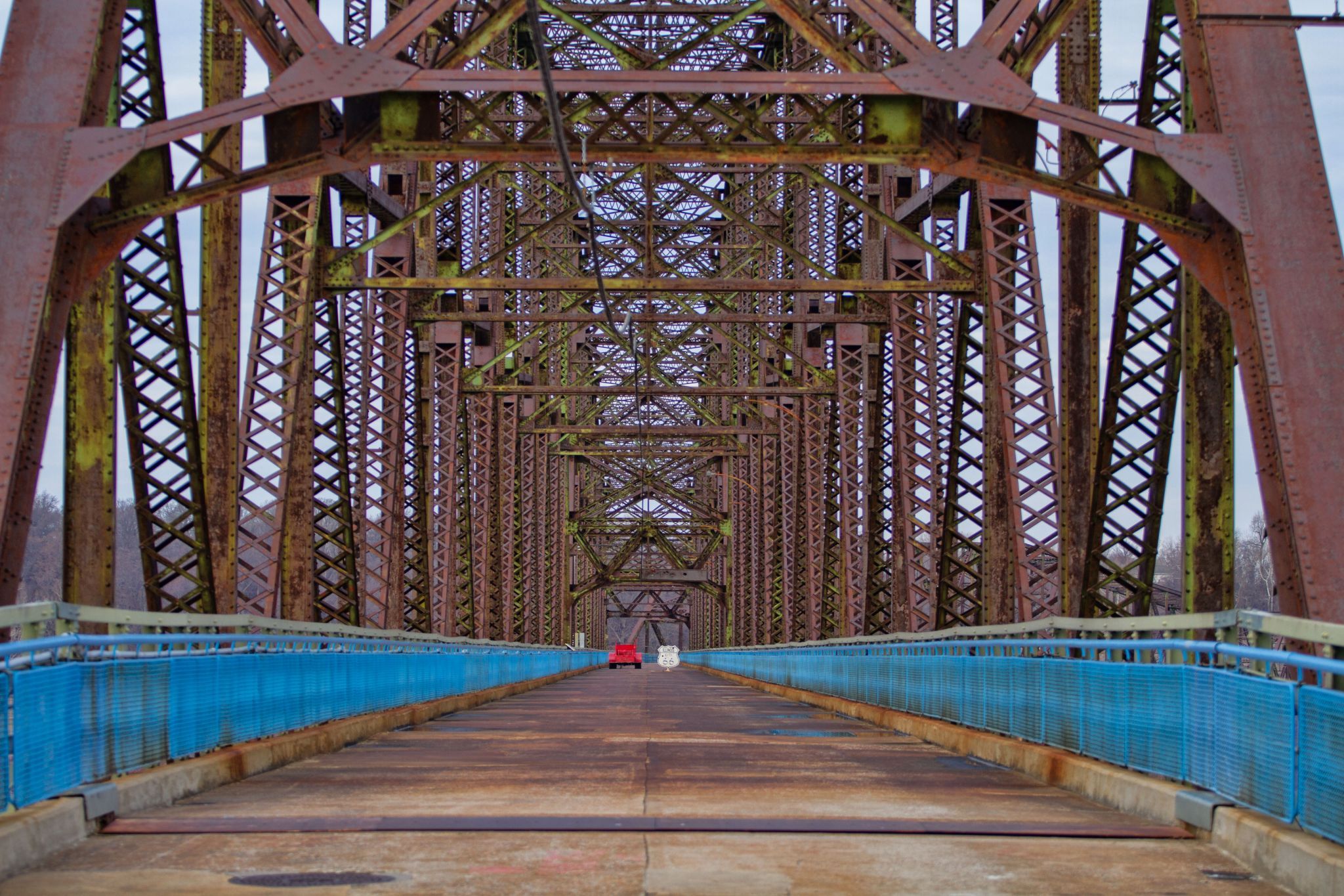
USA Chain of Rocks Bridge

  • Please log in or sign up for free to see the GPS coordinates & weather for this photo spot
The Old Chain of Rocks Bridge, at 5,353 feet long, is one of the world's longest bicycle and pedestrian bridges. The bridge spans the Mississippi River and provides a vital link in the b-state trail system, connecting to the MCT Confluence Trail in Illinois and the St. Louis Riverfront Trail in Missouri. The bridge has a rich history and was added to the National Register of Historic Places in 2006.

Photography Tips

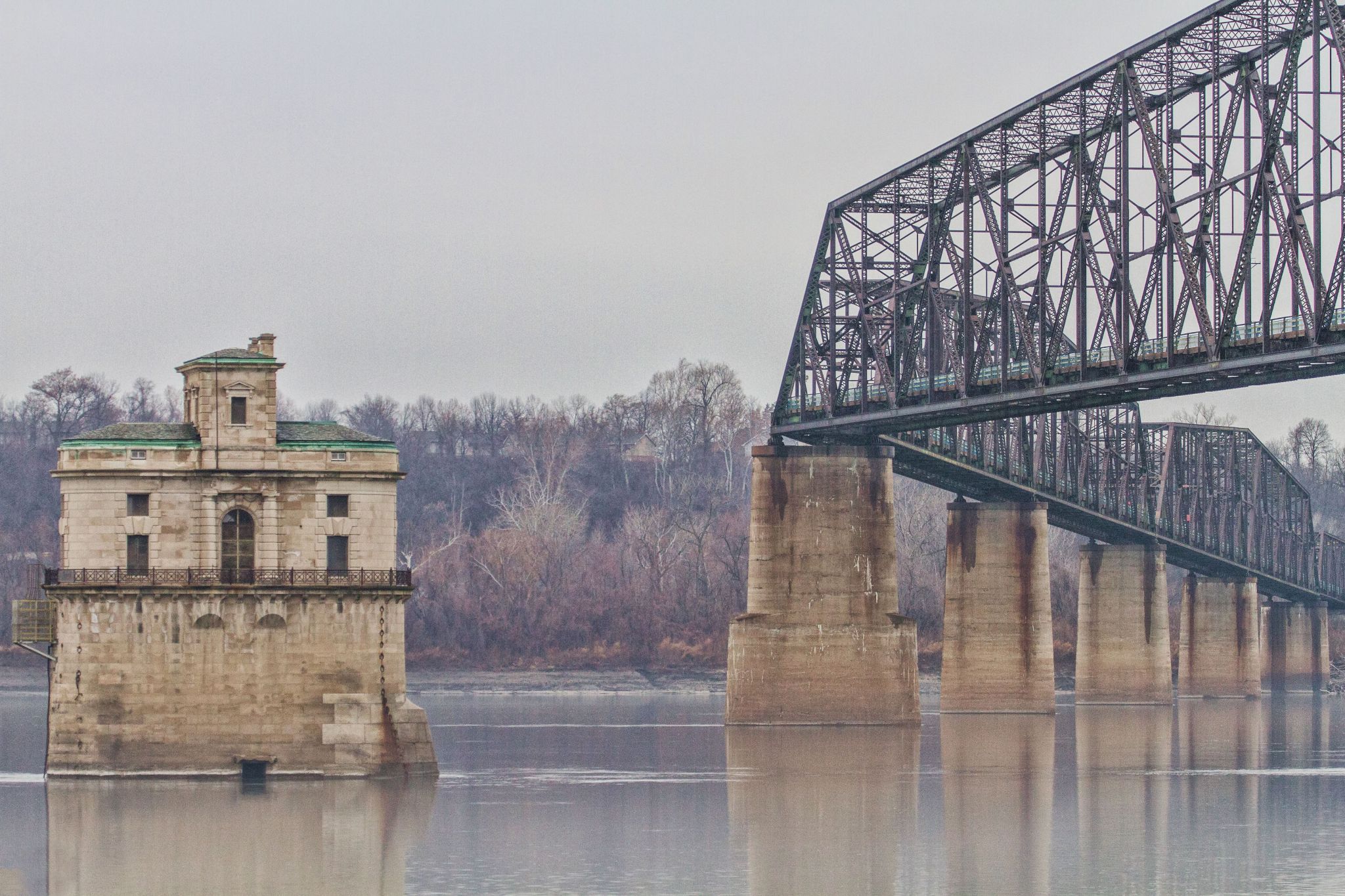
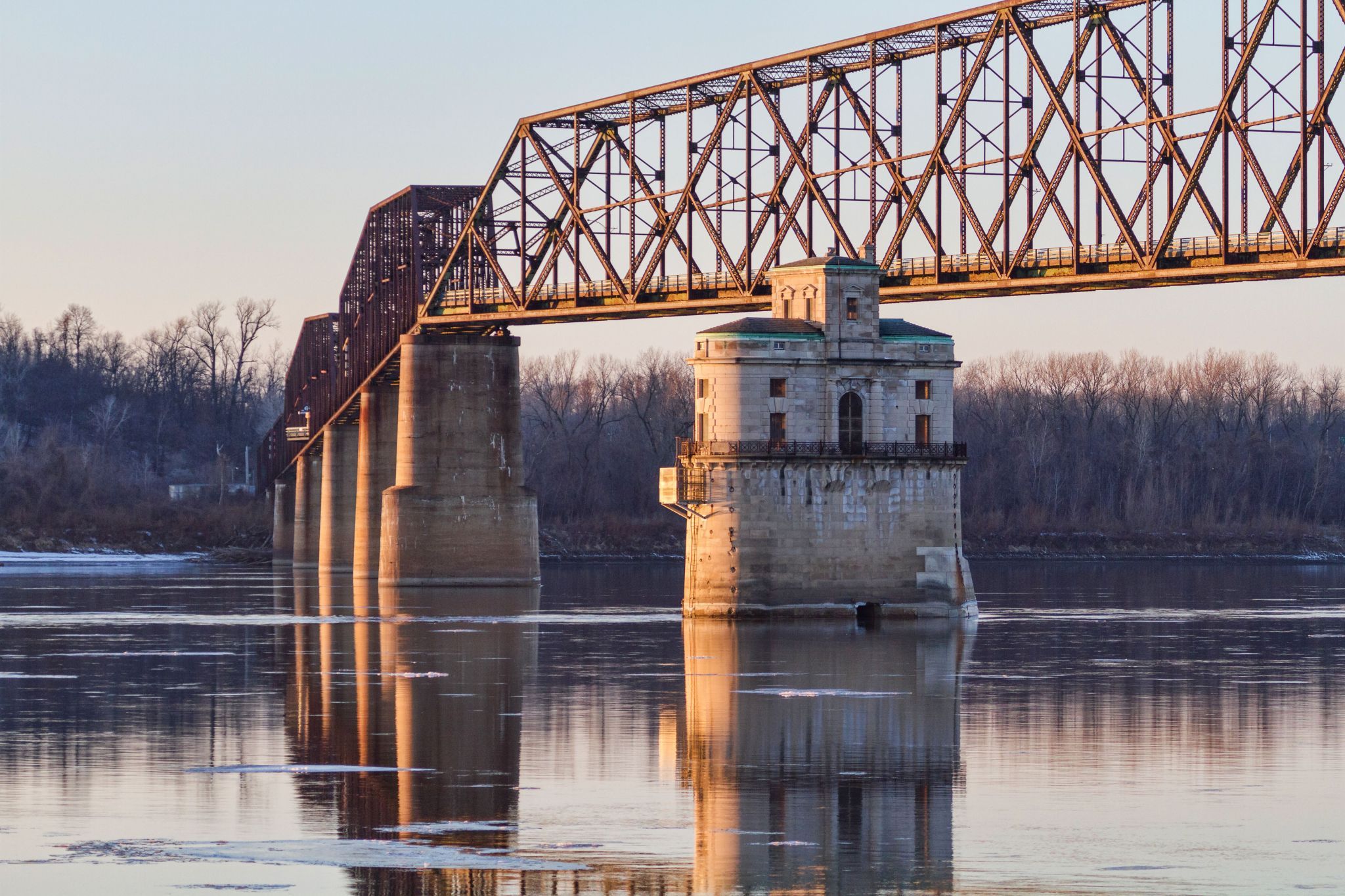
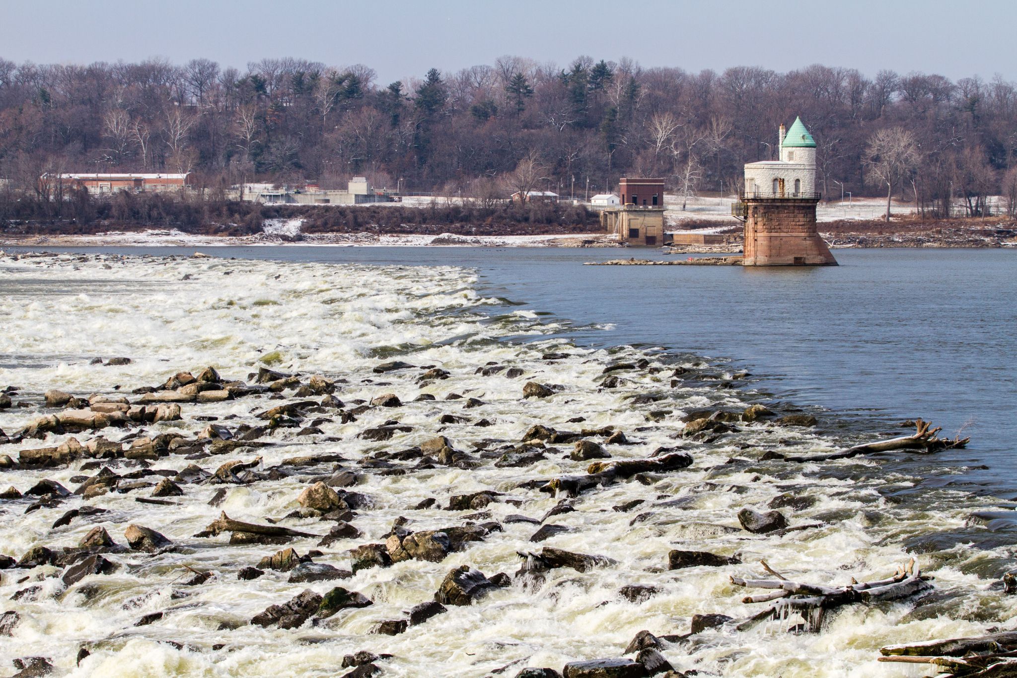
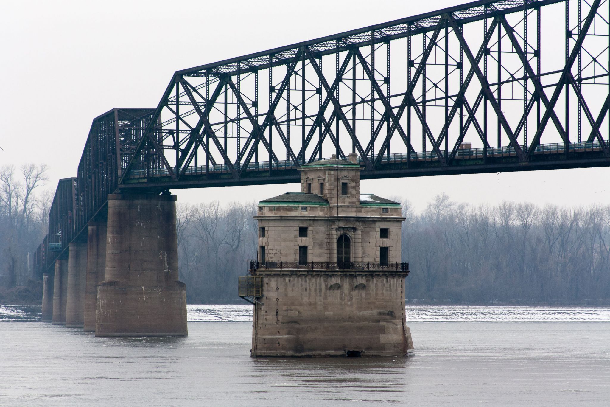
Great views of the Mississippi River and the two water intake towers that sit in the middle of the river.

Travel Information

Chain of Rocks Bridge parallels U.S. 270 along West Chain of Rocks Rd. between Riverview Dr. in St. Louis, MO and Illinois 3 in Madison County, IL. Connections are present to the MCT Confluence Trail, Mississippi River Trail, and St. Louis Riverfront Trail, and free parking is available in Illinois at the bridge entrance and at North Riverfront Park, south of the bridge along the Riverfront Trail. Access to the bridge from the Missouri side is CLOSED due to severe issues with car vandalism. Free parking is available at the Illinois Bridge entrance and at North Riverfront Park, south of the Bridge along the Riverfront Trail.
Spot Type Outdoor
Crowd Factor No info yet
Best Timing All timings are equally good
Sunrise & Sunset 04:48 - 17:22 | current local time: 10:44
Photo Themes historic historic site River Route 66 water

Get the exact geo-position for this spot

Log in to see the GPS coordinates, sun directions, and the map for this photo spot. Or simply bookmark it along with other spots to plan your next trip.

Spot Comments (4)

Please log in or sign up for free to leave a comment or ask a question.
JL JLM
JL JLM 05.10.2018
The location must be incorrect, can't be in the middle of San Francisco !
Michael Matney
Michael Matney 05.10.2018
I have updated it, but have no idea how it got changed to San Francisco.
JL JLM
JL JLM 06.10.2018
thanks Michael, no worries. These things happen ... just one digit on the longitude and you're few timezones away ;)
Holger Pleus
Holger Pleus 03.07.2018
Are You sure, you set the location correctly?

Ratings (0) starstarstarstarstar

Popular photo spots in this region

Thank you Michael Matney for creating this photo spot in USA.
Imprint & Contact © Locationscout 2024 Privacy / Terms