
USA The Control Tower
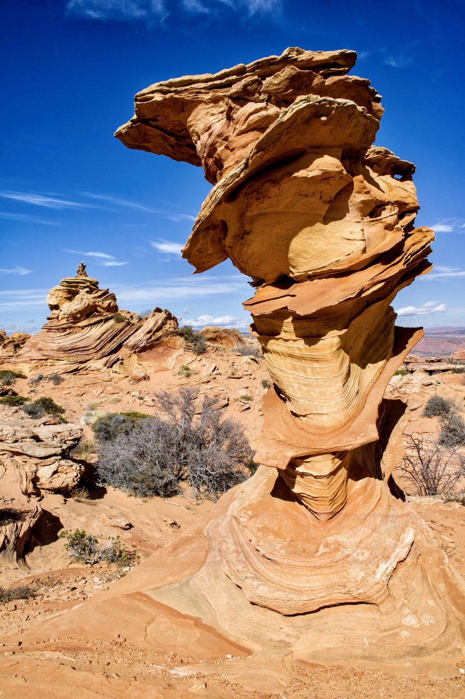
Cottonwood Cove or “Cottonwood Teepees” in Arizona is one of the lesser known and explored areas of North and South Coyote Buttes. “The Wave” has been photographed extensively by thousands of visitors. Cottonwood Cove, less so, primarily because it’s difficult to get to the trailhead. Like the nearby “White Pocket” and Paw Holes”, the road to the trailhead includes (about 11) miles of driving through extremely deep sand in a 4WD vehicle. The landscape however is no less spectacular. Twisted sandstone sculptured by nature abounds. Like “The Wave”, a permit is required to explore this area but unlike the Wave, it is not very difficult to acquire a permit. While The Wave typically draws hundreds of applicants every day vying for the 64 permits allotted, one can often simply walk in to the BLM office in Kanab and receive a permit uncontested due to the aforementioned difficult road conditions. A better alternative is to apply for a permit via an online lottery system. Unless you have a 4WD vehicle and are skilled at driving on narrow, winding, and deep sandy roads, I’d recommend hiring a guide to get there. You must first acquire a permit before hiring a guide. Guide services do not have privileged access to the Wave and can only guide you if you already have a permit.
Photography Tips
This is a good morning or afternoon location. The best view of the Control Tower is from the south making it great foreground for star trails. You can also shoot it from its north side with The Milky Way in the background. The Control Tower is also the closest formation to the parking area. This makes it easy to shoot there late or into the night (from “TheWave.info”). I shot this at f14, 1/160s, 20mm, ISO100.
Travel Information
If you're coming from the south (Hwy. 89A) take House Rock Road 9.4 miles north to the intersection. There is a corral at the turnoff. Take BLM 1017 3.1 miles and turn left on Red Pockets road. At 6.0 miles you will come to a cattle gate, leave it in the same condition as you found it (open or closed). Continue straight. At 8.3 miles bear right (the road on the left is now closed). At 8.7 miles turn left onto Upper Pawhole Road. This area is called Poverty Flat. There is a corral and some old buildings, there used to be a windmill here but it is gone. At 9.0 miles miles stay to the right. At 10.7 miles you will reach a closed gate with a Coyote Buttes Fee Area sign. At 11.4 miles you have arrived. Park on the left hand side of the road. Do not continue any further on the road (down the hill). If you do so you are very likely to get stuck on your return up the hill. There is a warning sign before the hill.
Spot Type
Outdoor
Crowd Factor
Nearly no other people
Best Timing
Sunrise in fall
Sunrise & Sunset
05:23 - 19:45
| current local time: 12:19
Photo Themes
Colored Sandstone Rock Formations
Rock Formation
Locations
Arizona
Coyote Buttes South


Spot comments (0)