
USA Paw Holes
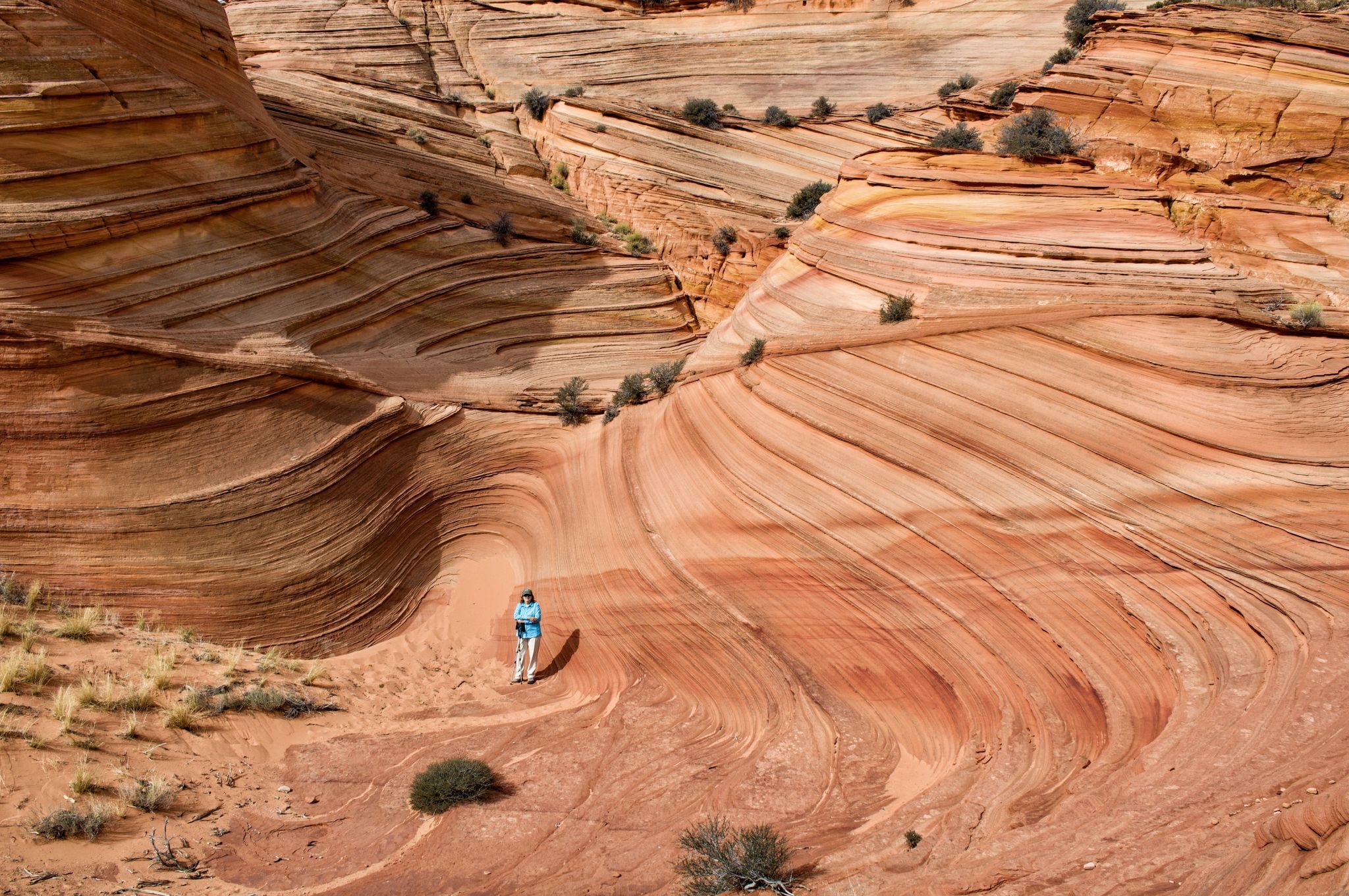
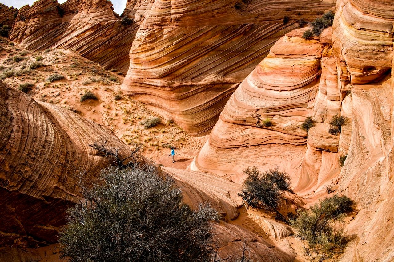
Large sandstone teepees, hoodoos, and twisted rock formations reminiscent of the Wave. Requires a permit but is not as difficult to acquire due to the difficult drive to get there. Absolutely worth visiting but hiring a guide to transport you might be a good idea. A good full day expedition would be combining Paw Holes with Cottonwood Cove (no water, sea of slickrock) a few miles away.
Photography Tips
Avoid visiting on a windy day. What isn’t sandstone is sand and the sand is usually deep. Be prepared to protect your gear if the wind starts blowing.
Travel Information
From Hwy. 89 in Utah, drive about 16 miles south on House Rock Valley Road to the intersection with the Lone Tree access road. Turn left on BLM 1079 and drive 2.6 miles to the Paw Holes trailhead. BLM 1079 is very narrow, barely the width of my Jeep Grand Cherokee for most of the drive. The VERY deep sand gets deeper the closer you get to the trailhead. The “road” is a rollercoaster ride, uphill all the way with very tight twisting turns. Reminded me of a bobsled course. Once you start the uphill climb, you cannot let off the gas or you will get stuck. If you stop anywhere on the way up, you will probably get stuck. If you meet anyone coming from the other direction, SOMEBODY is going to get stuck because there’s no room to pass. Simply put, it was the longest 2.6 miles I’ve ever driven in my life. You might seriously elect to park your vehicle on 1079 at the first opportunity and walk to the trailhead. The road continues beyond the Paw Holes trailhead and leads to another spectacular area called “Cottonwood Cove” or “Cottonwood Teepees”. However, the road is steeper and the sand is even deeper. Signs are posted urging you to NOT drive in that direction. There is a safer alternate route to that area, although it is much longer and includes about 11 miles of driving in deep sand.
Spot Type
Outdoor
Crowd Factor
Nearly no other people
Best Timing
Sunrise in fall
Sunrise & Sunset
05:23 - 19:45
| current local time: 00:22
Photo Themes
Colored Sandstone Rock Formations
Rock Formation
Locations
Arizona
Coyote Buttes South


Spot comments (0)