
USA Hoodoo City
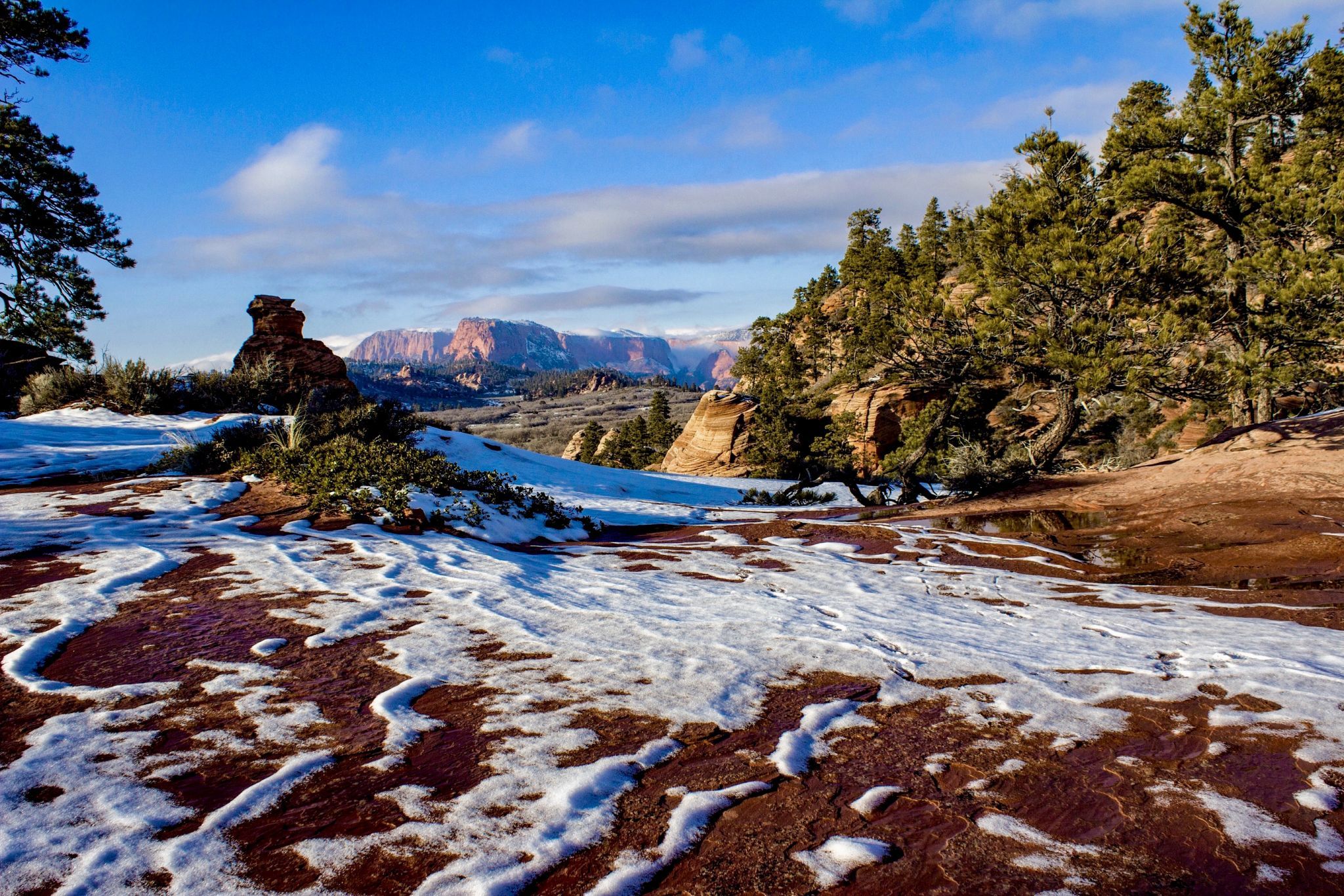
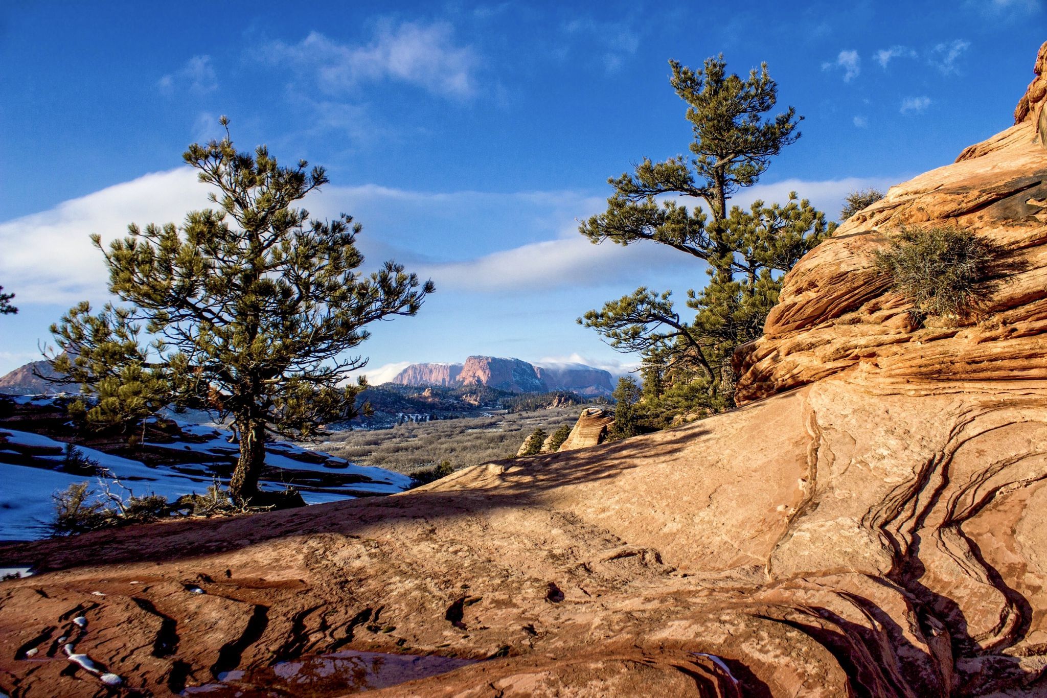
This is a very nice area overlooking Hop Valley with a cluster of hoodoos that allow for numerous photo compositions. Spendlove Knoll to the East is a green brush covered cinder cone. The northeast rim of Hoodoo City overlooks Hop Valley, Red Butte, and the pink and purple hues of the Kolob Canyons section of Zion NP in the distance. There is some serious exposure near the rim so exercise caution while wandering near the edge. The area is also fun to photograph in the winter with the snow contrasting with the brilliant red/orange slickrock. This of course assumes the road is passable. Kolob Terrace Road is paved up to and beyond hoodoo city but is typically closed a couple of miles past Hoodoo City to vehicular traffic except for snowmobiles. Kolob Road can be driven all the way to Cedar City, Utah but turns to dirt and gravel beyond Kolob Reservoir. It’s a beautiful drive in the Fall when clusters of aspens turn bright yellow. It’s highly unadvisable to attempt the drive in the winter when the road is wet or covered in snow. There have been catastrophic incidents when people attempted the drive and got stuck. Once you start up the narrow wet or snow covered road, it’s extremely difficult to turn around.
Photography Tips
During the winter, be mindful of possible icy areas that are sometimes clear and other times hidden below a layer of snow. Also, be very careful not to step on the extremely fragile fins and thin sandstone layers that are obvious in the summer but might be hidden under snow in the winter. Once they’re broken, they’re destroyed forever.
Travel Information
A roughly 12.5 mile scenic drive up Kolob Road from SR9 near the town of Virgin, Utah will get you to the parking spot for Hoodoo City. The hike to the hoodoo formations is an easy 10 minute walk up and over to the hoodoos. The small pull-out (room for two vehicles) is about 150 yards east of the Hop Valley trailhead. Walk roughly northwest along the shelf above the little valley below until you get to a spot where you can easily descend to Hoodoo City which floats above the lower valley. When you get even with the hoodoo I call the Harry Potter’s Hat or Witch’s Hat (you’ll know it when you see it) there’s an easy slickrock slope leading down toward the hoodoos. You can also descend immediately below the pullout where you parked. This option drops you right away among the slickrock but requires an uphill (but easy) climb to get to the hoodoos.
Spot Type
Outdoor
Crowd Factor
Nearly no other people
Best Timing
Sunset
Sunrise & Sunset
06:29 - 20:47
| current local time: 13:31
Photo Themes
Colored Sandstone Rock Formations
Rock
Tree
Locations
Utah
Zion National Park


Spot comments (0)