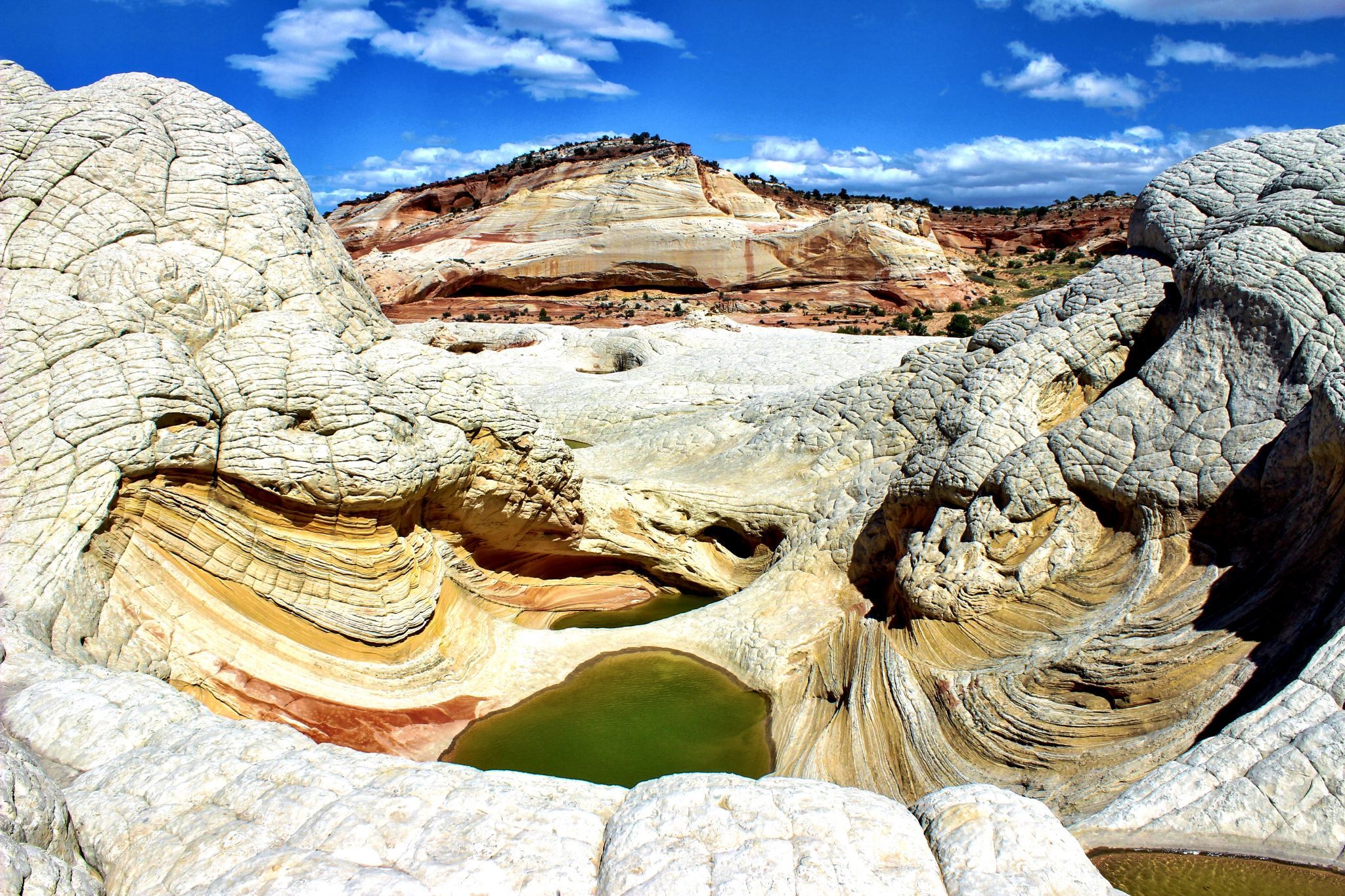

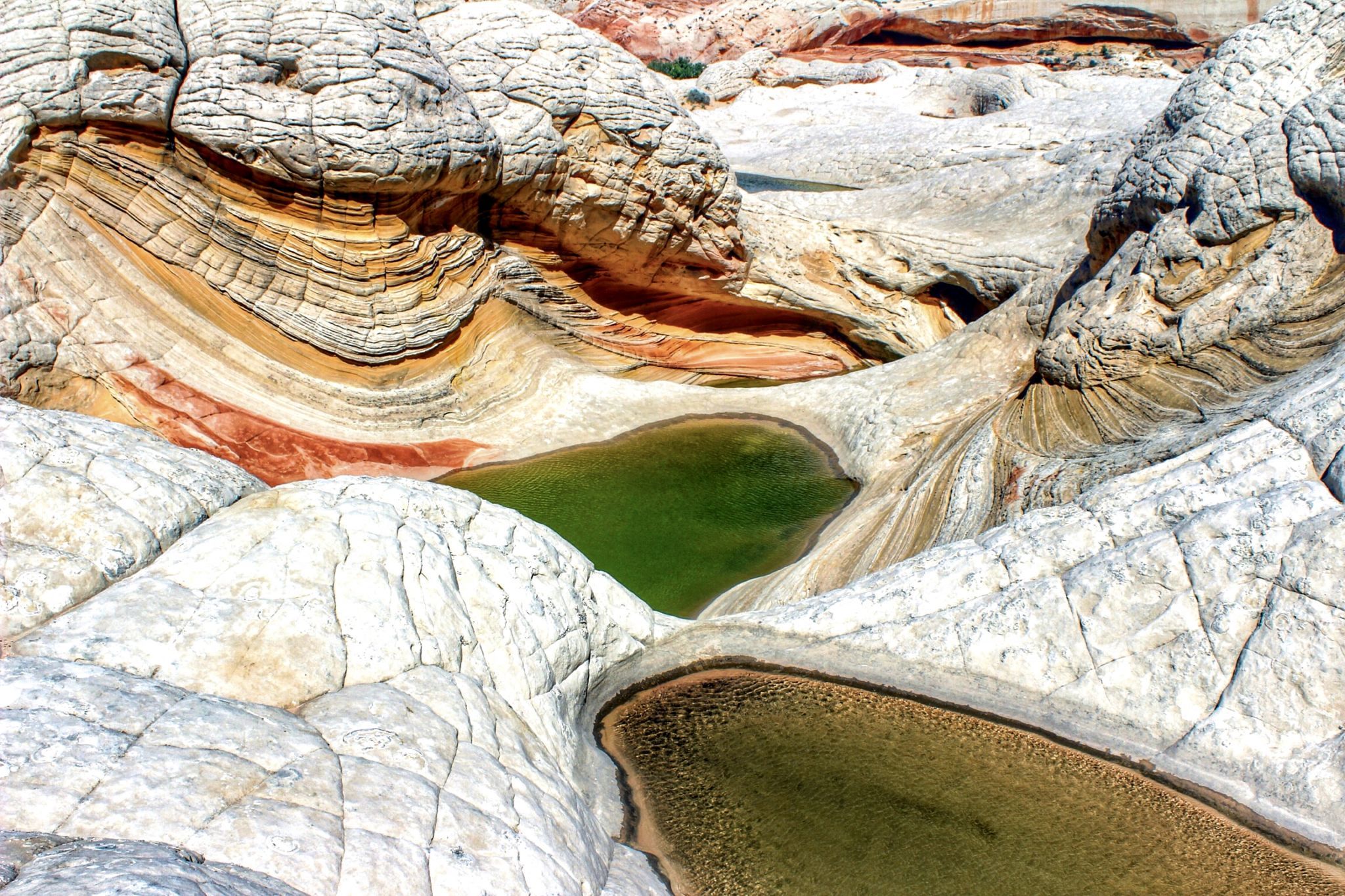
USA White Pocket
Unlike the world-famous “Wave” at nearby North Coyote Buttes, White Pocket doesn’t require getting the extremely hard-to-get permit. The multi-colored sandstone swirls are every bit as dramatic as what you’ll find at the “Wave” though. I suspect the reason the Bureau of Land Management hasn’t (yet) enacted a permit system to limit human impact on the fragile sandstone is because hard to get there. It’s a very difficult drive through extremely deep sand for approximately 15 miles. Unless you’re experienced driving in these conditions and are driving a high clearance 4WD vehicle. I would recommend hiring a guide out of Page, Arizona, or Kanab, Utah to drive you there. It’s worth it though. White Pocket covers a much larger area than the wave and you’ll think you’re on another planet. One could spend half a day wandering around this bizarre landscape.
Photography Tips
Camping is permitted in/near the parking area so if you’re driving yourself and your schedule permits, this would be a wonderful sunrise or sunset location. I haven’t done it but it would also be great for nighttime photography. Don’t even think about driving to or from White Pocket in the dark. You will get stuck! People get stuck in the sand driving to or from there VERY frequently.
Travel Information
If coming from the south on US-89A, turn onto House Rock Valley Road, and head north. There are two older businesses right off the turnoff. Take House Rock Valley Road for about 9.2 miles until you see an old corral on your left. Turn right onto Pine Tree Road/Road 1017 and head east for 6.2 miles, avoiding all side roads. You will then come to a farmhouse. You will turn left as the road will go in front of the farmhouse and begin to head north. This is Road 1087. At approximately 3.9 miles from the farmhouse you will take the left fork and continue on the left fork for 5.6 miles before you arrive at the White Pocket parking area. Along the way, you’ll come to a cattle fence crossing the road. Close the fence behind you. It should take about 90 minutes to get to White Pocket after turning off House Rock Valley Road. House Rock Valley is a graded gravel and dirt road that is driveable in 2WD unless it’s wet. If wet, it’s impassable even with 4WD. After you turn off HRVR, driving is relatively easy for the first couple of miles. Then, the road turns to sand that gets progressively deeper the farther you go and is perhaps deepest just before the parking area. Be especially mindful that the last 150 yards is downhill with deep sand and high Center. You have to negotiate that when you leave.
Spot Type
Outdoor
Crowd Factor
Nearly no other people
Best Timing
Sunrise
Sunrise & Sunset
05:22 - 19:45
| current local time: 21:30
Photo Themes
Rock Formation
Sandstone Monolith
Locations
Arizona
South Coyote Buttes


Spot comments (0)