
USA Cathedral Valley
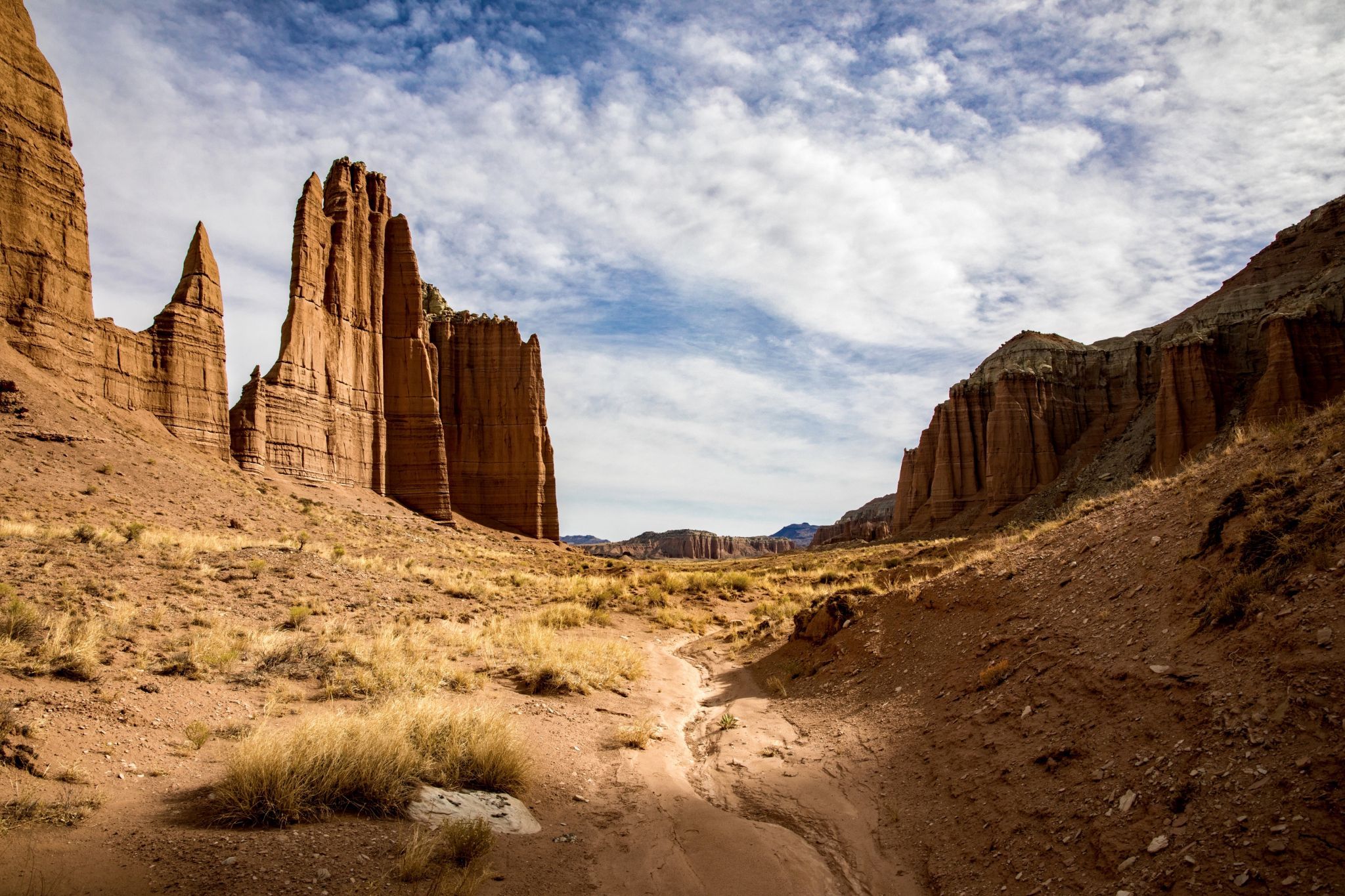
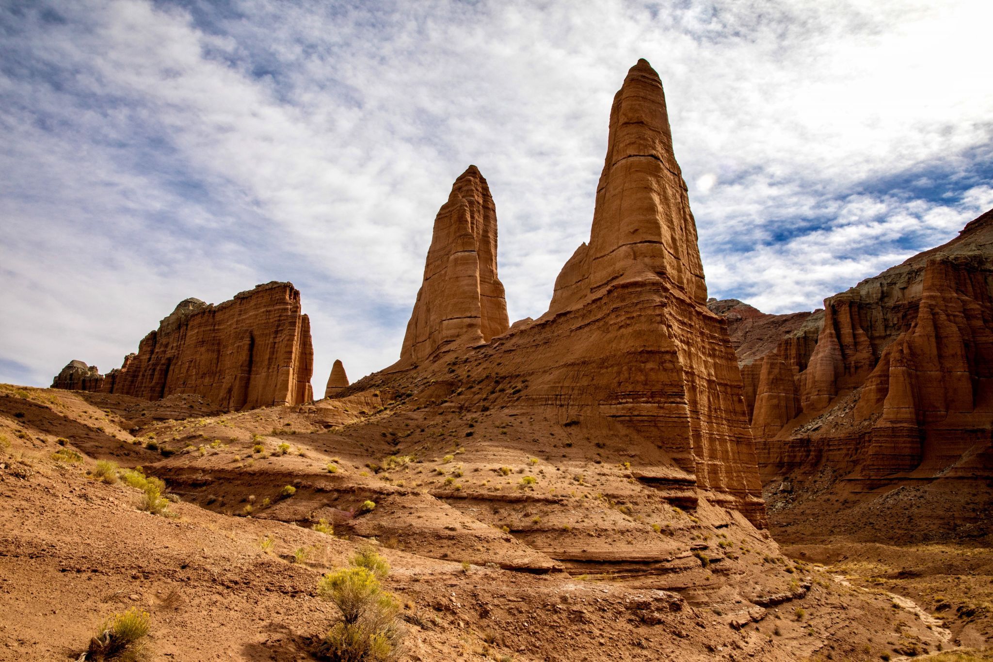
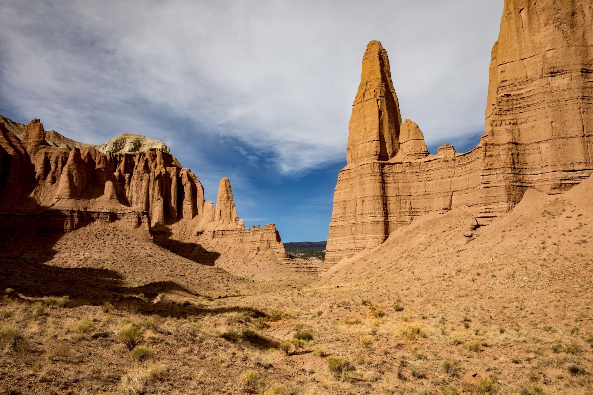
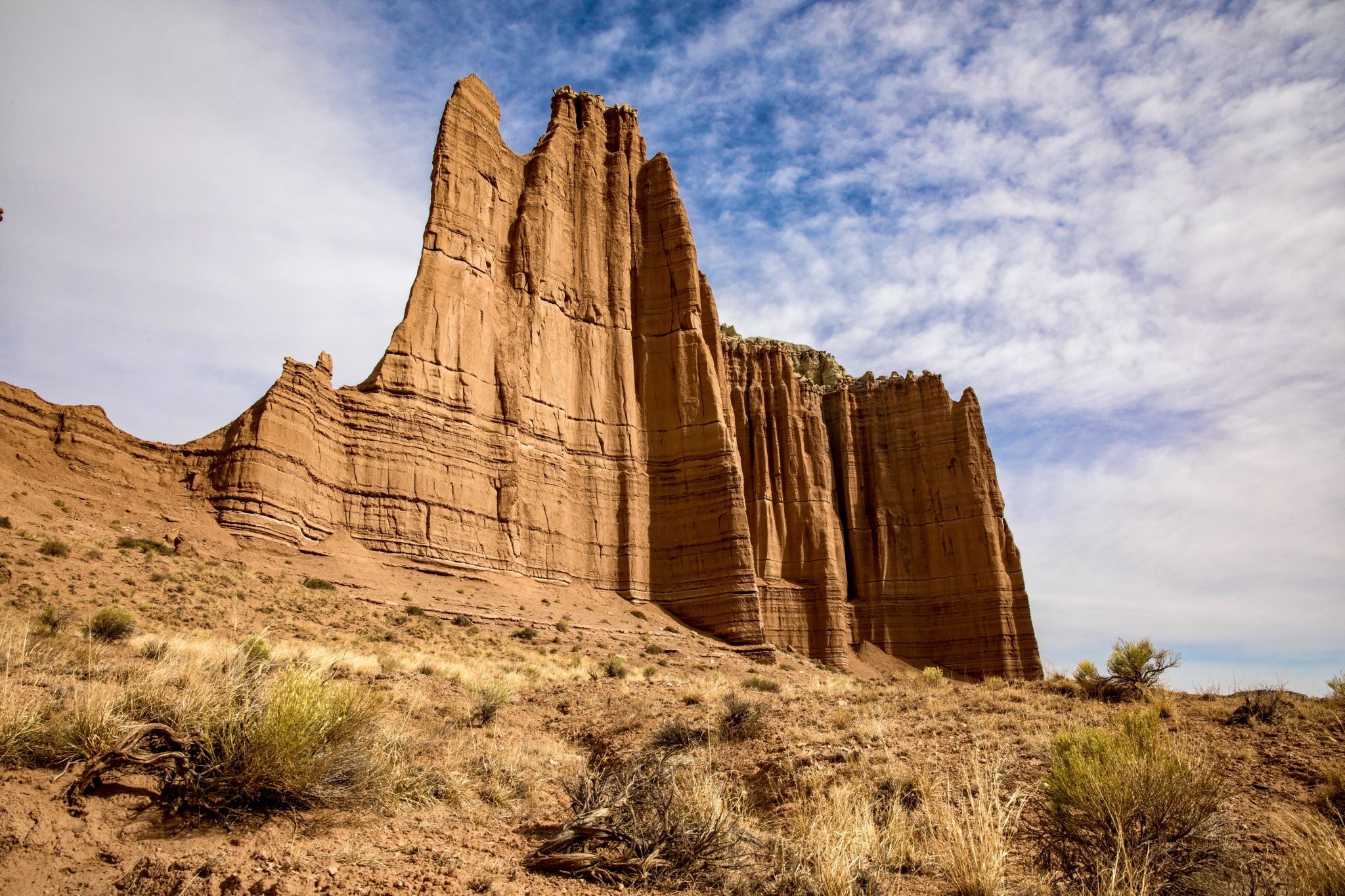
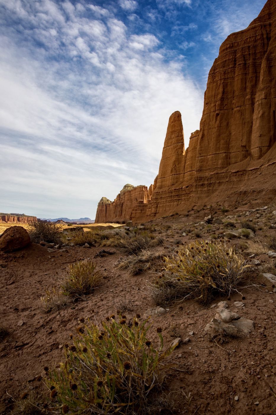
Cathedral Valley, in the northern area of Capitol Reef National Park in Utah, has some of the most stunning and dramatic views around. It is a bit difficult to get to, which makes it one of the lesser visited areas of the park. For travelers with a sense of adventure and a high clearance vehicle, you may find yourself alone in this beautiful place. The loop drive provides access to spectacular valley overlooks, bentonite hills, and massive sandstone monoliths including the much photographed “Temple of the Sun” and “Temple of the Moon” (not pictured here). If the absence of footprints is a reasonable gage, the spot in this photo is rarely visited, yet is a short 10 minute stroll from the road.
Photography Tips
Early morning/Late afternoon. Wide angle lens.
Travel Information
The drive through Cathedral Valley can be done via a 57.6 mile (93 km) loop through the remote Cathedral district, which is usually accessible to most vehicles with high clearance. If your intent is to drive the entire loop, I recommend starting from the E. Hartnet Road access which is 2.7 miles (4.3 km) east of the Capitol Reef boundary off of Highway 24. That will require fording the Fremont River which is normally less than one foot deep. If you have any reservations about driving through the river, it’s best to make the decision at the outset, about five minutes into the drive, rather than at the end of the loop, over five hours into the drive. If you just want to drive to this spot, it’s best to continue driving east on Highway 24 another 7.3 miles (11.7 km) to Caineville Road. From there, it is 27 miles (43.4 km) to this spot. You’ll pass the short spur road leading to the Temple of the Sun and Temple of the Moon monoliths en route to this spot. This direction includes an altogether different obstacle though. There has always been a bit of sand along this stretch but nothing to deter even a 2WD vehicle under normal conditions. I had driven the loop 3 or 4 times before but when this photo was taken (10/15/2020) the sand was far deeper than I’ve ever seen it before, perhaps due to extremely dry conditions over the past year or so. I estimate the sand to be an average 12 inches deep or more and had the texture of baking powder. I thought I was going to get stuck a half dozen times even though I’ve had experience driving in very deep sand. In fact, when I checked the park website that evening, there was a warning that a 10 mile section of the road was impassable even with 4WD and many people needed assistance getting unstuck. Shame on me for not checking road conditions first. The road alternates between dirt, sand, and clay and should be completely avoided in wet conditions or when rain is likely regardless of the vehicle you’re driving.
Spot Type
Outdoor
Crowd Factor
Nearly no other people
Best Timing
Daytime
Sunrise & Sunset
06:16 - 20:47
| current local time: 18:55
Photo Themes
Rock Formation
Sandstone Monolith
Locations
Utah
Capitol Reef National Park


Spot comments (0)