
USA Edmaier’s Secret
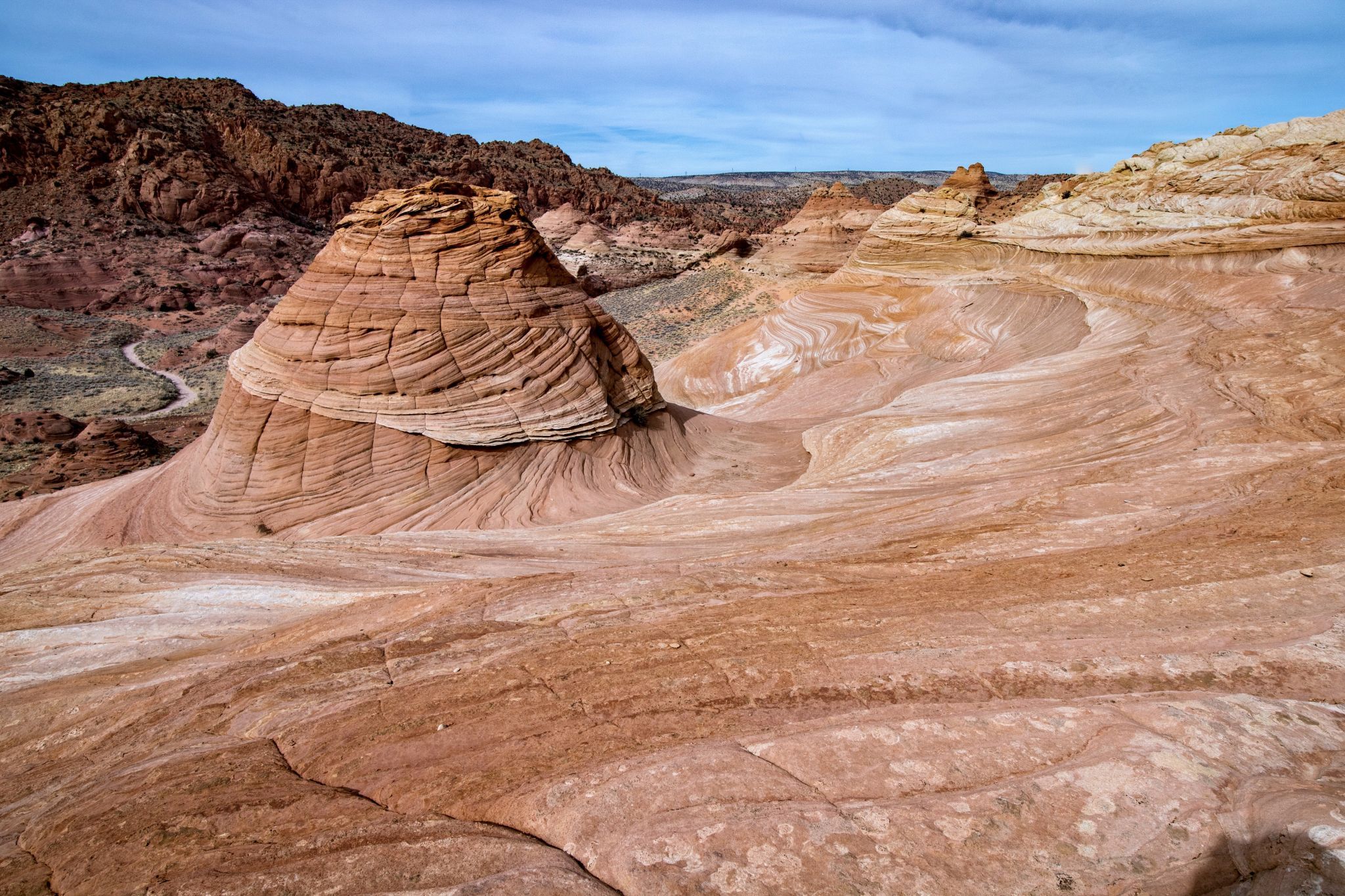
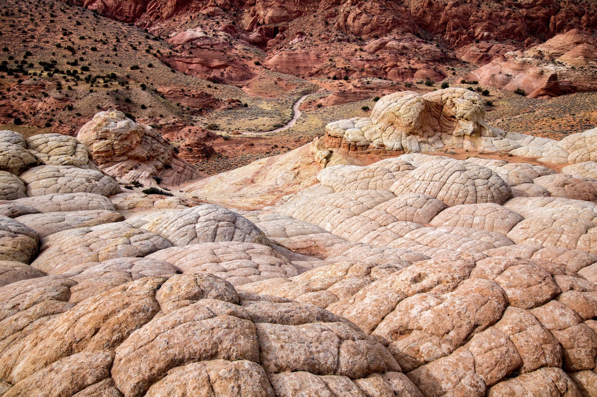
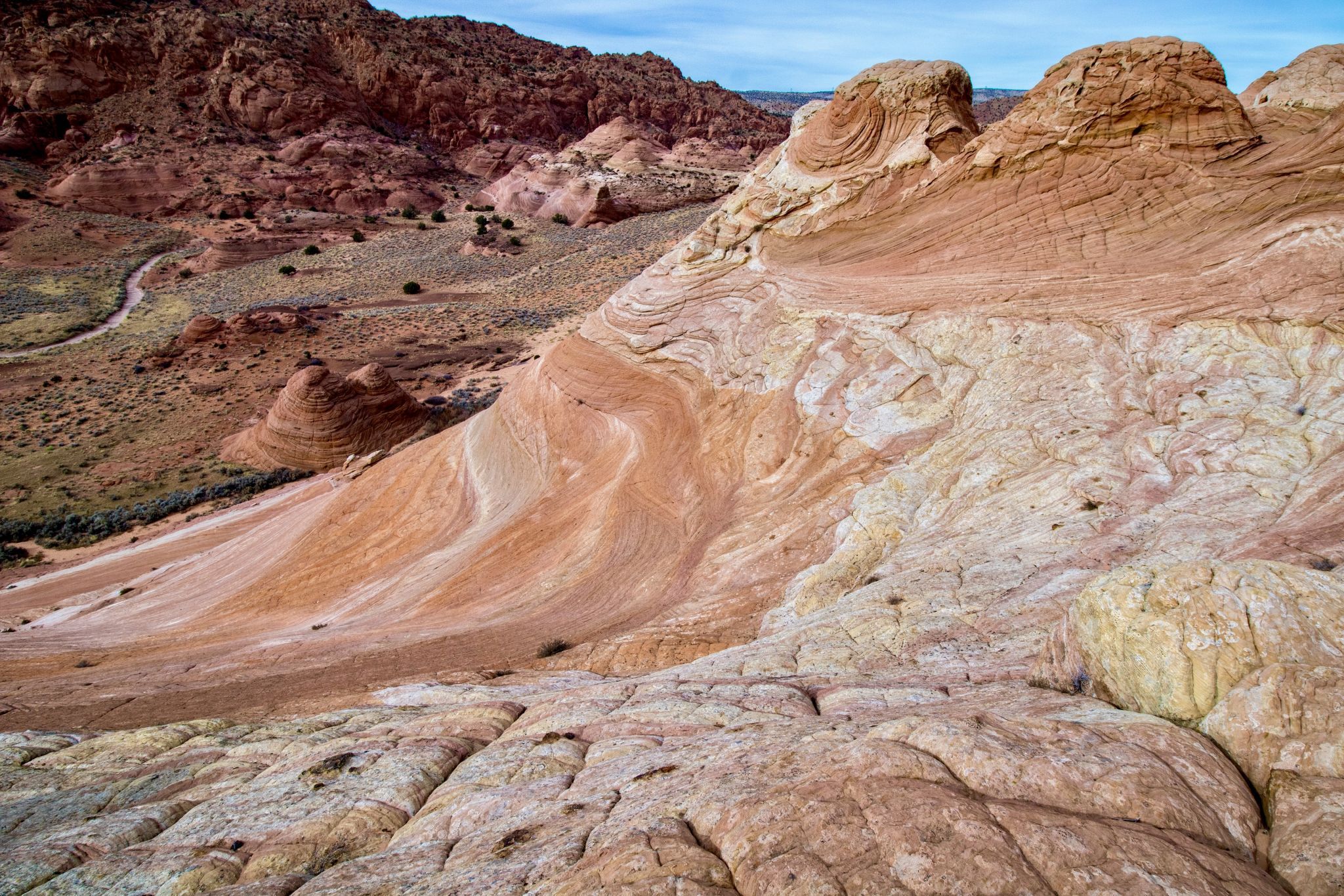
I stumbled across Edmaier’s Secret about five years ago while researching some of the nearby attractions in Coyote Buttes North and Coyote Buttes South. At the time, it was barely a blip on the map and there was very little describing it on the internet. It’s a spot I’ve been somewhat reluctant to share due to the extreme fragility of the landscape. It’s an area of swirling sandstone, lace rock, and fins that are at times paper thin and are very easily broken. A similar area called Gold Buttes in Nevada has been utterly destroyed by careless throngs who have seemed to intentionally target the thin rock structures for destruction. My hope that because this area is much more difficult to get to, those who go there will appreciate it’s beauty and fragility. My experience has been that as more effort is required to get to a place, the less likely it will draw mindless people bent on it’s destruction. I would also discourage adults from bringing young children, who aren’t typically as mindful of their recklessness. For some, it would be like popping bubble wrap. They just can’t help it. Just saying. There are also lots of places where a fall could be catastrophic. For these reasons, please be careful where you step. I’ve been to Edmaier’s many times and have never seen more than three other people other than a few friends I’ve taken there.
Photography Tips
Not a good sunrise location. Mid-morning and mid/late afternoon. There are a lot of different areas to explore with thousands of compositions possible including abstracts.
Travel Information
From Kanab, Utah drive east on Highway 89 for 38 miles (61 km) and turn right on House Rock Valley Road. The road is located just before the highway curves sharply to left at the beginning of a guardrail and goes through a deep road cut. This is a very abrupt turn and is easy to miss if you’re not looking for it. The road is a mixture of dirt, sand, and clay and can be completely impassable when wet, even with 4WD. The Buckskin Gulch trailhead is 4.4 miles (7.08 km) down House Rock Valley Road where there is a sign directing you to turn left at a short spur road. There is ample parking and a vault toilet at the trailhead. Park and pay the $6 US permit via the self pay box. Follow the well trodden path that is sometimes in the wash and sometimes shortcuts across the wash via trails above the wash. It’s usually advantageous to utilize the shortcuts whenever possible. After about 2 miles (3.2 km) turn left at the wide (about 100 ft wide) sandy wash and head toward the brain rock straight ahead. Then work your way up and over the brain rock to get an expansive view of the northernmost section of Edmaier’s Secret. There is a bit of scrambling necessary there but nothing at all difficult. This isn’t the only point of access but is the most straightforward directions without utilizing GPS coordinates (although the coordinates for this spot are accurate). Note: While the official name for the trailhead is “Buckskin Gulch” and the shallow wash eventually turns into Buckskin Gulch, the best part of Buckskin begins about four miles (6.4 km) from this trailhead. If you want to explore Buckin Gulch, I strongly recommend beginning your hike at the Wire Pass trailhead which is 4 miles (6.4 km) further down House Rock Valley Road. From that trailhead, you hike down Wire Pass (a destination in itself) for about 1.5 miles (2.4 km) where it meets Buckskin Gulch. Turn right at Buckskin to explore perhaps the longest and most spectacular slot canyon on earth. Thoroughly research this canyon before you go. Permits are required to hike the entire length of the canyon and there are seasonal water obstacles that range from a few inches deep to sections that could require swimming. I know people who have hiked the entire length when it was completely dry though.
Spot Type
Outdoor
Crowd Factor
Nearly no other people
Best Timing
Daytime or sunset in spring or fall
Sunrise & Sunset
06:24 - 20:44
| current local time: 14:34
Photo Themes
Colored Sandstone Rock Formations
Panoramic View
Rock Formation
Locations
Utah
Coyote Buttes North


Spot comments (0)