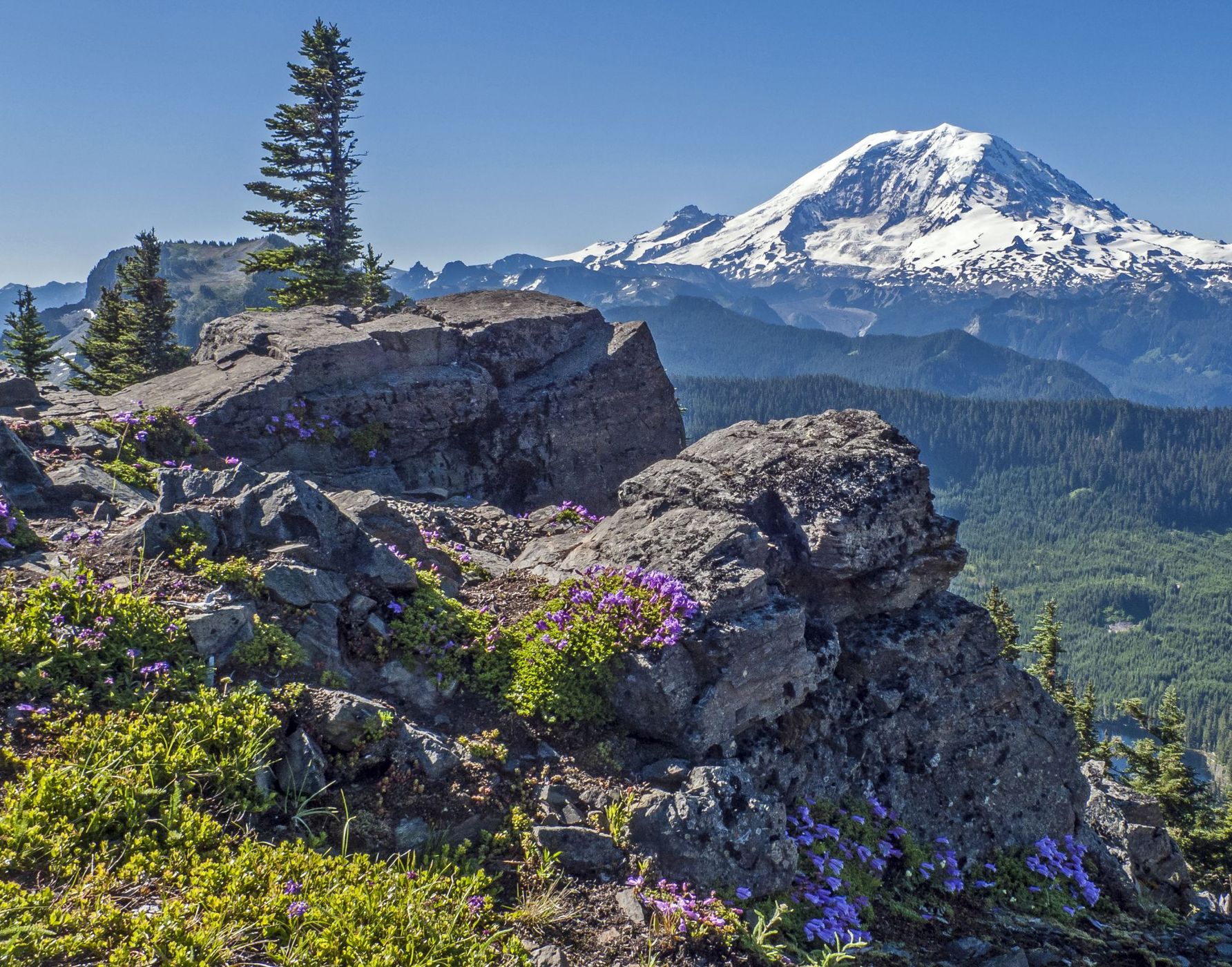

USA Summit Peak/Lake
This is a great, gentle hike to Summit Lake through beautiful forests and wildflowers in the spring. Once at the lake hike around and climb up the ridge to the summit. It gives great compositions of the lake in the foreground of Mt. Rainier or of the summit itself.
Photography Tips
Plan for early after the snow melts to enjoy the avalanche lilies as you approach the lake. Bring a polarizing filter but not too much so the sky doesn't go too dark.
Travel Information
From Seattle drive to Enumclaw then turn west on State Route 410 to SR 165. Proceed on SR 165 to the Carbon River Road/Mowich Lake Highway junction. Turn left onto Carbon River Road and follow it to Cayada Creek Road (Forest Road 7810), just before the national park entrance. Turn left (north) and drive about 6.8 miles to the trailhead at the end of FR 7810. It is a three mile to the lake.
Spot Type
Outdoor
Crowd Factor
Nearly no other people
Best Timing
Sunrise in spring
Sunrise & Sunset
05:35 - 20:52
| current local time: 14:14
Photo Themes
Lake
Mountains
Wildflower
Locations
Washington State
Mount Rainier National Park


Spot comments (0)