Atigun Pass, USA
Reinhard Prinzmeier
Reinhard Prinzmeier www.herumkommer.de/uns…
licensable
Atigun Pass, USA
Reinhard Prinzmeier
Reinhard Prinzmeier www.herumkommer.de/uns…
licensable
This photo is copyrighted by the author.
Thank you for respecting the rights and efforts of our photographers. Please contact the author for further information.

USA Atigun Pass

  • Please log in or sign up for free to see the GPS coordinates & weather for this photo spot
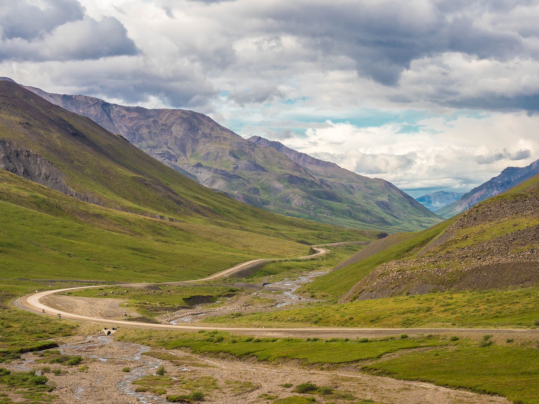
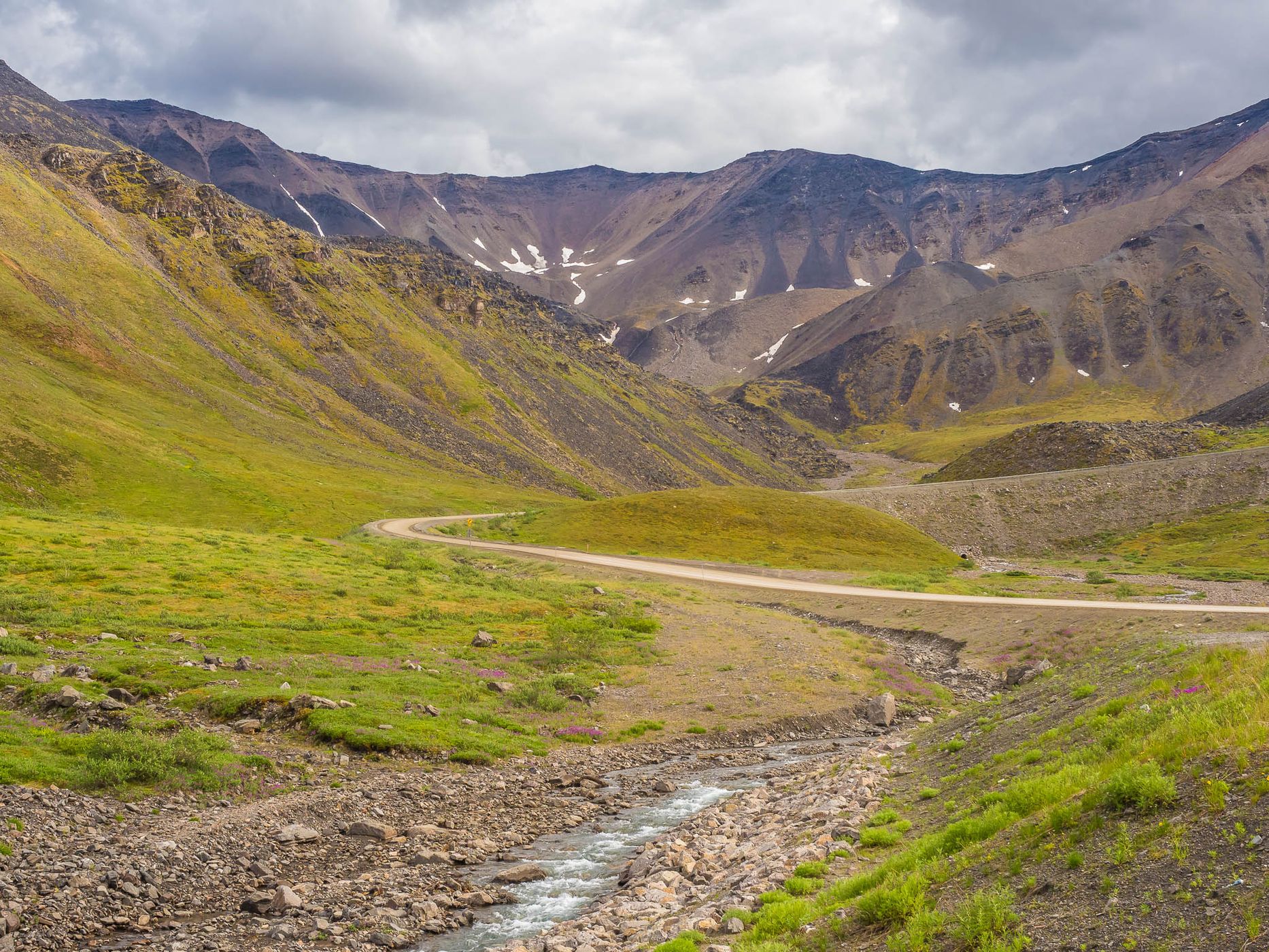
At 1422 m above sea level, Atigun Pass in the Brooks Range is the highest point on the Dalton Highway. The pass is a continental divide; southern rivers flow into the Pacific or the Bering Sea, while northern rivers flow into the Arctic Ocean. In winter, the snow masses above the highway are bombarded with artillery shells on an avalanche zone several kilometers long to get them moving. The bare, treeless and shrub-less landscape with the winding highway in it is an eye-catcher.
Spot Type Outdoor
Crowd Factor Nearly no other people
Best Timing Daytime in summer
Sunrise & Sunset Sun is always above the horizon today | current local time: 02:09
Photo Themes country road dirt road Gravel Road Mountain Pass Mountain Road Pass Road Road Trip roadtrip
Locations Wiseman

Get the exact geo-position for this spot

Log in to see the GPS coordinates, sun directions, and the map for this photo spot. Or simply bookmark it along with other spots to plan your next trip.

Spot comments (0)

Please log in or sign up for free to leave a comment or ask a question.

Ratings (1) star star star star star

star star star star star
1
star star star star star
0
star star star star star
0
star star star star star
0
star star star star star
0
Thank you Reinhard Prinzmeier for creating this photo spot in USA.
Imprint & Contact © Locationscout 2026 Privacy / Terms