
Hungary Sundown in Visegrád Mountains
Prédikálószék (whose name means "pulpit") is one of the highest summits of Visegrád Mountains. However, its fame derivates from other reasons.
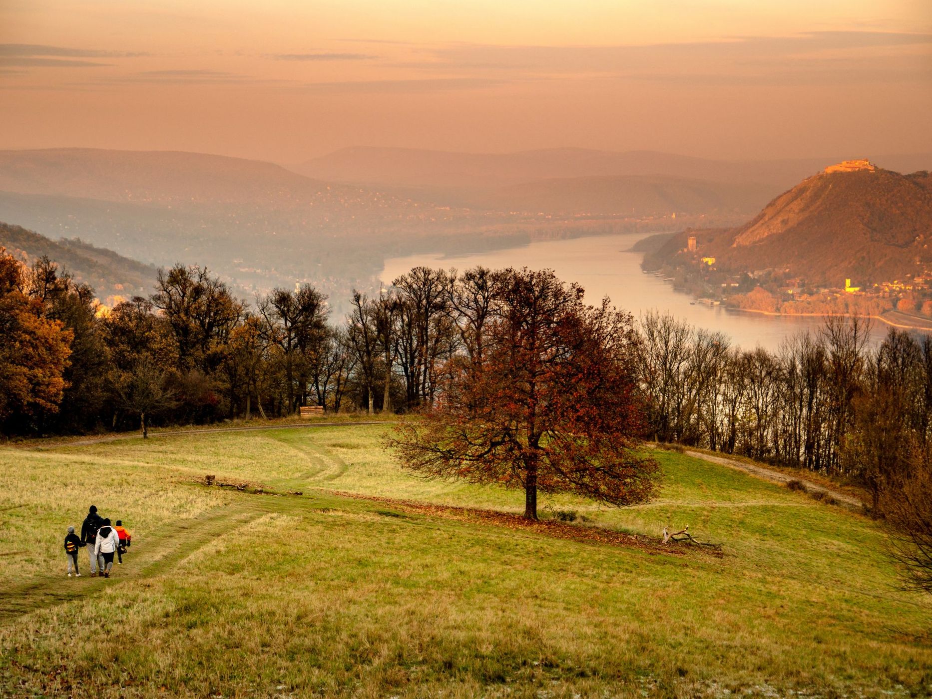
First of all, it offers one of the best panoramas in Hungary. Looking north from the summit rock (the pulpit), you have a complete view of the picturesque Danube Bend. About 500 meters below you, the wide river takes a pronounced curve around the Szent-Mihály-hegy (St. Michael Mountain). Behind it, in the distance, you can see the mountains of Börzsöny. Towards the east (on your right) you will notice the scenic castle of Visegrád, which is also an important historic place.
First of all, it offers one of the best panoramas in Hungary. Looking north from the summit rock (the pulpit), you have a complete view of the picturesque Danube Bend. About 500 meters below you, the wide river takes a pronounced curve around the Szent-Mihály-hegy (St. Michael Mountain). Behind it, in the distance, you can see the mountains of Börzsöny. Towards the east (on your right) you will notice the scenic castle of Visegrád, which is also an important historic place.
Photography Tips
Settings: f/4; exposure time, (1/160); ISO, 200; at 52 mm (104 mm in 35mm) shot with G9 camera (lens: Panasonic Leica DG Vario-Elmarit 12-60mm f/2.8-4.0)
Travel Information
From the north, start at Dömös village. Follow the signs towards Rám-szakadék (three marked trails begin here: red, yellow and green stripes).
After a while you leave the last houses of the village and will have to cross the stream. A short walk follows in the woods, but still along the stream. Soon you will reach a spring with benches. By the spring you will find the trailhead of the red triangle hiking trail towards Vadálló-kövek and Prédikálószék.
From here on, the footpath continuously ascends, occasionally in a quite inclined fashion (compared to an "ordinary Hungarian hiking trail"). The terrain gradually changes from forest to rocky surface, finally reaching the bare ridge of Vadálló-kövek. Having left behind this beautiful ridge, the trail returns into the forest, and soon reaches the summit of Prédikálószék.
From the south/east there are several points to start from, probably the most popular is Dobogókő, another fine lookout point, where a century ago only a modest hikers' hut stood, nowadays an often crowded tourist place with bus service, motorcycles, buffets, etc... From here follow the red triangle sign, which leaves Dobogókő towards the east along with the blue stripe (better marked), later departing from it towards the north, descending into a valley, then ascending north-west onto Prédikálószék, doing a semi-circle-shaped route.
Spot Type
Outdoor
Crowd Factor
Just a few people
Best Timing
All timings are equally good
Sunrise & Sunset
05:05 - 20:35
| current local time: 19:02
Photo Themes
Hiking
Landscape
Mountains
National Park
Natural Landscape
Nature
Panorama
River Bend
sundown
Trees
winter
Locations
Visegrád
Visegrad Mountains
Danube
Budapest
Danube bend


Spot comments (0)