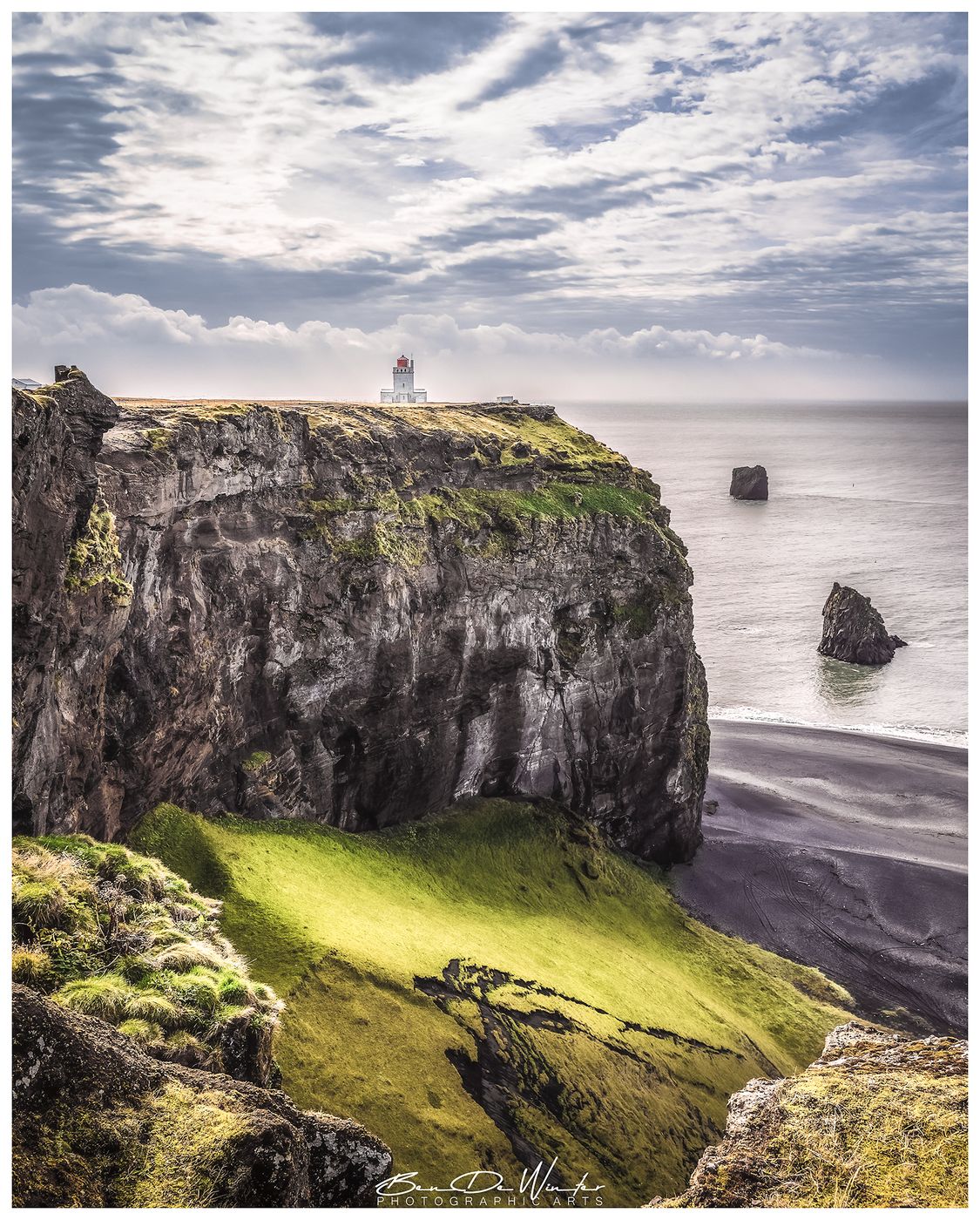

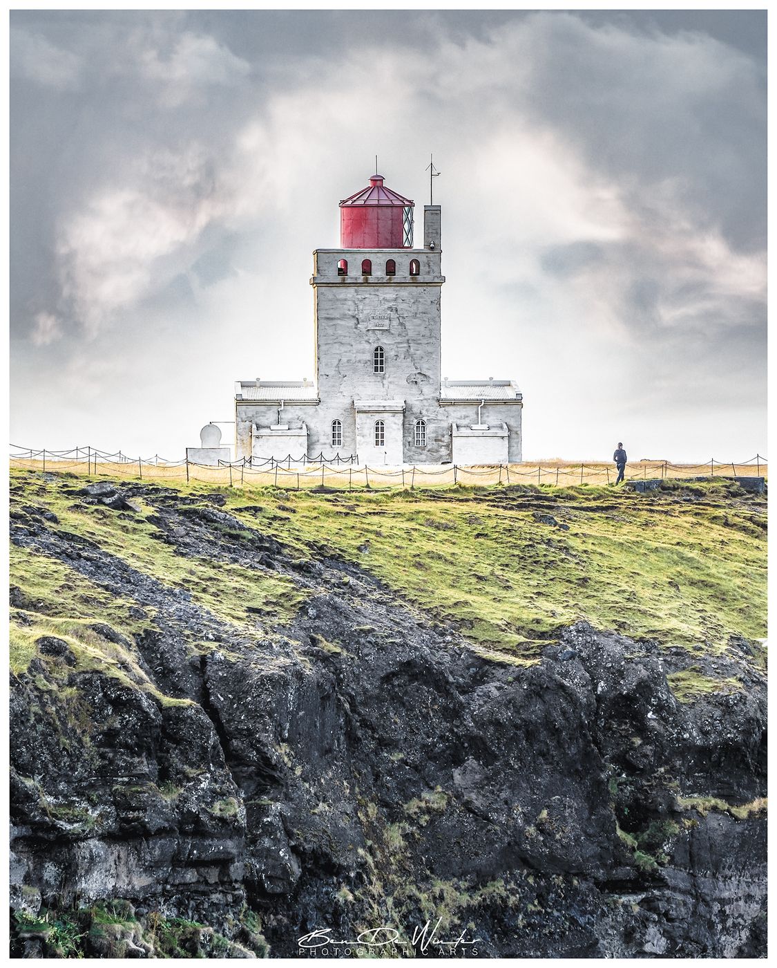
Iceland Dyrhólaey cliffs - view on lighthouse
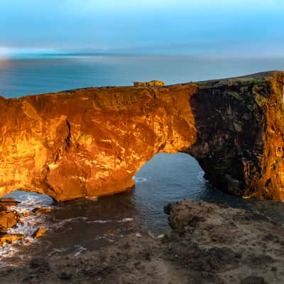
Dyrhólaey is a 120-meter-high tuya, a type of volcanic formation created by submarine eruptions during the last Ice Age, around 100,000 years ago.
Dyrhólaey Cliffs:
The name Dyrhólaey means “door hill island”, referring to the massive lava arch that resembles a doorway and is large enough for boats—and even a plane—to pass through.
The cliffs are surrounded by sea stacks, black sand beaches, and skerries, offering dramatic coastal scenery. The area is a protected nature reserve since 1978, covering 147.2 hectares, due to its geological significance and rich birdlife.
Dyrhólaey Lighthouse (Dyrhólaeyjarviti):
The first lighthouse was built in 1910, a skeletal steel tower imported from Sweden—the first of its kind in Iceland. The current structure, built in 1927, is a square concrete tower painted white with a red lantern. It was designed by Guðjón Samúelsson, Iceland’s State Architect, known for many iconic buildings. It stands 13 meters tall, with a focal height of 118 meters, and its light can be seen from 43 km away, flashing every 10 seconds.
Dyrhólaey Cliffs:
The name Dyrhólaey means “door hill island”, referring to the massive lava arch that resembles a doorway and is large enough for boats—and even a plane—to pass through.
The cliffs are surrounded by sea stacks, black sand beaches, and skerries, offering dramatic coastal scenery. The area is a protected nature reserve since 1978, covering 147.2 hectares, due to its geological significance and rich birdlife.
Dyrhólaey Lighthouse (Dyrhólaeyjarviti):
The first lighthouse was built in 1910, a skeletal steel tower imported from Sweden—the first of its kind in Iceland. The current structure, built in 1927, is a square concrete tower painted white with a red lantern. It was designed by Guðjón Samúelsson, Iceland’s State Architect, known for many iconic buildings. It stands 13 meters tall, with a focal height of 118 meters, and its light can be seen from 43 km away, flashing every 10 seconds.
Travel Information
From Reykjavík: ~2.5 hours via Route 1 (Ring Road), then turn onto Route 218 (Dyrhólavegur).
From Vík: ~20 minutes (12-mile loop).
There are two free parking lots at Dyrhólaey:
1. Upper Parking Lot (Háey)
Access: Western section of the peninsula.
2. Lower Parking Lot (Lágey)
Access: Eastern section.
From Vík: ~20 minutes (12-mile loop).
There are two free parking lots at Dyrhólaey:
1. Upper Parking Lot (Háey)
Access: Western section of the peninsula.
2. Lower Parking Lot (Lágey)
Access: Eastern section.
Spot Type
Outdoor
Crowd Factor
Just a few people
Best Timing
Fall
Sunrise & Sunset
08:07 - 17:56
| current local time: 20:04
Photo Themes
Cliff
Landscape
Lighthouse
Natural Landscape
Rocky Cliffs
Seascape
SeascapePhotography
Locations
South Iceland
Vik
Mýrdalshreppur
Dyrhólaey





Spot comments (0)