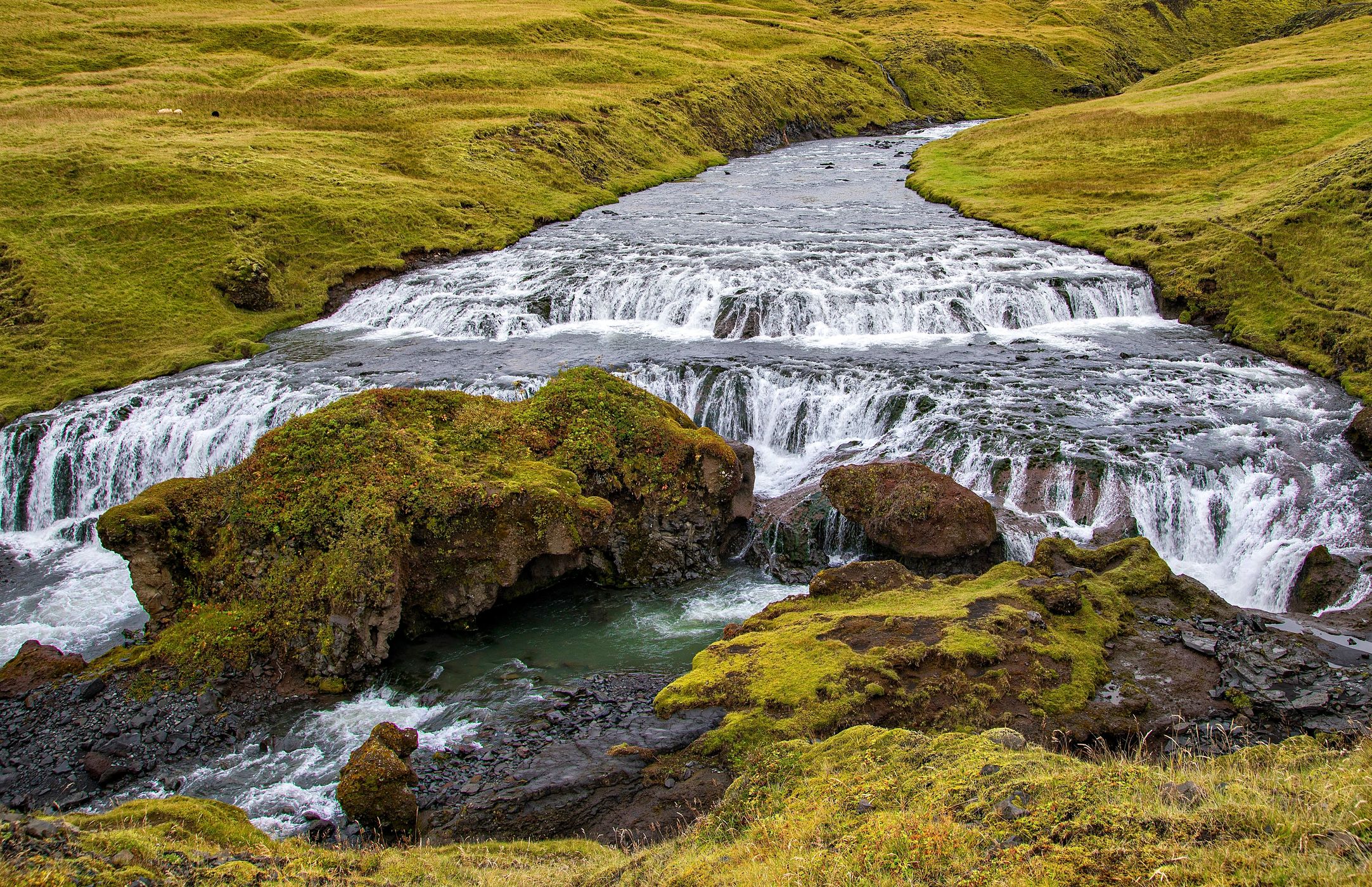

Iceland Fosstorfufoss
Fosstorfufoss is the second of about 25 waterfalls encountered as one hikes upstream from the brink of Skogafoss.
Photography Tips
A tripod and wide angle lens will be useful.
Travel Information
Take Highway 1 east from the town of Hvolsvöllur for 47km, then turn left where signs point prominently to Skógafoss (the falls are visible and very obvious at this point). In half of a kilometer take the next left and follow the road to its end adjacent to the camping area. The trail to the top of the falls begins adjacent to the grass field at the camping area, climbing up several hundreds of stairs for about one-third of a kilometer to a viewing platform at the top of the falls. From here the trail uses a stile to cross a sheep fence, and then continues gradually uphill. This waterfall is encountered six-tenths of a kilometer past the top of Skógafoss, and about 400 meters past Hestavaðsfoss.
Spot Type
Outdoor
Crowd Factor
Just a few people
Best Timing
Daytime in fall
Sunrise & Sunset
04:10 - 22:38
| current local time: 12:36
Photo Themes
Waterfall
Locations
South Iceland
Rangárþing eystra


Spot comments (0)