


Netherlands Aquaduct Veluwemeer
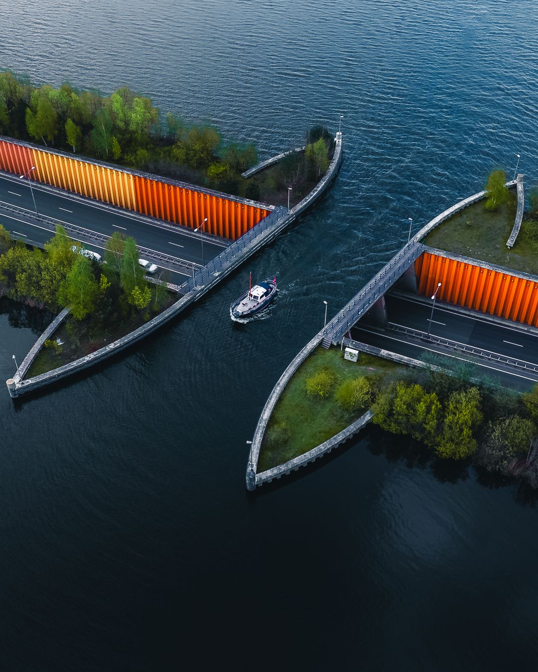
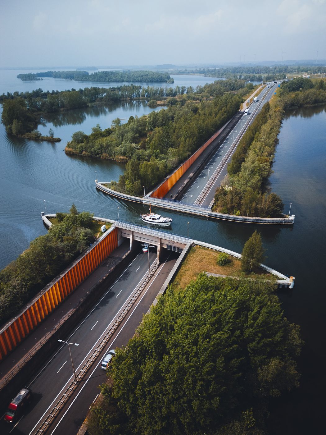
The Aquaduct Veluwemeer near Harderwijk is a fascinating example of Dutch infrastructure: instead of building a conventional bridge for boats, the N302 road passes underneath the water, while boats continue across the road at lake level. The navigable section is around 25 metres long and opened in 2002.
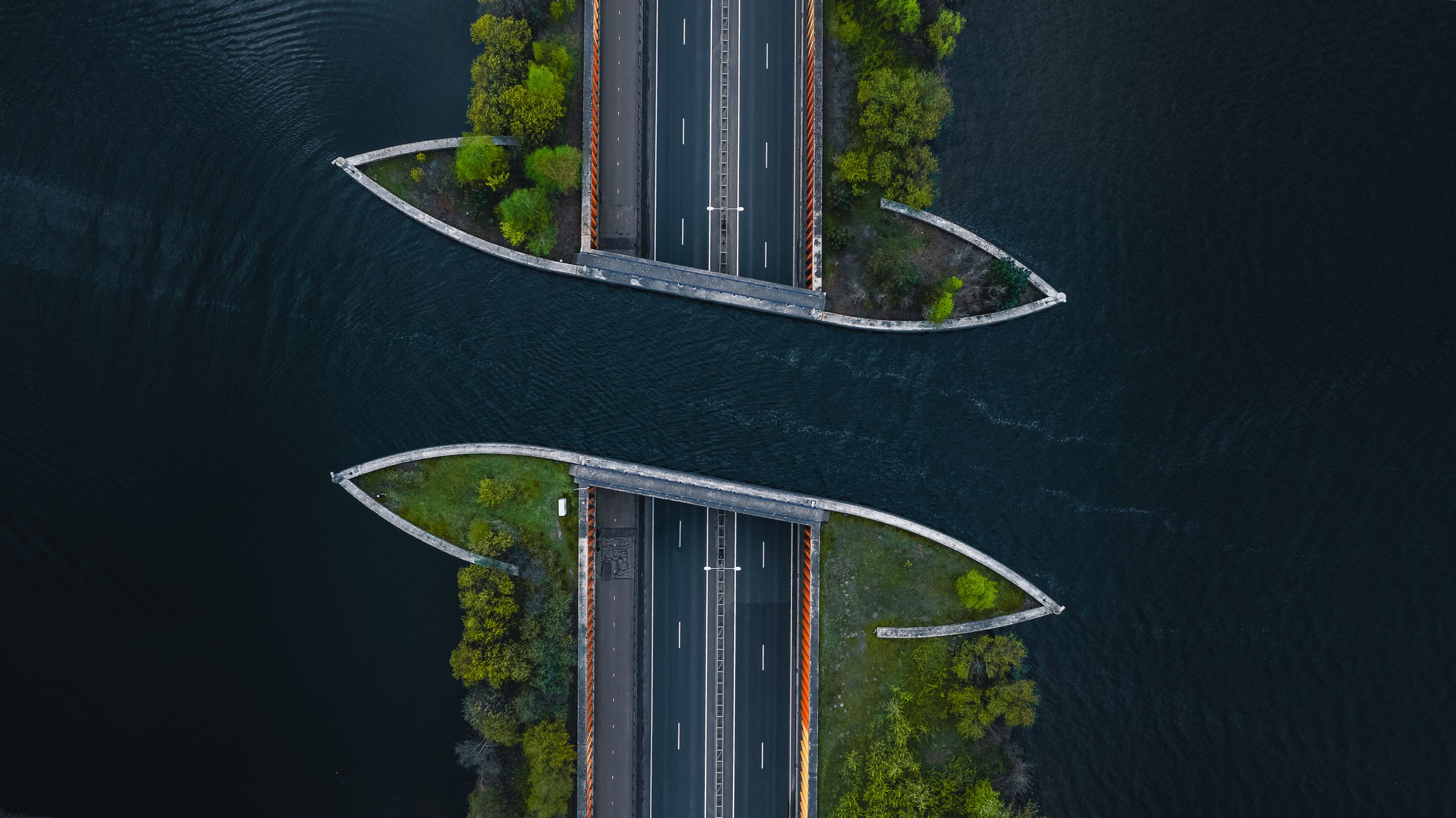
From the air, the concept becomes much easier to understand. The road appears to disappear underneath the lake while boats literally cross above the traffic, surrounded by the characteristic water and greenery of the Veluwerandmeren.
From the air, the concept becomes much easier to understand. The road appears to disappear underneath the lake while boats literally cross above the traffic, surrounded by the characteristic water and greenery of the Veluwerandmeren.
Photography Tips
A drone is by far my favorite perspective for this location, as the engineering concept is difficult to appreciate properly from ground level. I photographed vertically along the N302 so that the road acts as a strong leading line through the frame and directly toward the aqueduct.
If possible, wait for a boat to cross at the same time as cars are passing underneath. It immediately explains the scale and purpose of the structure and adds a strong focal point. A moderately high, slightly angled perspective like this also works better than shooting completely top-down because you can include the surrounding lakes and landscape.
If possible, wait for a boat to cross at the same time as cars are passing underneath. It immediately explains the scale and purpose of the structure and adds a strong focal point. A moderately high, slightly angled perspective like this also works better than shooting completely top-down because you can include the surrounding lakes and landscape.
Travel Information
The aqueduct lies on the N302 between Harderwijk in Gelderland and Flevoland, at the junction of the Veluwemeer and Wolderwijd. Pedestrian and cycling routes run alongside the crossing, so you can explore the structure from ground level rather than stopping anywhere along the busy N302.
For aerial photography, check the current Dutch drone map and local restrictions before launching, as airspace and temporary restrictions can change. The most interesting shot may also require some patience: boat traffic is intermittent, so give yourself enough time to wait for a vessel to actually cross the aqueduct.
For aerial photography, check the current Dutch drone map and local restrictions before launching, as airspace and temporary restrictions can change. The most interesting shot may also require some patience: boat traffic is intermittent, so give yourself enough time to wait for a vessel to actually cross the aqueduct.
Spot Type
Drone
Crowd Factor
Nearly no other people
Best Timing
Sunset
Sunrise & Sunset
07:47 - 19:04
| current local time: 10:10
Photo Themes
Aquaduct
Boat
Highway
sailboat
Sailing Boat
sailing boats
Sailing Ship
Ship
Water
waterway
Locations
Veluwe
Lelystad
Flevoland
Gelderland






Spot comments (0)