

Netherlands Aerial View of Urk
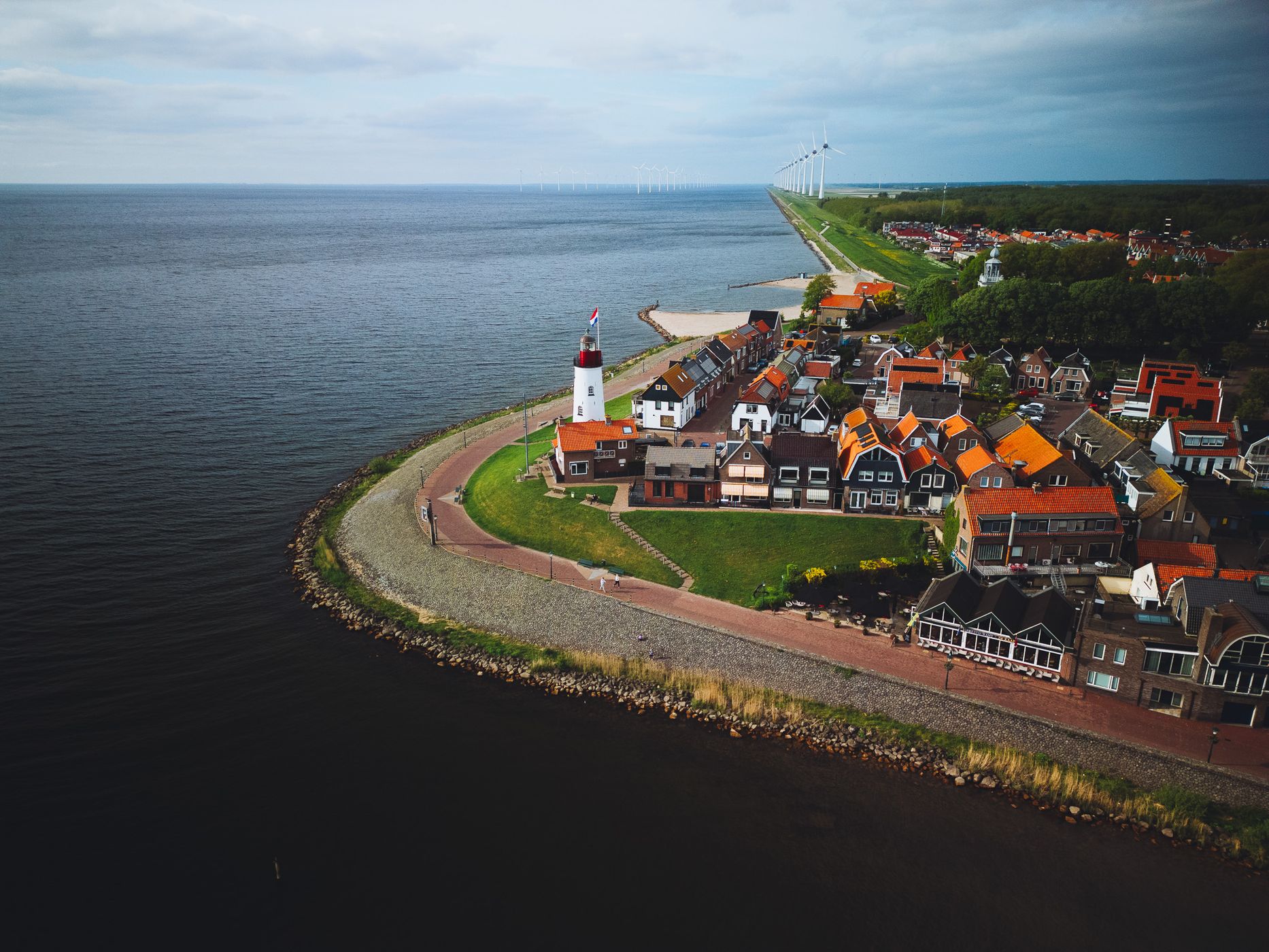
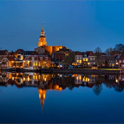
Urk is one of Flevoland's most distinctive towns. For centuries it was an island in the former Zuiderzee; after the surrounding Noordoostpolder was reclaimed, it became connected to the mainland. From above, that history is still visible: the compact old town sits directly against the IJsselmeer, with narrow streets, traditional houses, and the harbor clustered along the waterfront.
The main focal point in this composition is the Urk Lighthouse. The current lighthouse dates from the 1840s and stands right on the edge of the former island.
The main focal point in this composition is the Urk Lighthouse. The current lighthouse dates from the 1840s and stands right on the edge of the former island.
Photography Tips
A drone is perfect for Urk because the elevated perspective reveals the unusual relationship between the historic town and the water. For this composition, I placed the lighthouse in the lower third and followed the coastline into the distance. The line of wind turbines works surprisingly well as an additional leading line and emphasizes the extremely flat Dutch landscape.
Flying slightly offshore and shooting diagonally back toward Urk gives the town much more separation than a straight top-down perspective. A moderate altitude also keeps individual houses and the lighthouse recognizable rather than reducing the town to an abstract pattern.
Flying slightly offshore and shooting diagonally back toward Urk gives the town much more separation than a straight top-down perspective. A moderate altitude also keeps individual houses and the lighthouse recognizable rather than reducing the town to an abstract pattern.
Travel Information
Urk is located on the eastern shore of the IJsselmeer in Flevoland and is easy to reach by road. To explore the old town, it is best to park near the harbor or below the dike and walk; there is no parking directly beside the lighthouse. The historic center is compact, so you can easily combine the lighthouse, harbor, and waterfront into the same photography walk.
For drone photography, check the current Dutch airspace map immediately before flying. Dutch rules restrict flights in several types of areas, including certain Natura 2000 sites, airport zones, major roads, and other protected or sensitive locations, and the government specifically recommends checking the current drone map before each flight.
For drone photography, check the current Dutch airspace map immediately before flying. Dutch rules restrict flights in several types of areas, including certain Natura 2000 sites, airport zones, major roads, and other protected or sensitive locations, and the government specifically recommends checking the current drone map before each flight.
Spot Type
Drone
Crowd Factor
A decent amount of people
Best Timing
Sunset in summer
Sunrise & Sunset
07:40 - 19:13
| current local time: 00:49
Photo Themes
Harbor
Lighthouse
Ocean
Village
Locations
Flevoland





Spot comments (0)