


Norway Atlanterhavsveien
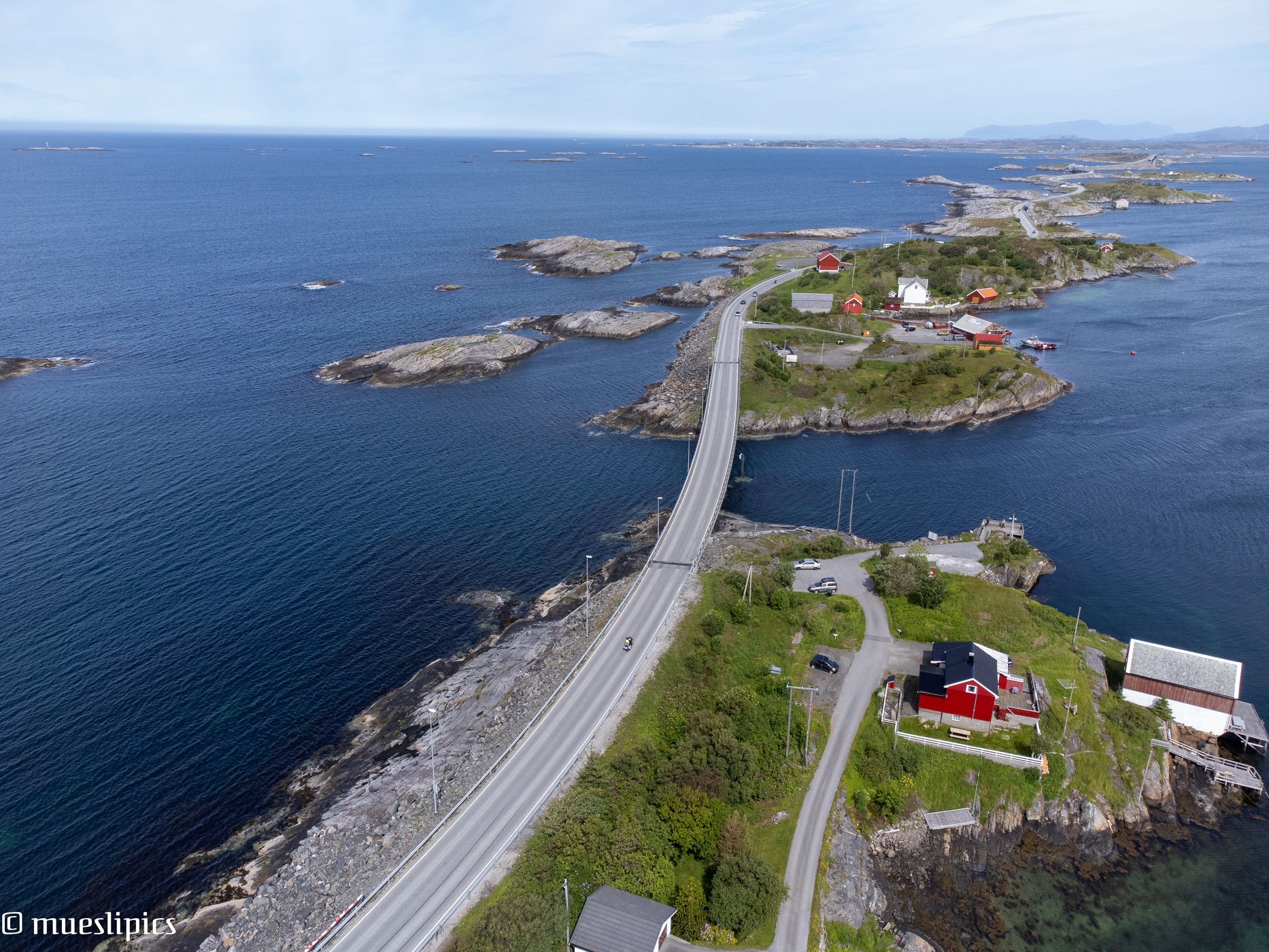
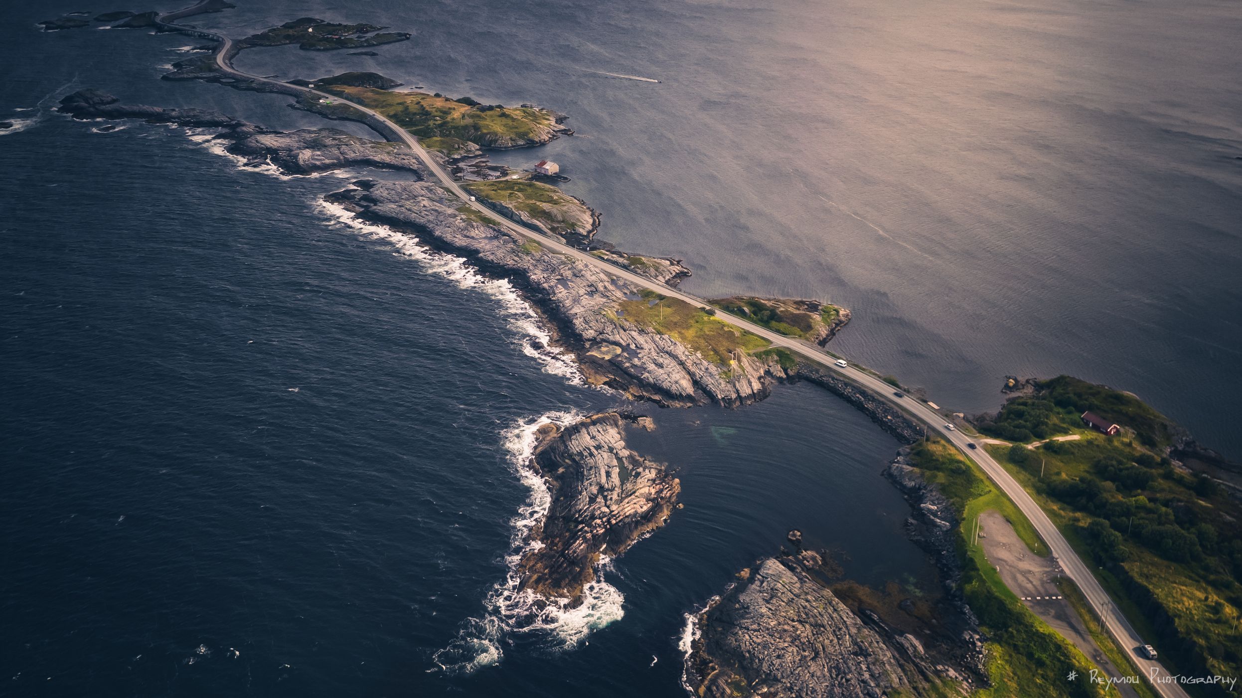
The Atlantic Ocean Road or the Atlantic Road (Norwegian: Atlanterhavsvegen/Atlanterhavsveien) is an 8.3-kilometer (5.2 mi) long section of County Road 64 that runs through an archipelago. The road is a visual delight as it curves elegantly from islet to islet over its seven bridges.
Photography Tips
Get your drone and let it fly.
Travel Information
If you drive northbound to the "island part" of Atlanterhavsveien, just turn right, where it is shown on the map. There you can catch beautiful aerial views. Be a bit careful.
We saw a picture like the one shown later at the cafe at one of the official parking and drove back to make the same catch :-)
We saw a picture like the one shown later at the cafe at one of the official parking and drove back to make the same catch :-)
Spot Type
Drone
Crowd Factor
Just a few people
Best Timing
Sunrise in summer
Sunrise & Sunset
04:34 - 22:19
| current local time: 22:06
Photo Themes
Bridge
nature
Scenic Road
Street
Locations
Vevang
Atlanterhavsveien
scenic road


Spot Comments (0)