![The different Geiranger view [drone], Norway](https://images.locationscout.net/2022/12/the-different-geiranger-view-drone-norway-oetn.webp?h=1400&q=83)

Norway The different Geiranger view [drone]
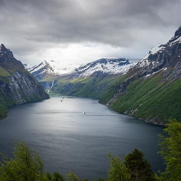
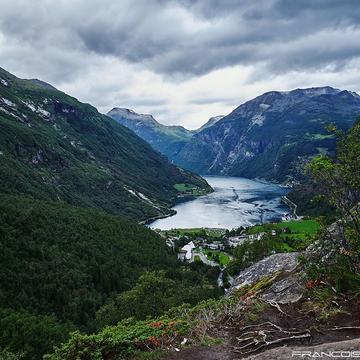
The Geirangerfjord is one of Norway's most famous fjords and has been a UNESCO World Heritage Site since July 14, 2005. It is about 15 km long and between 0.6 and 1.3 km wide. Geiranger is a continuation of Sunnylvsfjord, which in turn is a branch of Storfjord. At the end of the Geirangerfjord, around 100 km from the coast, lies the town of Geiranger. This road leads up the mountain connecting Geiranger and Trollstigen.
Photography Tips
I used a drone and waited for a car to give this scene a sense of scale. It was pretty challenging to get a good photo because I visited during the day and had to wait for clouds to come in, covering the harsh light.
Travel Information
I parked my car near the road without blocking it and started the drone on the nearby field. Make sure to respect the private properties when walking /flying around.
Spot Type
Outdoor
Crowd Factor
Just a few people
Best Timing
Sunrise
Sunrise & Sunset
05:06 - 21:50
| current local time: 07:06
Photo Themes
fjord
Mountain
Mountain road
Locations
Geiranger
Geirangerfjord
Spot Comments (0)