South Strengelvåg Bay, Norway
Sebastian Lehrke
Sebastian Lehrke www.sebastianlehrkepho…
licensable
This photo is copyrighted by the author.
Thank you for respecting the rights and efforts of our photographers. Please contact the author for further information.

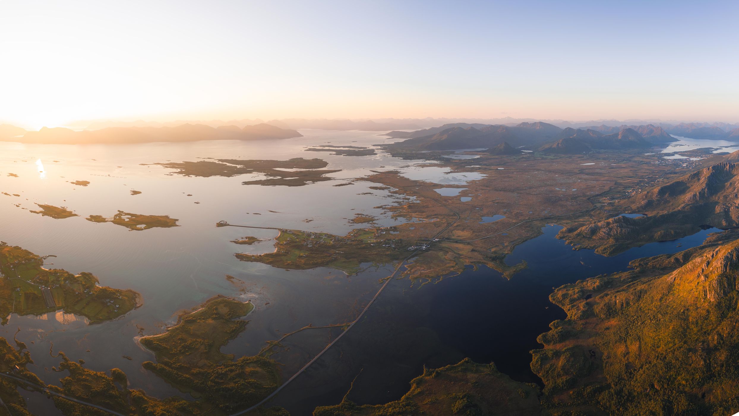
Norway South Strengelvåg Bay

  • Please log in or sign up for free to see the GPS coordinates & weather for this photo spot
The overview on the mountains and outflows of the nearby lakes and water sources in the river builds up that pretty layer of water and rock.

Photography Tips

This flight has been taken from the Dronningruta hike up high from the mountains. Its crucial to already have an elevated position.

Travel Information

Hiking up Finngamheia and past that summit requires some stamina since the alpine section is quite steep. Sure footedness and not being afraid of vertigo is needed for the steel rope section.
Spot Type Drone
Crowd Factor Nearly no other people
Best Timing Sunrise in summer
Sunrise & Sunset Sun is always above the horizon today | current local time: 11:36
Photo Themes Fjord Mountain Mountainscape Ocean Ocean View

Get the exact geo-position for this spot

Log in to see the GPS coordinates, sun directions, and the map for this photo spot. Or simply bookmark it along with other spots to plan your next trip.

Spot comments (0)

Please log in or sign up for free to leave a comment or ask a question.

Ratings (1) star star star star star

star star star star star
1
star star star star star
0
star star star star star
0
star star star star star
0
star star star star star
0

Popular photo spots in this region

Thank you Sebastian Lehrke for creating this photo spot in Norway.
Imprint & Contact © Locationscout 2026 Privacy / Terms