
Norway Rørnestinden
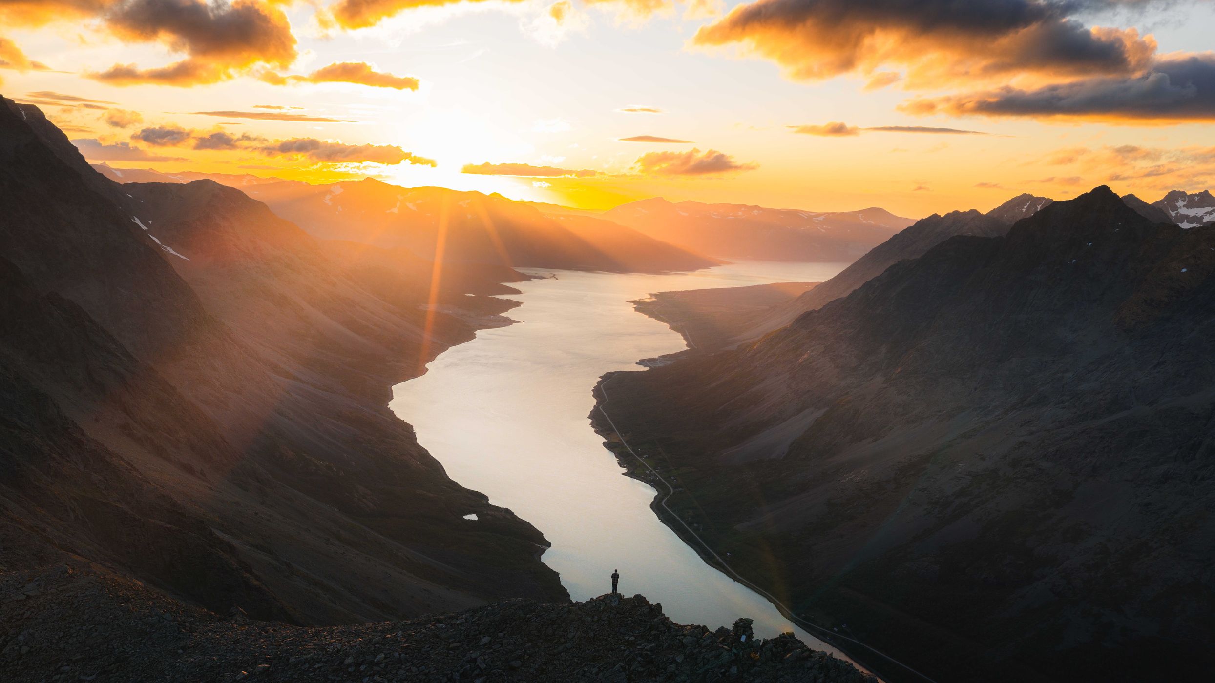
Rørnestinden is an absolute beast of a summit in the Lyngen Alps. Magnificent views all around the fjords, mountains and basically the whole area. It's a quite small edge and slope which offers many angles to take photos.
Photography Tips
This place is just on the edge and allowed to fly drone. Place a person for scale in the frame and make it popping out well with a bright and dark contrast.
Travel Information
Hiking up here is quite a stretch and it's required to be very fit and good in navigation. There is no trail leading up the rocky slopes and there is heaps of loose rock on the way.
Furthermore, the parking is quite hidden and small next to the road. It doesnt look like that there's a hike starting.
Furthermore, the parking is quite hidden and small next to the road. It doesnt look like that there's a hike starting.
Spot Type
Drone
Crowd Factor
Nearly no other people
Best Timing
Sunset in summer
Sunrise & Sunset
Sun is always above the horizon today
| current local time: 03:09
Photo Themes
adventure
Fjord
Hiking
Mountain
Mountainscape
Locations
Northern Norway
Rørnestinden
Troms
Lyngen Alps
Lyngen


Spot comments (0)