Ponta de São Lourenço, Portugal
Dirk Wiemer
Dirk Wiemer dirkwiemer.de
Ponta de São Lourenço, Portugal
licensable
This photo is copyrighted by the author.
Thank you for respecting the rights and efforts of our photographers. Please contact the author for further information.

Portugal Ponta de São Lourenço

  • Please log in or sign up for free to see the GPS coordinates & weather for this photo spot
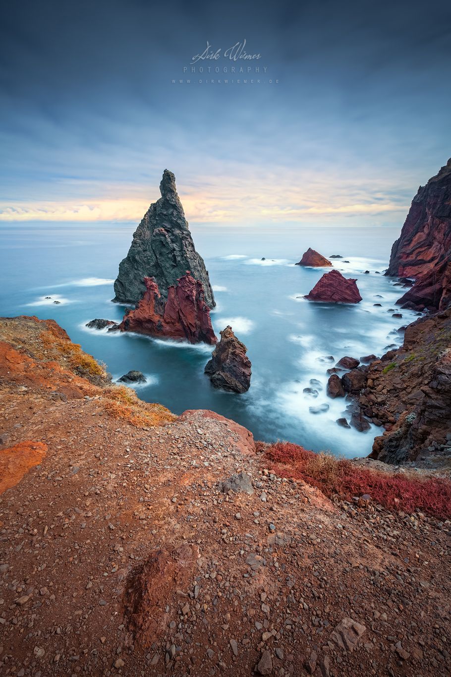
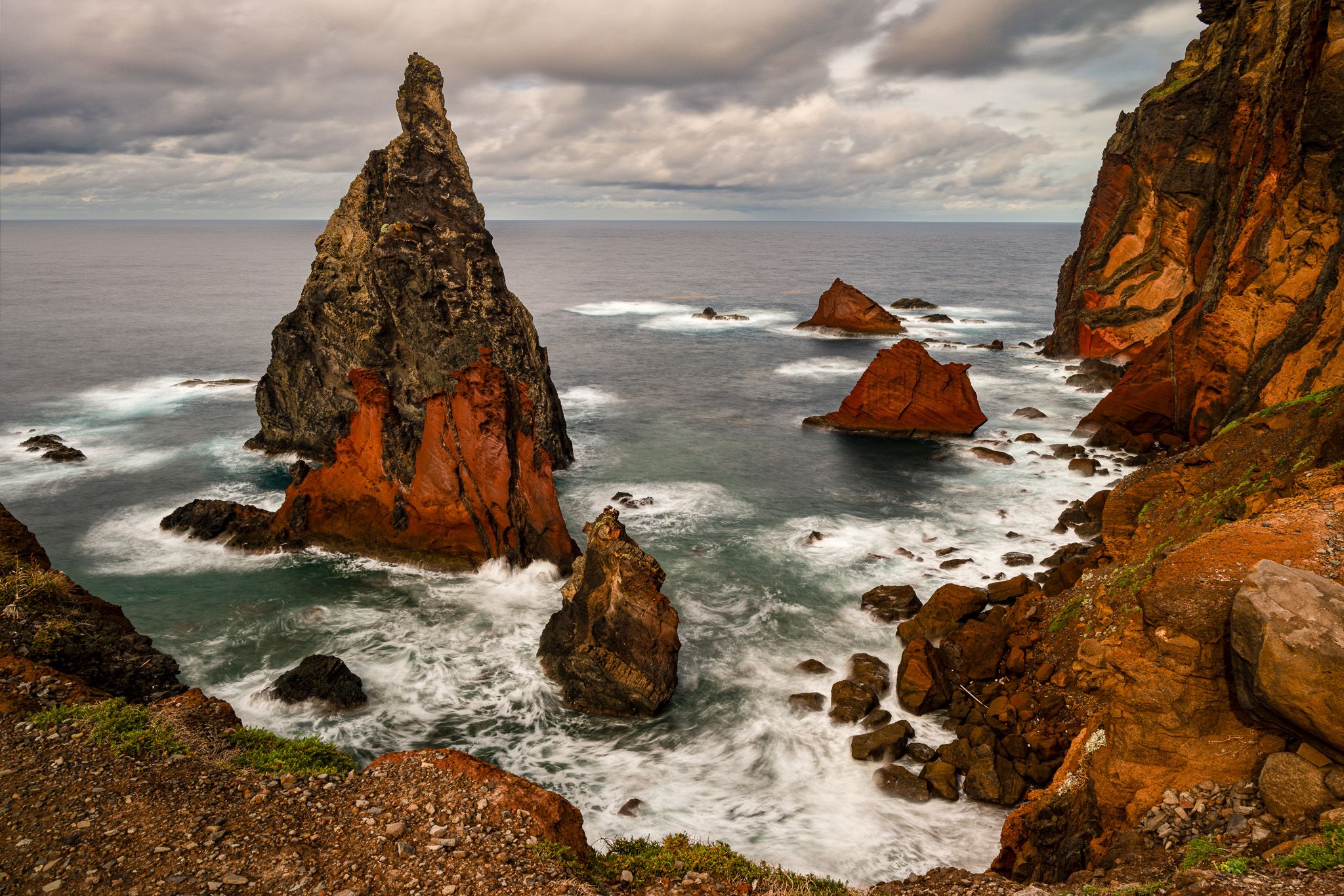
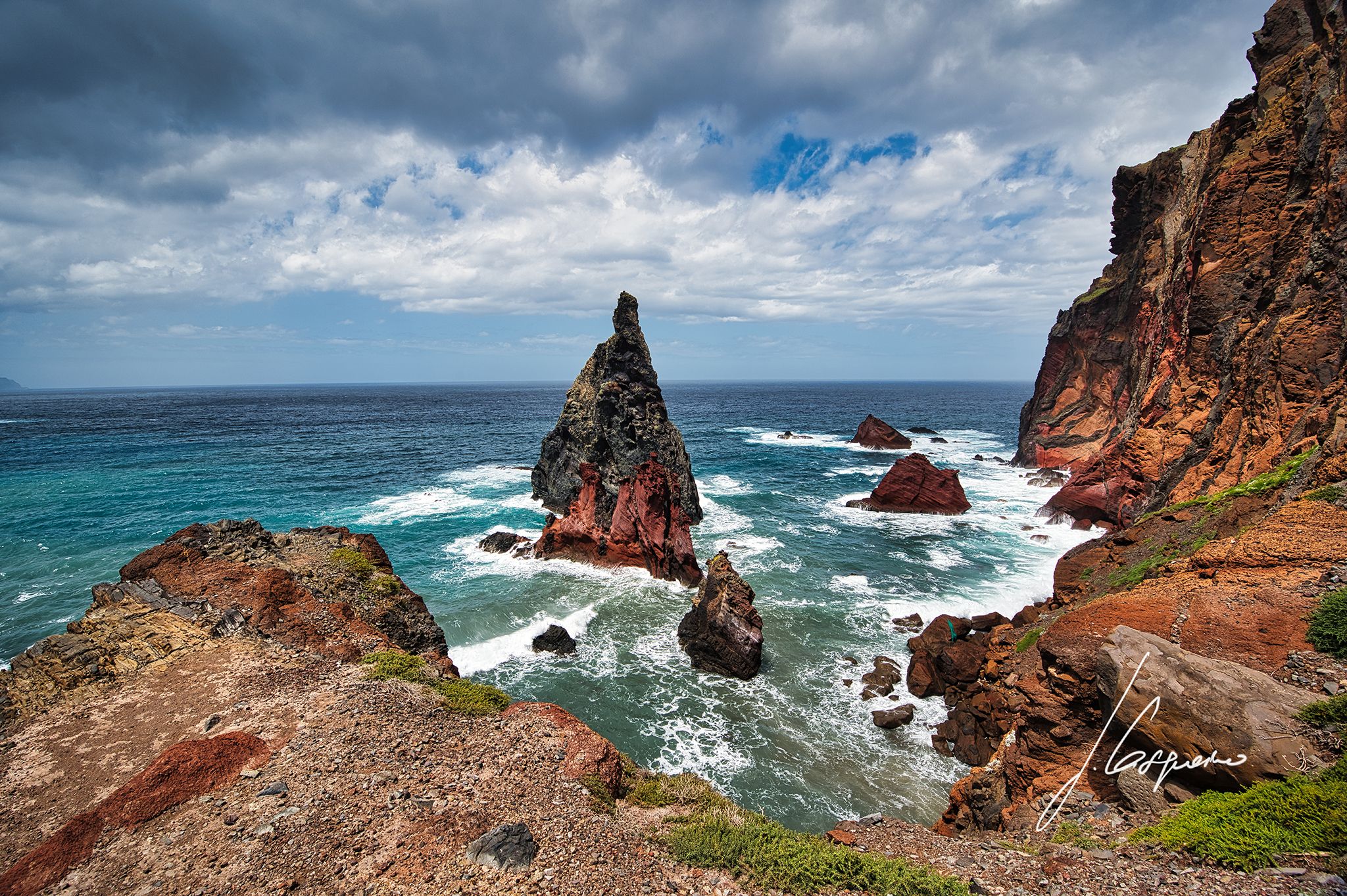
Ponta de São Lourenço, the easternmost part of Madeira is a natural park with a panoramic view of the Atlantic and spectacular volcanic rock formations. Compared to the rest of the island, the landscape is unique.

Photography Tips

Be careful at the edge of the cliff!

Travel Information

Park your car at the roundabout at the end of the road. Up to this view, there are then about 20 minutes on foot.
Crowd Factor Just a few people
Best Timing Sunrise
Sunrise & Sunset 06:57 - 21:14 | current local time: 17:04
Photo Themes atlantic ocean cliff rock formation rocks
Locations Madeira
Please log in or sign up for free to see travel details, sun directions and the exact geo-position for this photo spot on a map.

Spot Comments (0)

Please log in or sign up for free to leave a comment or ask a question.

Ratings (3) starstarstarstarstar

starstarstarstarstar
3
starstarstarstarstar
0
starstarstarstarstar
0
starstarstarstarstar
0
starstarstarstarstar
0

Popular photo spots in this region

Thank you Dirk Wiemer for creating this photo spot in Portugal and pakri, Jo Casqueiro for improving it with additional photos or content.
Imprint & Contact © Locationscout 2023 Privacy / Terms