
Switzerland La Borgne de Ferpècle
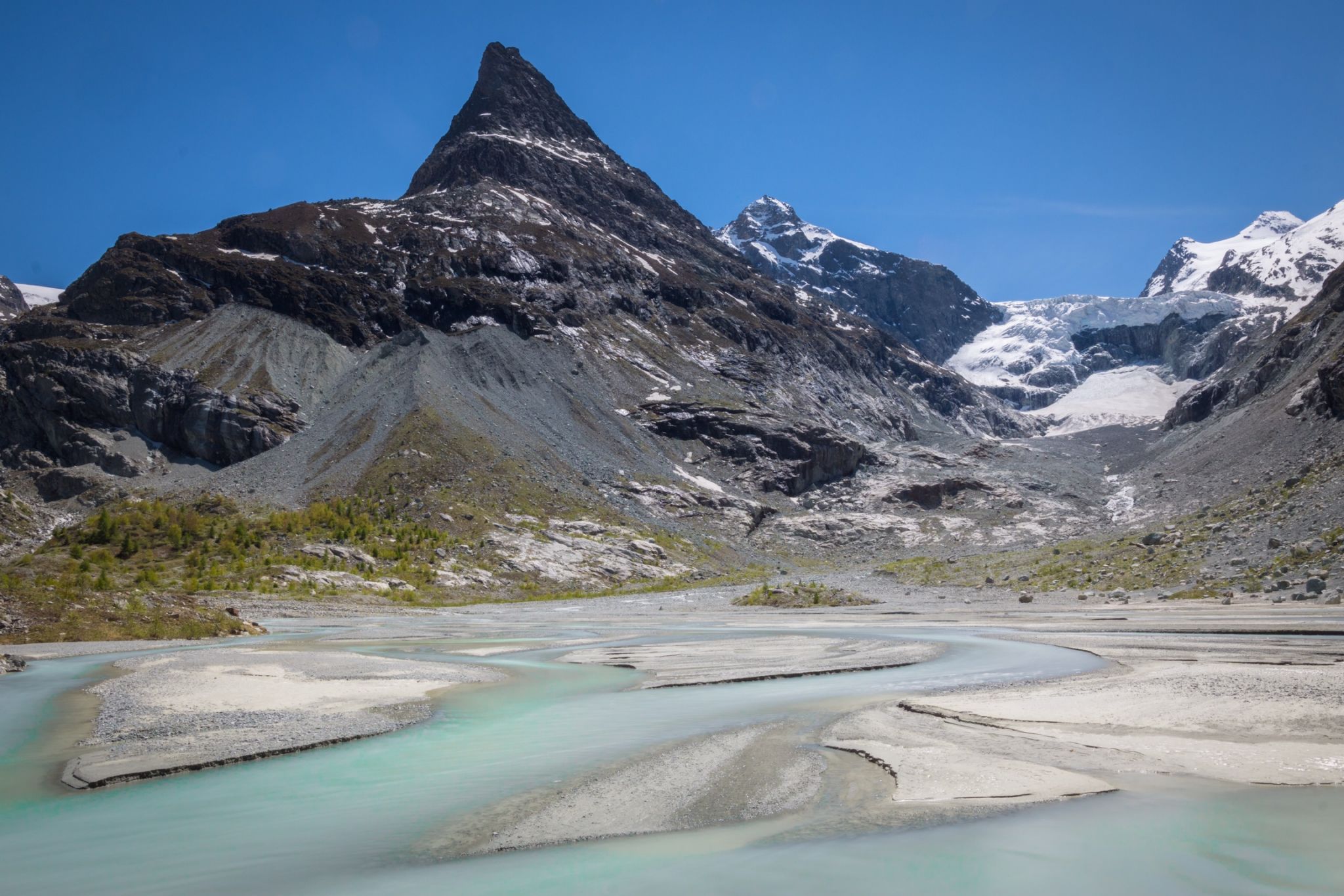
The first meters of the Borgne de Ferpècle, a river that is fed by the Mont Miné glacier in Val d‘Hérens. Turquoise glacier water finds its way through an amazing scenery.
Photography Tips
tripod and nd filters to smoothen the water
Travel Information
You can either drive to Ferpècle and walk around 40 minutes (parking in the forest just before the single track road ends for public traffic) or walk from Les Haudères via La Forclaz (2.5hrs). Towards the very end of the valley there is a natural bridge. From those rocks you get a nice view of the area. This spot is on 1960m so get dressed decently and wear hiking boots.
Spot Type
Outdoor
Crowd Factor
Nearly no other people
Best Timing
Spring
Sunrise & Sunset
05:59 - 21:12
| current local time: 01:01
Photo Themes
Glacier River
Mountainscape
Swiss Alps
Locations
Wallis
Val d‘Hérens
Glacier du Mont Miné


Spot comments (0)