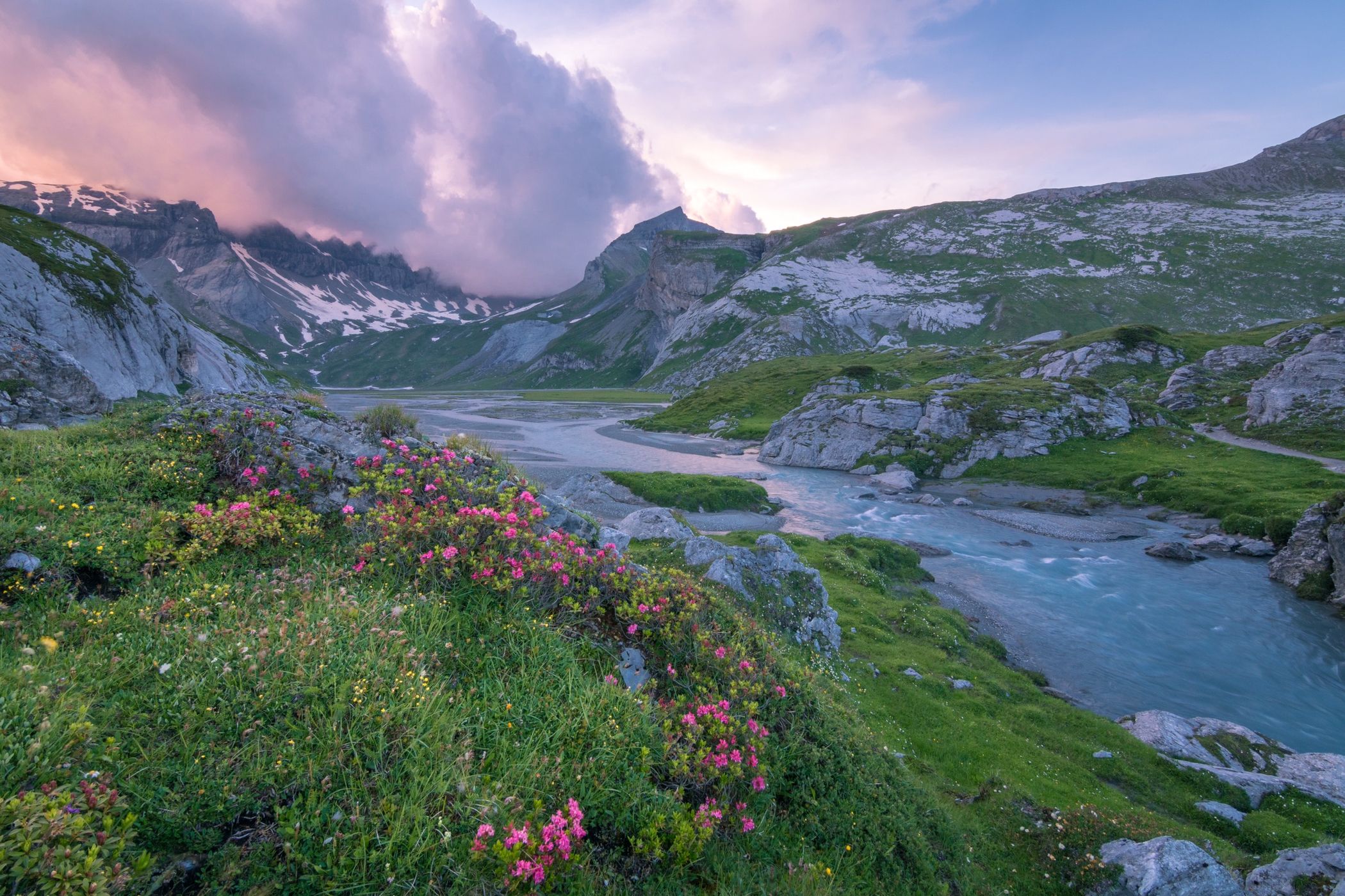

Switzerland Unterer Segnesboden
Amazing scenery at Segnes Plain, part of the Sardona UNESCO world heritage site. Mid to late July is best for flowers (depends on the year of course)
Photography Tips
You are on 2100m, dress accordingly. It can be cold when the wind kicks in during sunset. Protect the fragile nature!
Tripod and wide angle lens are useful.
Tripod and wide angle lens are useful.
Travel Information
Walk from Flims (1250m climb, 4 hours) or take cable car up to Naraus and walk from there (250m climb, 1 1/4 hours), decent hiking gear is a must. There is a hut where you can stay.
This spot is near the Segnes climbing park.
This spot is near the Segnes climbing park.
Spot Type
Outdoor
Crowd Factor
Nearly no other people
Best Timing
Sunset in summer
Sunrise & Sunset
05:47 - 21:10
| current local time: 21:30
Photo Themes
Alps
Mountain River
Mountainscape
Locations
Graubünden
Swiss Alps
Flims
Sardona


Spot comments (0)