
USA Archangel Falls
Approach to the iconic “Subway” section via the “bottom up” route.
Photography Tips
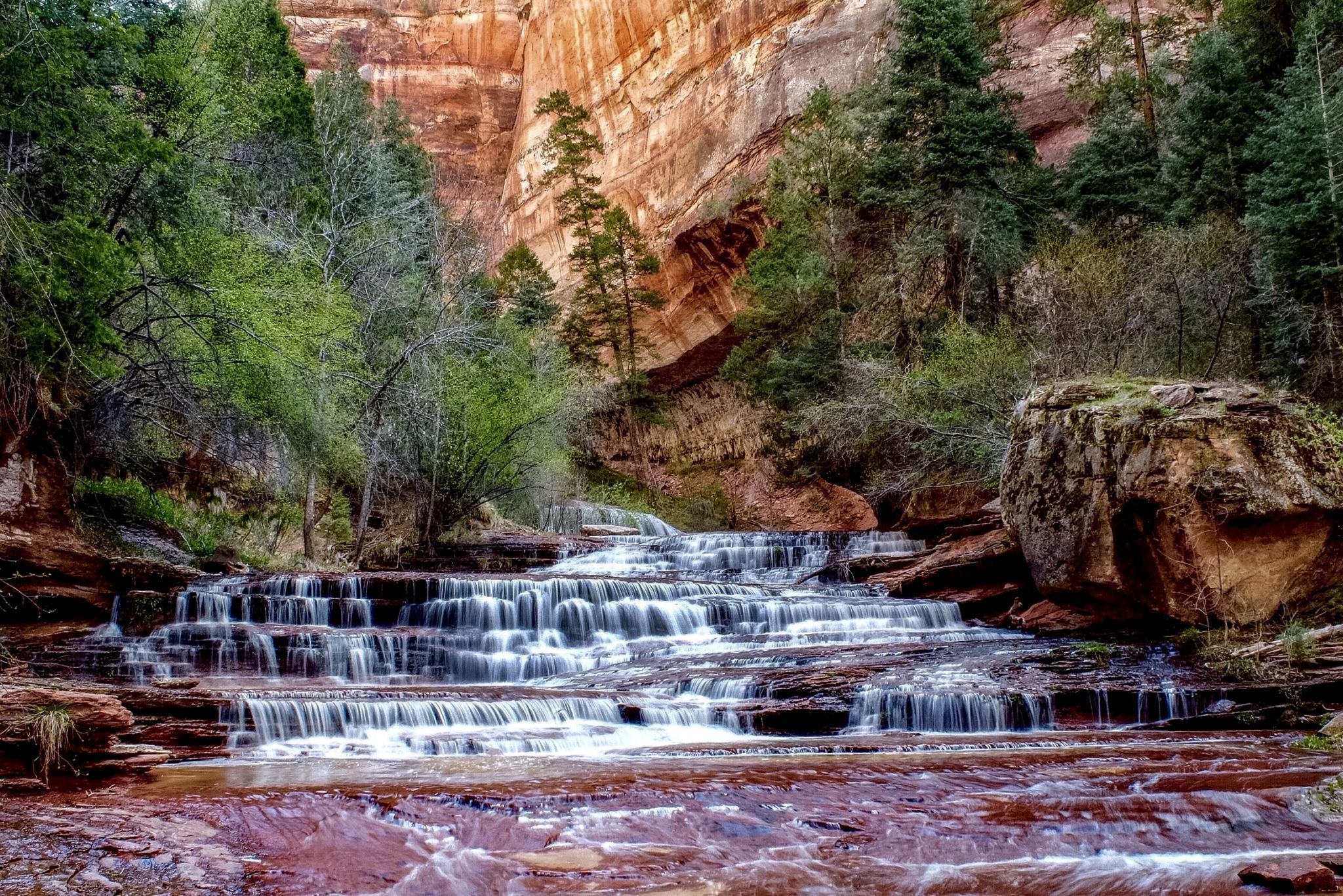
Begin the hike at or near sunrise to get to this spot before the canyon is splashed with direct sunlight creating difficult compositions. The hike requires a back country permit (acquired via online lottery or in rare instances at the Zion National Park visitor center back country desk). Avoid making the trek in the mid summer heat when temps can reach 38°+C (100°+F). This is a strenuous eight mile hike that starts and ends with a climb down, then up a 122m (400ft) wall that occasionally requires use of hands. Much of the hike you’ll be walking in the water, so water shoes and trekking poles are advisable. There are numerous waterfalls, including this one, where the route Is directly up the waterfall. The sandstone bottom is usually tacky and easy to walk on. The actual “Subway” section is an exception. The red, white, orange, and yellow colored rock is very easy to walk on. The dark green or black rock is actually covered in algae or moss and is extremely difficult to walk on. I’ve seen many people slip down in the Subway section.
Travel Information
From Springdale, drive south and west 14 miles to the town of Virgin. Turn right on the Kolob road, sometimes called the Kolob Terrace road. The paved road climbs a dramatic ridge six and a half miles from Virgin, the road enters the park and three trailheads are soon encountered – the Right Fork, Grapevine Springs, then the Left Fork. Park at the Left Fork Trailhead. Mileage from the town of Virgin is about 8.6 miles. Driving time from Springdale is 45 minutes.
Spot Type
Outdoor
Crowd Factor
Just a few people
Best Timing
Sunrise in spring
Sunrise & Sunset
06:26 - 20:50
| current local time: 07:25
Photo Themes
Rock Formation
Slickrock Waterway
Tree
Locations
Utah
Zion National Park


Spot comments (0)