
USA Yants Flat 3
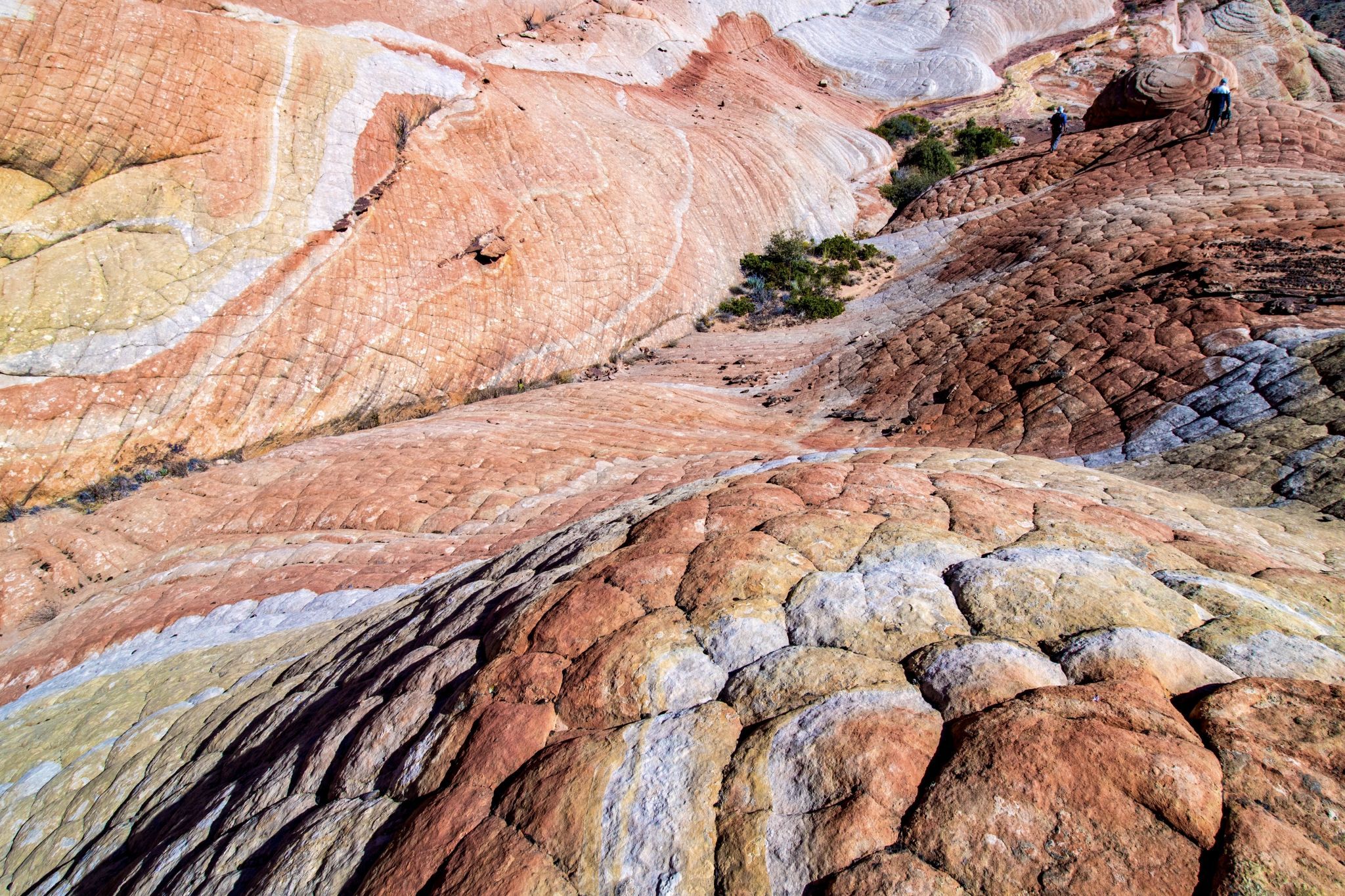
Wonderland of swirling sandstone and hoodoos. This is what I call the third of three distinct areas of Yants Flat. It is a bit more difficult to reach but if you’re in reasonably good health is doable. I’m 67 and it’s a good workout for me but another gentleman who I think is in his upper 70s had no problem. This area is known for a colorful feature aptly named “The Elusive Butterfly” by locals.
Photography Tips
I was there mid morning but I think late afternoon would be best for photography. Just remember to allow for time (90 minutes?) to make your way back to your vehicle.
Travel Information
Some locals call the area "Candy Cliffs". I've also found it on Google Maps named "Anna's Viewpoint".
If coming from St. George, take the Leeds exit off of I-15 just a few miles up the freeway and turn left under the freeway onto Silver Reef Rd. Follow Silver Reef Road for 1 mile where it changes to Oak Grove Road. Continue on Oak Grove Road 0.4 miles where the pavement ends at a small bridge and you'll see a "Dixie National Conservation Area" sign. From here, the road turns to gravel and changes to FR 032. Follow the winding FR 032 up the hill where the road splits to the right to the Oak Grove Campground and to the left to St. George. This junction is 3.2 miles from I15. There's a large sign at the junction giving mileage to Oak Grove and to St. George. Continue straight ahead at this junction (toward St. George) where the road changes once again to Forest Road 031. This road is very well maintained until a couple miles before the trailhead where the road changes to bright red sand and/or clay and is sometimes deeply rutted depending on recent weather. Follow 031 for another 7.3 miles for a total of 10.5 miles from I15 to the Yants Flat trailhead. The forest road markers are on narrow stakes about 4 inches wide with just enough room for the road number, so you have to watch carefully to spot them. Park on either side of Forest Road 031 at the "T" junction with Forest Road 903. FR 903 heads to the right (up hill). The trailhead to Yants Flat is directly opposite 903. There are sometimes a few bumpy stretches of road when you get close to the trailhead but they're very brief (50 yards or so). Unless there has been recent heavy rain or snow that would make those last few short stretches muddy, the road is fine for a 2WD sedan. If there has been recent heavy rain, don't even think about it.
It's a 1.1 mile hike to the first section of Yants Flat and the rim of Cottonwood Canyon. Near the end of the trail there are USUALLY two or three rock cairns on the left side of the trail leading toward a much narrower footpath on the left. When you spot the cairns, the main trail dissolves into slickrock a few yards beyond them and the canyon rim is less than a minute farther. You'll want to at least walk to the edge of the rim to see the sandstone fields below and you might want to walk (left) along the rim about 50 yards to find a relatively easy route down among the sandstone. There's all kinds of interesting and colorful sandstone features and water pockets to explore below the rim there. From the rim you can see St. George in the far distance.
OUR preferred area is farther toward the east. To get there, backtrack on the main trail to the aforementioned rock cairns (if they’re there) or simply locate the narrow foot path leading toward the east. Follow this trail for 10-15 minutes until you emerge once again at the edge of the canyon rim. Continuing along the rim heading east (left), look for rock cairns (sometimes there, sometimes not) that lead you down faint switchbacks for 40-50 feet and deposit you amongst the swirling sandstone and hoodoos. If you miss the rock cairns, the farther east you walk along the rim, the more shallow the descent until it becomes an easy stroll to reach the sandstone fields. Make your way as Far East as you can until you reach a wall. Turn right and make your way down to where canyon naturally funnels you further eastward. There’s a bit of scrambling involved but nothing serious. Continue hiking until the wash eventually opens up, revealing yet another vast area of colorful slickrock.
One could spend 1.5 to 2 hours if just hiking to the overlooks or all day depending on how much exploring you want to do below the rim. The best part about this hike (from my perspective) is that the landscape is amazing and we rarely see another soul.


Spot comments (0)