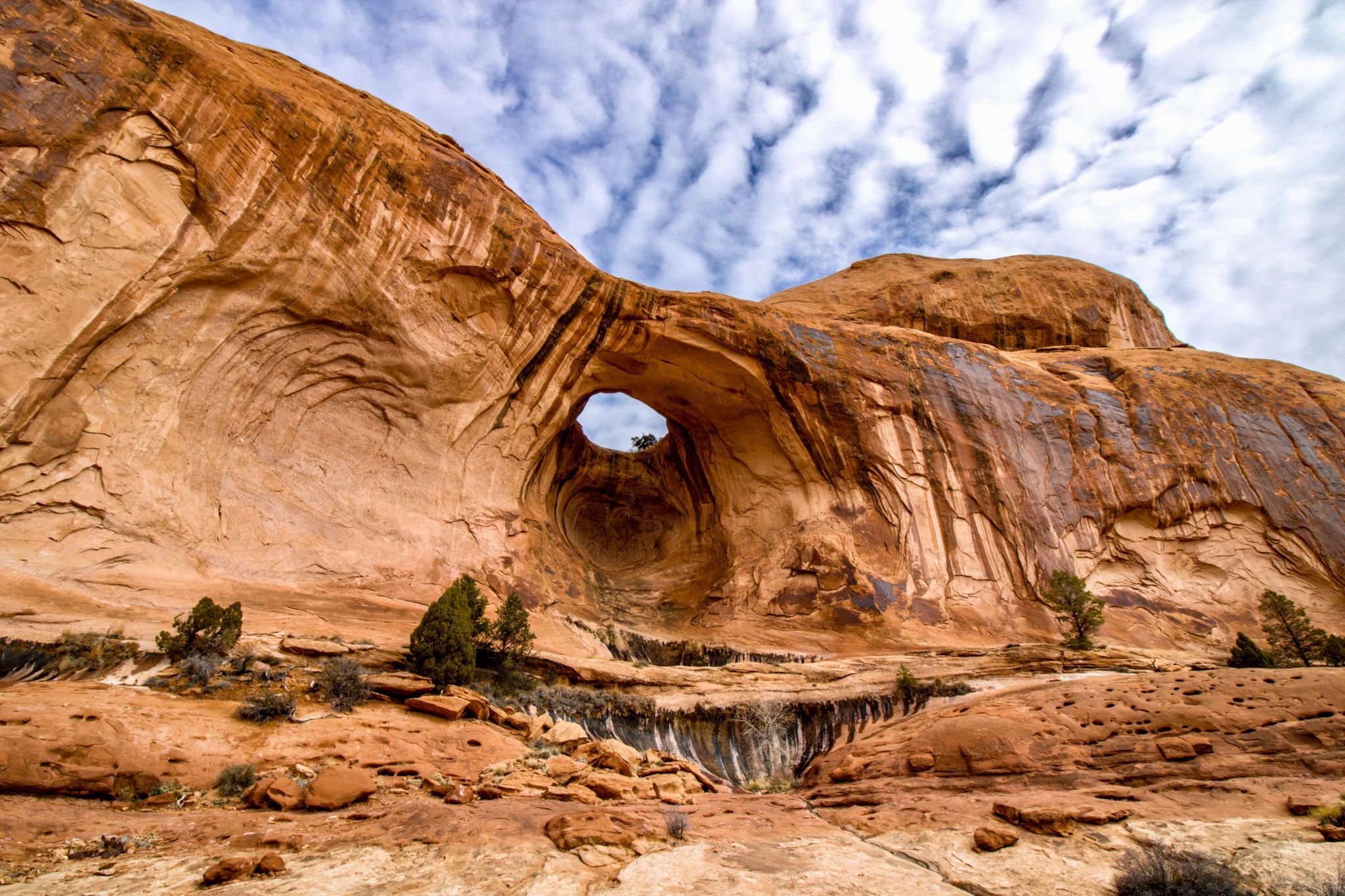

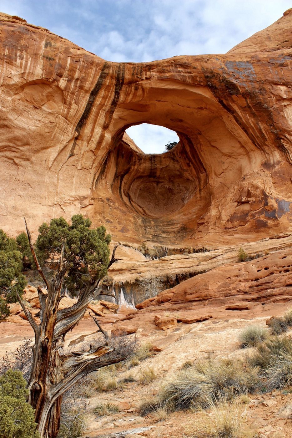
USA Bow Tie Arch
Includes views of a large slickrock canyon. The VERY large parking area gives you an idea how popular the hike is. The last time I was there we got to the trailhead just after sunrise and had the whole trail to ourselves until just before we began our hike back to the parking area. You’ll see Corona Arch just 100 yards or so away.
Photography Tips
I like to visit Bow Tie in the spring or fall during the cooler months. If you visit during the summer, try to start the 1.5 mile hike to the arch as early in the morning as possible to beat the heat and the crowd. Aside from the shade provided by nearby Corona arch, there is very little escape from the sun. There are camping spots available all along the Colorado River en route to the trailhead in addition to the campground across the road from the parking area making this an easy sunrise or sunset location.
Travel Information
The trailhead is located on Scenic Byway 279, 10 miles west of the Utah 279/U.S. 191 junction. There are vault toilets nearby. From the parking lot on the north side of the road, follow the trail up to the visitor register box near the railroad tracks. Cross the railroad track and follow an old road bed up through a gap in the rim. From the gap, follow the cairns up the wash for about 100 yards where the trail swings to the left. Follow the trail and cairns over a low sandy pass and then down towards the base of a large cliff. Occasionally, there are small green dots painted on the slickrock to help guide you. Continue along the base of the cliff to the first safety cable and around to the second cable where steps have been cut into the slickrock. Corona Arch is visible from this point. From the top of the second cable climb up over a short ledge and follow the cairns up to the top of the large bench. These are relatively minor obstacles and actually make fun photo ops. From this point, it is an easy walk along the broad slickrock bench to the base of Bow Tie Arch.


Spot comments (0)