
USA Willis Creek
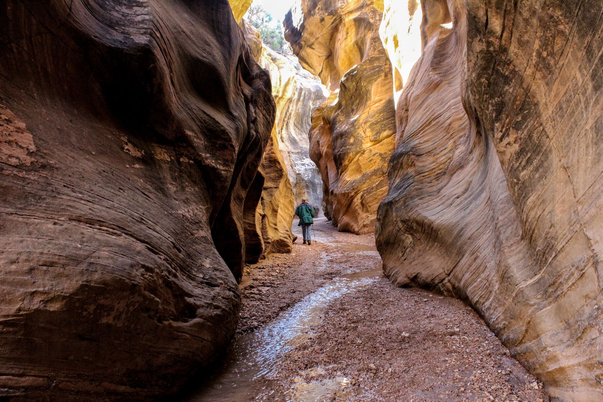
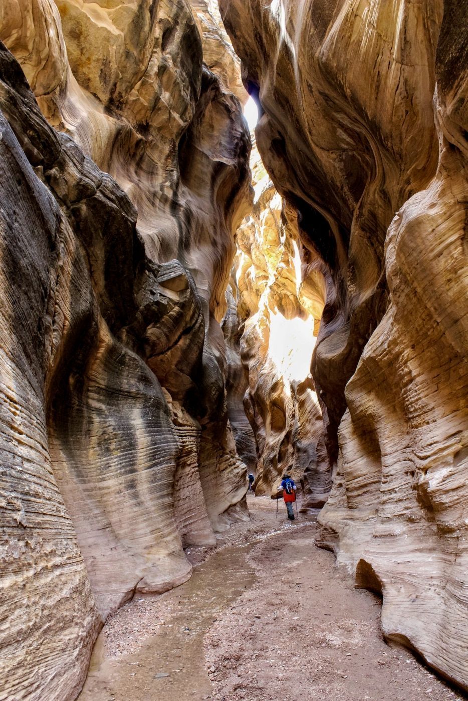
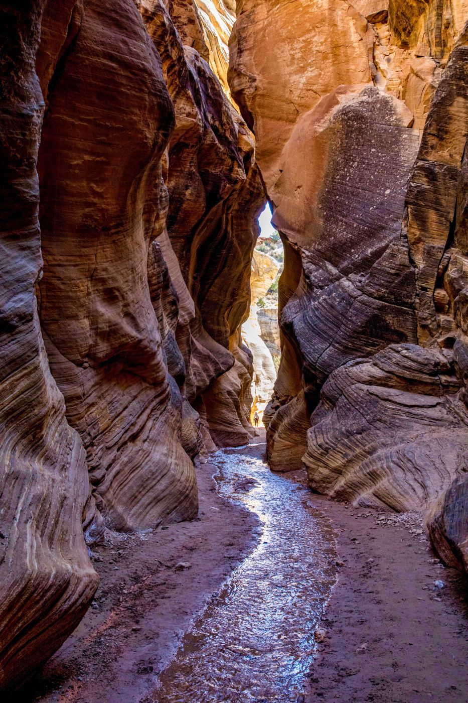
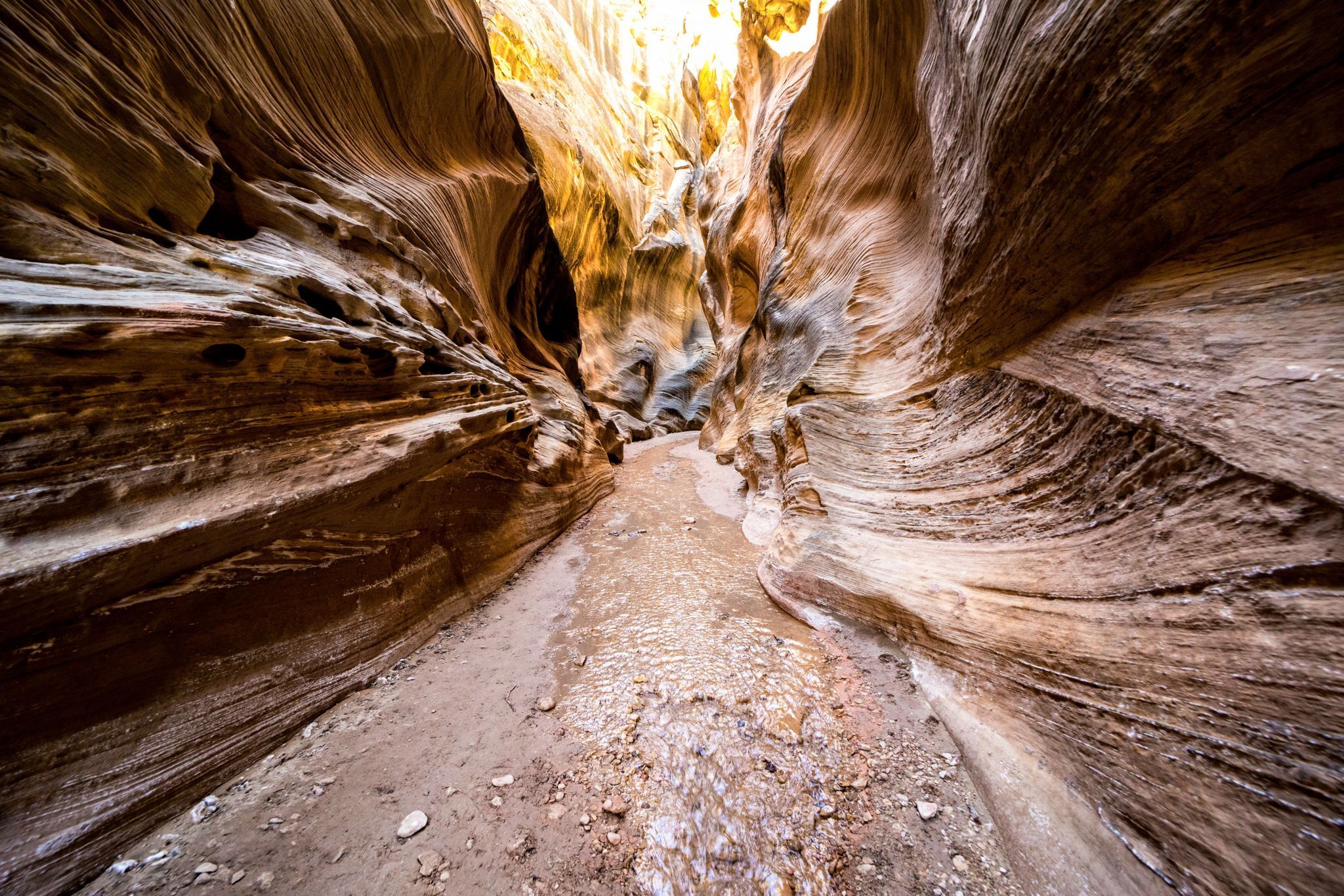
A few miles south of Cannonville, Utah, Willis Creek is one of my favorite slot canyon hikes. In the afternoon, the walls turn a very pretty golden yellow. It's a very easy (level) hike with the canyon walls providing shade through much of the hike. Most of the canyon floor is packed sand or pea gravel that makes it easy walking. Under normal conditions, there's just enough water to get the soles of your shoes wet. I’ve hiked through this canyon many times and rarely encounter more than a half dozen people and have been there a couple of times and seen no one else. Most of the time I turn around when I get to the confluence with Averett Canyon (will be obvious) for a round trip of about 4 miles.
Photography Tips
The little stream that runs through the canyon is only an inch or two deep. It’s possible to hike through it without getting your feet wet by stepping from one side of the stream to the other or periodically stepping on stones. I suggest wearing water shoes or shoes you don’t mind getting wet. That way, you can walk in the water and set up wherever you want for your photo composition. Besides, in the summer when it’s 100°+ outside the cool water is refreshing. I use a super wide angle lens and like to set my camera in aperture priority mode and auto ISO which works well most of the time in narrow slot canyons like this.
Travel Information
Once in the small town of Cannonville, drive a short distance south from Hwy 12 on Main Street and, on the right, stop in at the BLM (Bureau of Land Management) visitor center. Here you can inquire on the road conditions to Willis Creek and learn about the other places of interest to visit in this area including Kodachrome Basin and Bull Valley Gorge. The dirt road is usually well maintained and OK for a regular sedan when it’s dry (which is most of the time). After a heavy rain, the road is impassable even with 4WD. After stopping at the visitor center, continue south on Main Street which turns into the main road to Kodachrome Basin. After about 2.8 miles (4.5 km) from Canonville, turn right onto Skutumpah Rd (BLM500). Continue on this road for a little over 6 miles (10 km). At about 5.5 miles (8.8 km), the road will descend into a wide canyon. At the bottom and before crossing the creek, look for a parking area on the right which also doubles as a small campground. Park your vehicle here. There are no toilets.
Spot Type
Outdoor
Crowd Factor
Just a few people
Best Timing
Sunrise
Sunrise & Sunset
06:27 - 20:41
| current local time: 20:53
Photo Themes
Slot Canyon


Spot comments (0)