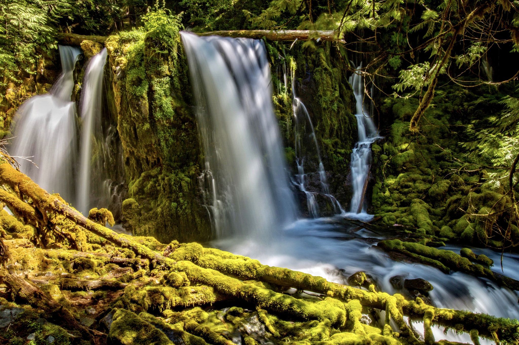

USA Downing Creek Falls
The waterfall drops 32 feet with 3 or 4 side channels depending on recent snow melt or rainfall. The creek flows strong enough to produce a consistent cloud of mist at the base of the falls which helps ensure the forest and cliffs around the falls are liberally covered in a thick blanket of moss.
Photography Tips
Downing Creek Falls is very scenic, but the thick forest around the falls makes it difficult to find more than one or two distinctly unique compositions. The creek below the falls is very pretty, however, and one could spend hours shooting along its banks. The falls are located in deep, thick forests and will be moderately shaded for much of the day, but the area immediately in front of the falls is exposed to the sky, so high contrast issues will arise during the middle of the day when the sun is out. Spray can be moderately heavy at the base of the falls as well.
Travel Information
From the junction of Interstate 5 and Highway 22 in Salem, take Highway 22 east for 66 miles, or from Santiam Junction (intersection of Highways 22 and 126/20) follow Highway 22 for 13 miles north, to the junction with Straight Creek Road (NFR-11). Continue south on Highway 22 for another fifth of a mile from this point and then turn east onto an unmarked road heading uphill at a diagonal angle to the highway. Follow this moderately overgrown road uphill for one-third of a mile to a wide open area at a junction and park. On foot, continue walking along the right (straight) fork of the road for another third of a mile - note that while part of this road is still in good enough shape to drive on, it degrades shortly and there is no room to turn around beyond the junction. After one-third of a mile, watch for a well-defined path branching to the right, which enters the woods and makes its way to the base of the falls in another eighth of a mile, a total of just under a half mile from where you parked.
Spot Type
Outdoor
Crowd Factor
Nearly no other people
Best Timing
Sunrise in spring
Sunrise & Sunset
05:25 - 20:57
| current local time: 15:21
Photo Themes
Waterfall
Locations
Oregon
Downing Creek Falls


Spot comments (0)