
USA Hurricane Valley
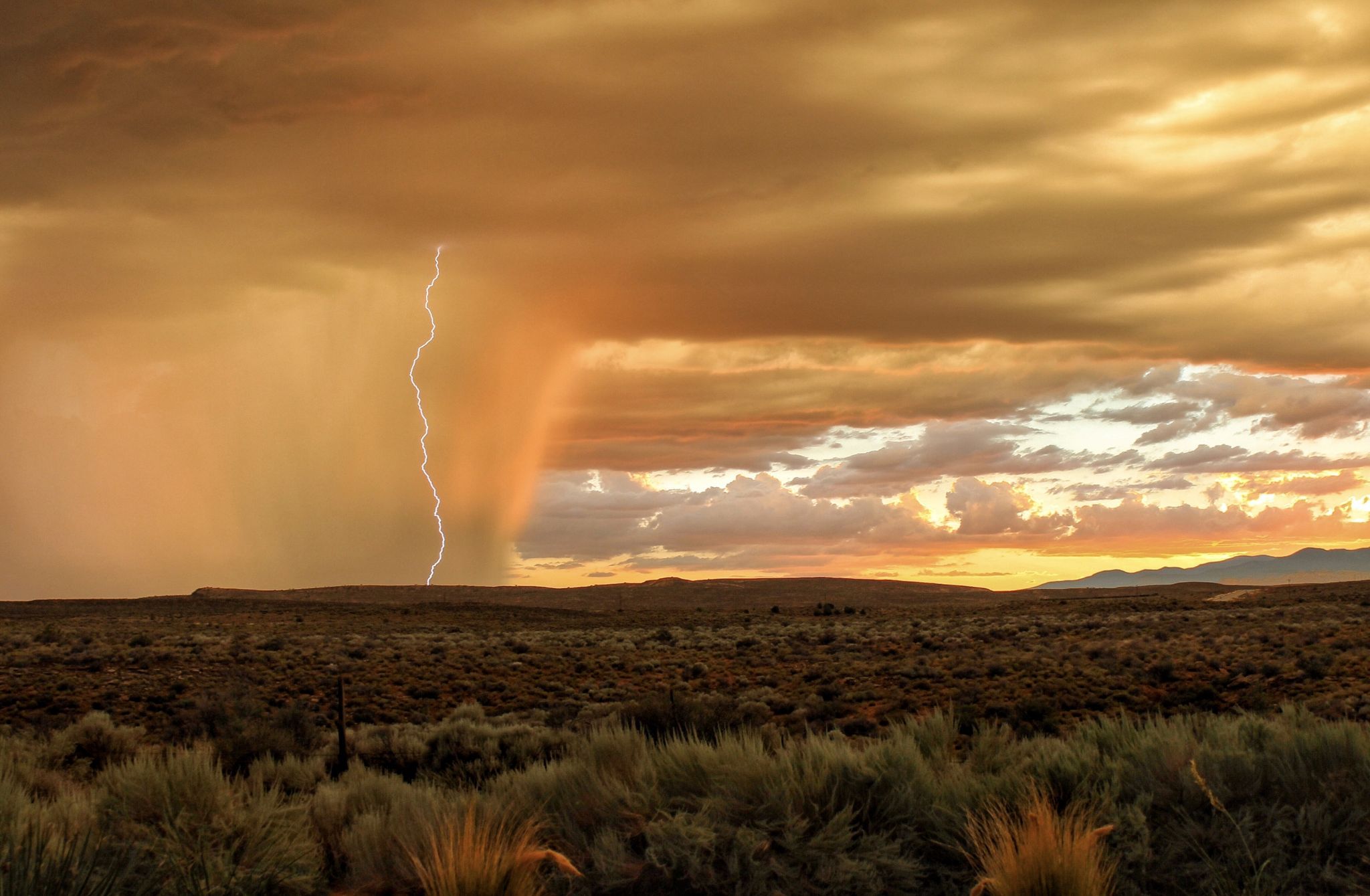
Hurricane Valley is a large swath of land including private land and BLM (Bureau of Land Management) land that is located more or less Between highways 59 and SR9. Visitors traveling north from the small city of LaVerkin will pass it as they make their way to Zion National Park. It’s a land of desert washes, cactus, sagebrush, coyotes, and the Virgin River Gorge. On this day it was drenched by a powerful and fast moving storm.
Photography Tips
This shot was pure luck. I was photographing the dark sheet of rain as a storm moved through. I always shoot with a two second shutter delay and lightning struck just as the shutter opened.
Travel Information
From the town of Virgin, drive west for 2.5 miles to a dirt road on the south side of SR9.
Spot Type
Outdoor
Crowd Factor
Nearly no other people
Best Timing
Sunset
Sunrise & Sunset
06:27 - 20:50
| current local time: 03:57
Photo Themes
Desert Landscape
Locations
Utah


Spot comments (0)