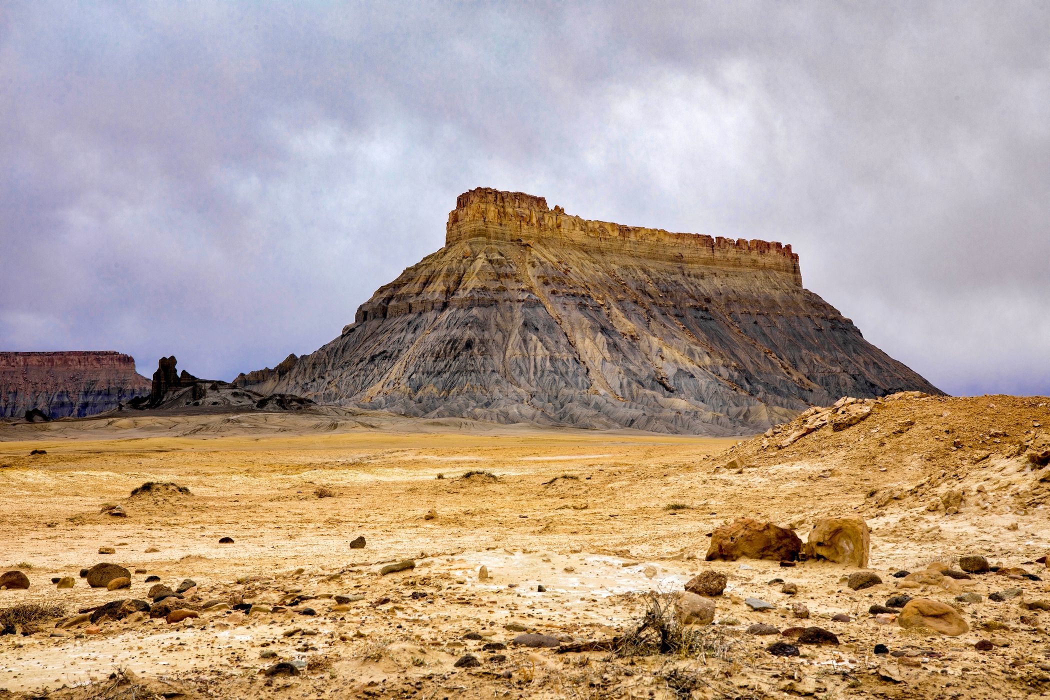

USA Factory Butte
Iconic butte located in the “Upper Blue Hills” of Wayne County, Utah. The 6,302-foot (1,921 m) butte was so named by early settlers who thought its outline resembled a huge factory building.
Photography Tips
Very good early morning/late afternoon location. The mancos shale, mud flats, and sandstone topography in the area make for endless possibilities for photo compositions. A short drive down a dirt road 3 or 4 miles east of the butte takes you to Skyline Rim, overlooking a vast badlands area.
Travel Information
From Hanksville, Utah drive 11 miles (17.7Km) west on Highway 24 to Coal Mine Road and turn right. The road runs along the eastern side of the butte and curves around the northern end of the butte. There’s a vault toilet just off of 24. There’s ample parking just north of the highway in a very large open area and all along Coal Mine Road.
Spot Type
Outdoor
Crowd Factor
Just a few people
Best Timing
Sunset
Sunrise & Sunset
06:14 - 20:45
| current local time: 14:18
Photo Themes
Desert Landscape
Locations
Utah


Spot comments (0)