
USA South Fork of the Kings River
Between the Grant Grove and Cedar Grove sections of Kings Canyon National Park, California State Highway 180 passes through the Giant Sequoia National Monument, although you will see precious few giant sequoias along this stretch of highway (the individual groves are on dirt side roads or must be reached on foot….see descriptions for nearby spots closer to Grant Grove). This spot is a large turnout adjacent to the south bank of the South Fork of the Kings River (SFKR) adjacent to the west end of the highway bridge that crosses the river on its way to Cedar Grove. If you turn right just before the bridge, you enter the parking lot for Boyden Cavern, which will get its own spot.
At this spot, you have finally climbed down from Grant Grove to reach the SFKR. To the east, Hwy 180 follows the north bank of the river back into Kings Canyon National Park where more adventure awaits. The USGS Wren Peak Quadrangle (7.5’ topographic map) gives an elevation of 3,062.8 ft (933.5 m) for the bench mark on the west end of the bridge.
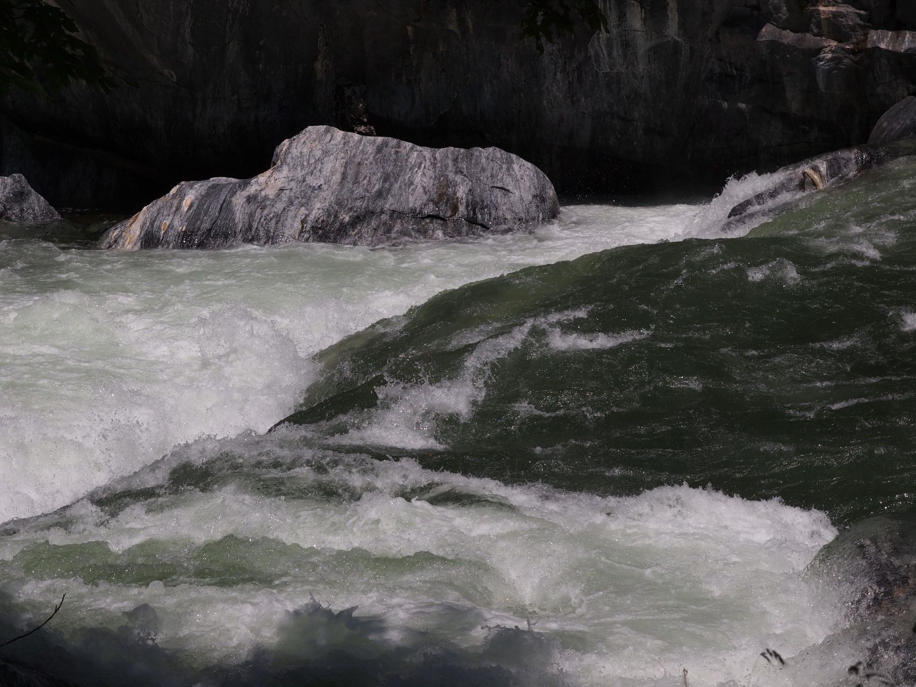
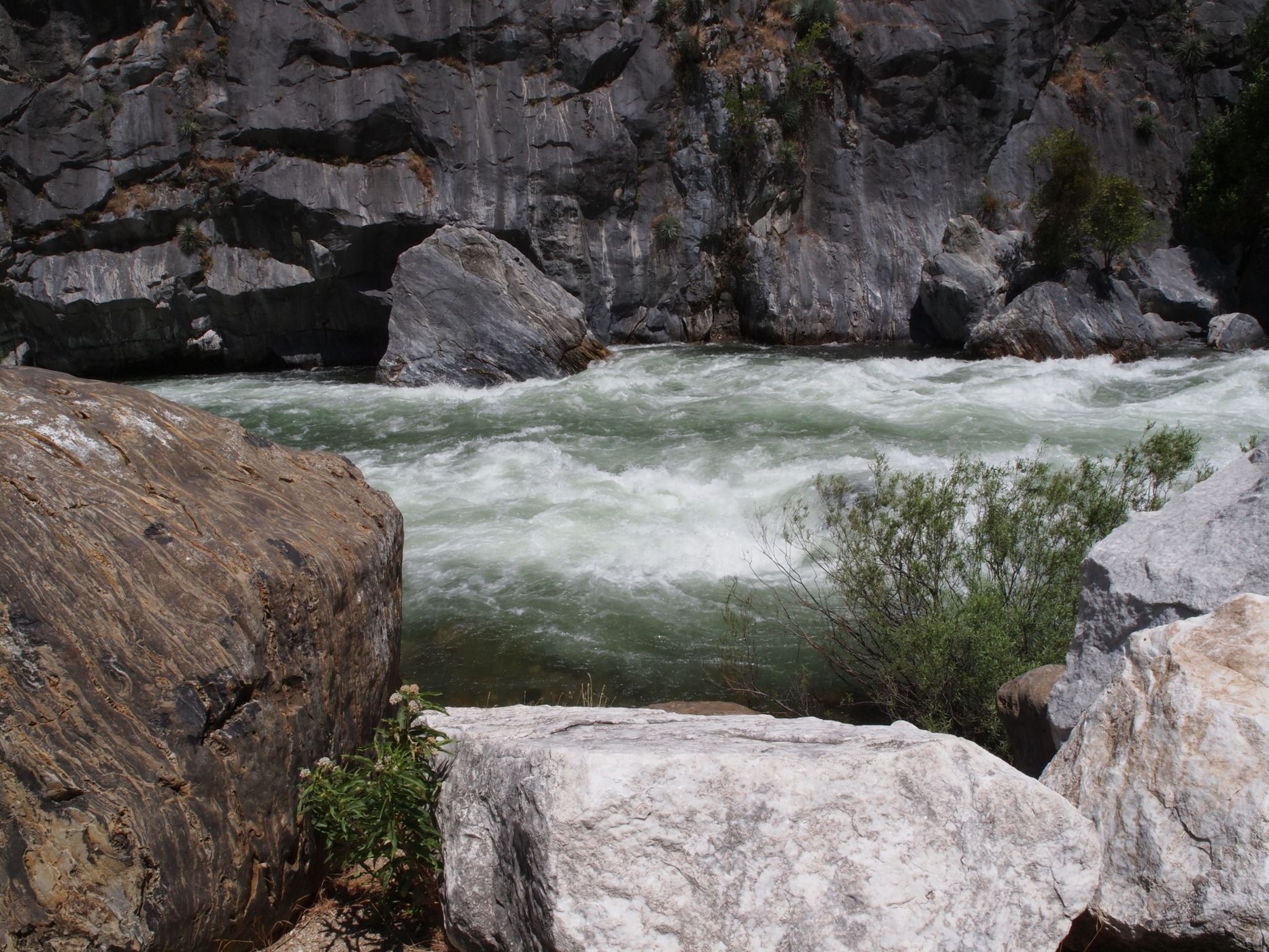
The Kings River is not long, even by California Standards. From its headwaters along the crest of the Sierra Nevada to its terminus at Tulare Lake, its length is only 177 miles (285 km). On the other hand, it drops approximately 14,000 ft (4,270 m), most of which occurs within Kings Canyon National Park. Thus, the upper reaches of the Kings River, and specifically the SFKR, are fast and turbulent, especially during peak late-spring runoff. This is a wild river and the only dam on it is far downstream at Pine Flat. The SFKR is the largest of the three main forks and is the most easily accessed by road. From this spot, you can capture the power of the river as it forces its way through a deep and narrow canyon.
Be cautious near the edge of the river. If you slip into it, you may not be able to get back out.
At this spot, you have finally climbed down from Grant Grove to reach the SFKR. To the east, Hwy 180 follows the north bank of the river back into Kings Canyon National Park where more adventure awaits. The USGS Wren Peak Quadrangle (7.5’ topographic map) gives an elevation of 3,062.8 ft (933.5 m) for the bench mark on the west end of the bridge.
The Kings River is not long, even by California Standards. From its headwaters along the crest of the Sierra Nevada to its terminus at Tulare Lake, its length is only 177 miles (285 km). On the other hand, it drops approximately 14,000 ft (4,270 m), most of which occurs within Kings Canyon National Park. Thus, the upper reaches of the Kings River, and specifically the SFKR, are fast and turbulent, especially during peak late-spring runoff. This is a wild river and the only dam on it is far downstream at Pine Flat. The SFKR is the largest of the three main forks and is the most easily accessed by road. From this spot, you can capture the power of the river as it forces its way through a deep and narrow canyon.
Be cautious near the edge of the river. If you slip into it, you may not be able to get back out.
Photography Tips
There are two popular approaches to photographing rivers and waterfalls: short exposures to show power and turbulence (and even capture individual water drops) and long exposures to smooth out the water and create a more dreamy look. I use both techniques for rivers and waterfalls, often in back-to-back exposures. However, for a turbulent river at peak flow, like the SFKR, I prefer short exposures. The first image had a shutter speed of 1/200 s and the second image had a shutter speed of 1/2000 s.
As is most often the case with outdoor photography, a polarizer is very useful.
As is most often the case with outdoor photography, a polarizer is very useful.
Travel Information
From the Visitor Center in Grant Grove in Kings Canyon National Park, drive 19.4 miles (31.2 km) north/northeast/east to a large turnout on the other side of the road just before reaching the bridge over the SFKR. Because the highway turns to meet the bridge and because the parking lot for Boyden Cavern is right here, watch for cross traffic and pedestrians.
Here is some information about the Giant Sequoia National Monument:
https://en.wikipedia.org/wiki/Giant_Sequoia_National_Monument
https://www.fs.usda.gov/detail/sequoia/home/?cid=stelprdb5394941
https://www.fs.usda.gov/visit/destination/giant-sequoia-national-monument-0
https://www.fs.usda.gov/main/sequoia/maps-pubs
https://www.nps.gov/seki/planyourvisit/maps.htm
Here is some information about the Kings River:
https://en.wikipedia.org/wiki/Kings_River_(California)
Here is some information about nearby Boyden Cavern:
https://boydencavern.com/
https://www.fs.usda.gov/recarea/sequoia/recarea/?recid=79588
https://en.wikipedia.org/wiki/Boyden_Cavern
Spot Type
Outdoor
Crowd Factor
Just a few people
Best Timing
Daytime in spring
Sunrise & Sunset
05:50 - 20:12
| current local time: 17:48
Photo Themes
River
Locations
California
Giant Sequoia National Monument


Spot comments (0)